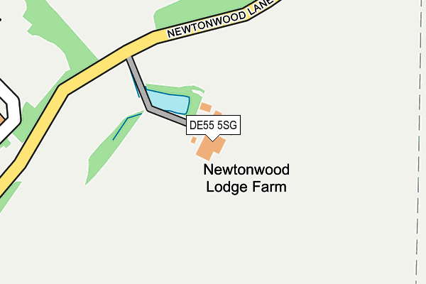
DE55 5SG is located in the Blackwell electoral ward, within the local authority district of Bolsover and the English Parliamentary constituency of Bolsover. The Sub Integrated Care Board (ICB) Location is NHS Derby and Derbyshire ICB - 15M and the police force is Derbyshire. This postcode has been in use since January 1980.


GetTheData
Source: OS OpenMap – Local (Ordnance Survey)
Source: OS VectorMap District (Ordnance Survey)
Licence: Open Government Licence (requires attribution)
| Easting | 445337 |
| Northing | 360256 |
| Latitude | 53.137556 |
| Longitude | -1.323754 |
GetTheData
Source: Open Postcode Geo
Licence: Open Government Licence
| Country | England |
| Postcode District | DE55 |
| ➜ DE55 open data dashboard ➜ See where DE55 is on a map | |
GetTheData
Source: Land Registry Price Paid Data
Licence: Open Government Licence
Elevation or altitude of DE55 5SG as distance above sea level:
| Metres | Feet | |
|---|---|---|
| Elevation | 180m | 591ft |
Elevation is measured from the approximate centre of the postcode, to the nearest point on an OS contour line from OS Terrain 50, which has contour spacing of ten vertical metres.
➜ How high above sea level am I? Find the elevation of your current position using your device's GPS.
GetTheData
Source: Open Postcode Elevation
Licence: Open Government Licence
| Ward | Blackwell |
| Constituency | Bolsover |
GetTheData
Source: ONS Postcode Database
Licence: Open Government Licence
| June 2022 | Criminal damage and arson | On or near Motorway Service Area | 283m |
| June 2022 | Violence and sexual offences | On or near Motorway Service Area | 283m |
| June 2022 | Vehicle crime | On or near Motorway Service Area | 283m |
| ➜ Get more crime data in our Crime section | |||
GetTheData
Source: data.police.uk
Licence: Open Government Licence
| Newtonwood Lane | Newton | 183m |
| Newtonwood Lane | Newton | 194m |
| Newtonwood Lane (Chesterfield Road) | Huthwaite | 535m |
| Newtonwood Lane (Chesterfield Road) | Huthwaite | 555m |
| Bridge House Farm (Newtonwood Lane) | Newton | 618m |
| Alfreton Station | 5.1km |
| Kirkby in Ashfield Station | 6.3km |
GetTheData
Source: NaPTAN
Licence: Open Government Licence
| Percentage of properties with Next Generation Access | 100.0% |
| Percentage of properties with Superfast Broadband | 0.0% |
| Percentage of properties with Ultrafast Broadband | 0.0% |
| Percentage of properties with Full Fibre Broadband | 0.0% |
Superfast Broadband is between 30Mbps and 300Mbps
Ultrafast Broadband is > 300Mbps
| Percentage of properties unable to receive 2Mbps | 0.0% |
| Percentage of properties unable to receive 5Mbps | 100.0% |
| Percentage of properties unable to receive 10Mbps | 100.0% |
| Percentage of properties unable to receive 30Mbps | 100.0% |
GetTheData
Source: Ofcom
Licence: Ofcom Terms of Use (requires attribution)
GetTheData
Source: ONS Postcode Database
Licence: Open Government Licence


➜ Get more ratings from the Food Standards Agency
GetTheData
Source: Food Standards Agency
Licence: FSA terms & conditions
| Last Collection | |||
|---|---|---|---|
| Location | Mon-Fri | Sat | Distance |
| Sherwood Street/Wire Lane | 16:00 | 08:00 | 1,068m |
| Chesterfield Road | 16:45 | 10:30 | 1,094m |
| Wild Hill | 16:15 | 11:00 | 1,209m |
GetTheData
Source: Dracos
Licence: Creative Commons Attribution-ShareAlike
| Facility | Distance |
|---|---|
| Charnwood Crescent Charnwood Crescent, Newton, Alfreton Grass Pitches | 1.3km |
| Newton Primary School Hall Lane, Newton, Alfreton Grass Pitches | 1.3km |
| Exercise 4 All (Closed) High Street, Tibshelf, Alfreton Health and Fitness Gym | 1.3km |
GetTheData
Source: Active Places
Licence: Open Government Licence
| School | Phase of Education | Distance |
|---|---|---|
| Newton Primary School Hall Lane, Newton, Newton Primary School, Alfreton, DE55 5TL | Primary | 1.3km |
| Tibshelf Infant School 144 High Street, Tibshelf, Alfreton, DE55 5PP | Primary | 1.4km |
| Woodland View Primary School Barker Street, Huthwaite, Sutton-in-Ashfield, NG17 2LH | Primary | 1.5km |
GetTheData
Source: Edubase
Licence: Open Government Licence
The below table lists the International Territorial Level (ITL) codes (formerly Nomenclature of Territorial Units for Statistics (NUTS) codes) and Local Administrative Units (LAU) codes for DE55 5SG:
| ITL 1 Code | Name |
|---|---|
| TLF | East Midlands (England) |
| ITL 2 Code | Name |
| TLF1 | Derbyshire and Nottinghamshire |
| ITL 3 Code | Name |
| TLF12 | East Derbyshire |
| LAU 1 Code | Name |
| E07000033 | Bolsover |
GetTheData
Source: ONS Postcode Directory
Licence: Open Government Licence
The below table lists the Census Output Area (OA), Lower Layer Super Output Area (LSOA), and Middle Layer Super Output Area (MSOA) for DE55 5SG:
| Code | Name | |
|---|---|---|
| OA | E00098520 | |
| LSOA | E01019482 | Bolsover 008B |
| MSOA | E02004052 | Bolsover 008 |
GetTheData
Source: ONS Postcode Directory
Licence: Open Government Licence
| NG17 2QJ | Chesterfield Road | 677m |
| DE55 5TZ | Newton Wood Lane | 684m |
| DE55 5NH | Sawpit Lane | 776m |
| DE55 5NQ | Sawpit Lane | 794m |
| NG17 2QG | Strawberry Bank | 854m |
| NG17 2QH | Woodland Avenue | 900m |
| NG17 3JF | Wild Hill | 943m |
| DE55 5SE | Sherwood Street | 966m |
| DE55 5TY | Littlemoor Lane | 1014m |
| DE55 5NG | Mansfield Road | 1018m |
GetTheData
Source: Open Postcode Geo; Land Registry Price Paid Data
Licence: Open Government Licence