Exercise 4 All (Closed) - Tibshelf
Exercise 4 All (Closed) is located in Tibshelf, Alfreton (DE55).
| Address | 107, High Street, Tibshelf, Alfreton, DE55 5PP |
| Management Type | Commercial Management |
| Management Group | Commercial |
| Owner Type | Commercial |
| Owner Group | Commercial |
| Education Phase | Not Known |
| Closure Date | 20th Mar 2017 |
| Closure Reason | Unclassified |
Facilities
| Closure Date | 20th Mar 2017 |
| Closure Reason | Unclassified |
| Accessibility | Pay and Play |
| Management Type | Commercial Management |
| Year Built | 2002 |
| Year Refurbished | 2013 |
| Changing Rooms | Yes |
| Year Changing Rooms Refurbished | 2013 |
| Date Record Checked | 20th Mar 2017 |
Opening times
| Access description | Pay and Play |
|---|
| Opening time | 08:00 |
| Closing time | 19:00 |
| Period open for | Monday |
| |
| Access description | Pay and Play |
|---|
| Opening time | 08:00 |
| Closing time | 17:00 |
| Period open for | Tuesday |
| |
| Access description | Pay and Play |
|---|
| Opening time | 08:00 |
| Closing time | 19:00 |
| Period open for | Wednesday |
| |
| Access description | Pay and Play |
|---|
| Opening time | 08:00 |
| Closing time | 19:00 |
| Period open for | Thursday |
| |
| Access description | Pay and Play |
|---|
| Opening time | 08:00 |
| Closing time | 17:00 |
| Period open for | Friday |
Facility specifics
Disabled access
| Disabled Access | Yes |
| Finding/Reaching Entrance | Yes |
| Reception Area | Yes |
| Doorways | Yes |
| Disabled Changing Facilities | Yes |
| Activity Areas | Yes |
| Disabled Toilets | Yes |
| Social Areas | Yes |
| Emergency Exits | Yes |
Contact
Disabled access
Disabled access for Exercise 4 All (Closed)
| Disabled Access | Yes |
| Finding/Reaching Entrance | Yes |
| Reception Area | Yes |
| Doorways | Yes |
| Disabled Changing Facilities | Yes |
| Activity Areas | Yes |
| Disabled Toilets | Yes |
| Social Areas | Yes |
| Emergency Exits | Yes |
Where is Exercise 4 All (Closed)?
| Sub Building Name | |
| Building Name | |
| Building Number | 107 |
| Dependent Thoroughfare | |
| Thoroughfare Name | High Street |
| Double Dependent Locality | |
| Dependent Locality | Tibshelf |
| PostTown | Alfreton |
| Postcode | DE55 5PP |
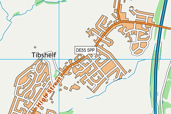
Exercise 4 All (Closed) on a map

Exercise 4 All (Closed) geodata
| Easting | 444248 |
| Northing | 361028 |
| Latitude | 53.144567 |
| Longitude | -1.339927 |
| Local Authority Name | Bolsover |
| Local Authority Code | E07000033 |
| Parliamentary Constituency Name | Bolsover |
| Parliamentary Constituency Code | E14000577 |
| Region Name | East Midlands |
| Region Code | E15000004 |
| Ward Name | Tibshelf |
| Ward Code | E05011998 |
| Output Area Code | E00098730 |
About this data
This data is open data sourced from Active Places Power and licenced under the Active Places Open Data Licence.
| Created On | 20th Feb 2006 |
| Audited On | 16th Feb 2015 |
| Checked On | 16th Feb 2015 |
