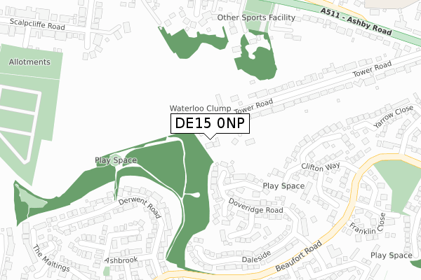
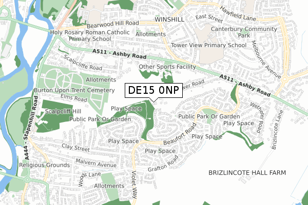
DE15 0NP is located in the Brizlincote electoral ward, within the local authority district of East Staffordshire and the English Parliamentary constituency of Burton. The Sub Integrated Care Board (ICB) Location is NHS Staffordshire and Stoke-on-Trent ICB - 05D and the police force is Staffordshire. This postcode has been in use since December 2019.


GetTheData
Source: OS Open Zoomstack (Ordnance Survey)
Licence: Open Government Licence (requires attribution)
Attribution: Contains OS data © Crown copyright and database right 2024
Source: Open Postcode Geo
Licence: Open Government Licence (requires attribution)
Attribution: Contains OS data © Crown copyright and database right 2024; Contains Royal Mail data © Royal Mail copyright and database right 2024; Source: Office for National Statistics licensed under the Open Government Licence v.3.0
| Easting | 426557 |
| Northing | 322634 |
| Latitude | 52.800633 |
| Longitude | -1.607538 |
GetTheData
Source: Open Postcode Geo
Licence: Open Government Licence
| Country | England |
| Postcode District | DE15 |
| ➜ DE15 open data dashboard ➜ See where DE15 is on a map ➜ Where is Burton upon Trent? | |
GetTheData
Source: Land Registry Price Paid Data
Licence: Open Government Licence
| Ward | Brizlincote |
| Constituency | Burton |
GetTheData
Source: ONS Postcode Database
Licence: Open Government Licence
NORTHLEA HOUSE, THE MEADOWS, BURTON-ON-TRENT, DE15 0NP 2020 17 DEC £610,000 |
HIGHFIELD HOUSE, THE MEADOWS, BURTON-ON-TRENT, DE15 0NP 2020 11 FEB £495,000 |
➜ Burton upon Trent house prices
GetTheData
Source: HM Land Registry Price Paid Data
Licence: Contains HM Land Registry data © Crown copyright and database right 2024. This data is licensed under the Open Government Licence v3.0.
| June 2022 | Violence and sexual offences | On or near Cottesmore Close | 353m |
| June 2022 | Anti-social behaviour | On or near Cameron Close | 405m |
| June 2022 | Violence and sexual offences | On or near Cameron Close | 405m |
| ➜ Get more crime data in our Crime section | |||
GetTheData
Source: data.police.uk
Licence: Open Government Licence
| Dalton Avenue (Beaufort Road) | Brizlincote | 359m |
| Dalton Avenue (Beaufort Road) | Brizlincote | 369m |
| Burton Tennis And Squash Club (Ashby Rd) | Winshill | 379m |
| Burton Tennis And Squash Club (Ashby Road) | Winshill | 385m |
| Mervyn Road (Ashby Road) | Winshill | 422m |
| Burton-on-Trent Station | 2.4km |
GetTheData
Source: NaPTAN
Licence: Open Government Licence
GetTheData
Source: ONS Postcode Database
Licence: Open Government Licence


➜ Get more ratings from the Food Standards Agency
GetTheData
Source: Food Standards Agency
Licence: FSA terms & conditions
| Last Collection | |||
|---|---|---|---|
| Location | Mon-Fri | Sat | Distance |
| Grafton Road | 16:00 | 12:30 | 495m |
| Alexandra Road | 16:00 | 10:30 | 527m |
| Tower Road | 16:00 | 12:30 | 565m |
GetTheData
Source: Dracos
Licence: Creative Commons Attribution-ShareAlike
| Facility | Distance |
|---|---|
| Burton Tennis & Squash Club Ashby Road, Burton-on-trent Indoor Tennis Centre, Squash Courts, Outdoor Tennis Courts | 322m |
| Tower View School Vancouver Drive, Burton-on-trent Grass Pitches | 693m |
| Holy Rosary Catholic Voluntary Academy Alexandra Road, Alexandra Road, Burton-on-trent Grass Pitches | 757m |
GetTheData
Source: Active Places
Licence: Open Government Licence
| School | Phase of Education | Distance |
|---|---|---|
| Tower View Primary School Vancouver Drive, Winshill, Burton-on-Trent, DE15 0EZ | Primary | 747m |
| Holy Rosary Catholic Voluntary Academy Alexandra Road, Burton-on-Trent, DE15 0JE | Primary | 757m |
| Abbot Beyne School Linnell Building, Osborne Street, Burton-on-Trent, DE15 0JL | Secondary | 905m |
GetTheData
Source: Edubase
Licence: Open Government Licence
The below table lists the International Territorial Level (ITL) codes (formerly Nomenclature of Territorial Units for Statistics (NUTS) codes) and Local Administrative Units (LAU) codes for DE15 0NP:
| ITL 1 Code | Name |
|---|---|
| TLG | West Midlands (England) |
| ITL 2 Code | Name |
| TLG2 | Shropshire and Staffordshire |
| ITL 3 Code | Name |
| TLG24 | Staffordshire CC |
| LAU 1 Code | Name |
| E07000193 | East Staffordshire |
GetTheData
Source: ONS Postcode Directory
Licence: Open Government Licence
The below table lists the Census Output Area (OA), Lower Layer Super Output Area (LSOA), and Middle Layer Super Output Area (MSOA) for DE15 0NP:
| Code | Name | |
|---|---|---|
| OA | E00150156 | |
| LSOA | E01029470 | East Staffordshire 010C |
| MSOA | E02006140 | East Staffordshire 010 |
GetTheData
Source: ONS Postcode Directory
Licence: Open Government Licence
| DE15 0NS | Southgate Drive | 68m |
| DE15 9GF | Eyam Close | 139m |
| DE15 9GQ | Grizedale Close | 167m |
| DE15 9GD | Doveridge Road | 178m |
| DE15 9GG | Newby Close | 240m |
| DE15 9FR | Derwent Road | 254m |
| DE15 0NL | Tower Road | 260m |
| DE15 9DW | Clifton Way | 264m |
| DE15 9GB | Doveridge Road | 269m |
| DE15 9FY | Avon Way | 275m |
GetTheData
Source: Open Postcode Geo; Land Registry Price Paid Data
Licence: Open Government Licence