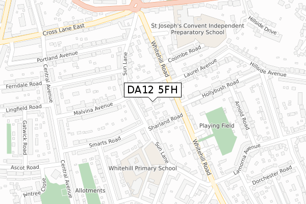
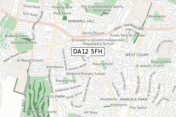
DA12 5FH is located in the Whitehill & Windmill Hill electoral ward, within the local authority district of Gravesham and the English Parliamentary constituency of Gravesham. The Sub Integrated Care Board (ICB) Location is NHS Kent and Medway ICB - 91Q and the police force is Kent. This postcode has been in use since March 2018.


GetTheData
Source: OS Open Zoomstack (Ordnance Survey)
Licence: Open Government Licence (requires attribution)
Attribution: Contains OS data © Crown copyright and database right 2024
Source: Open Postcode Geo
Licence: Open Government Licence (requires attribution)
Attribution: Contains OS data © Crown copyright and database right 2024; Contains Royal Mail data © Royal Mail copyright and database right 2024; Source: Office for National Statistics licensed under the Open Government Licence v.3.0
| Easting | 565244 |
| Northing | 172650 |
| Latitude | 51.428764 |
| Longitude | 0.375618 |
GetTheData
Source: Open Postcode Geo
Licence: Open Government Licence
| Country | England |
| Postcode District | DA12 |
| ➜ DA12 open data dashboard ➜ See where DA12 is on a map ➜ Where is Gravesend? | |
GetTheData
Source: Land Registry Price Paid Data
Licence: Open Government Licence
| Ward | Whitehill & Windmill Hill |
| Constituency | Gravesham |
GetTheData
Source: ONS Postcode Database
Licence: Open Government Licence
1, WOODSIDE MEWS, GRAVESEND, DA12 5FH 2018 15 JUN £500,000 |
GetTheData
Source: HM Land Registry Price Paid Data
Licence: Contains HM Land Registry data © Crown copyright and database right 2024. This data is licensed under the Open Government Licence v3.0.
| January 2024 | Anti-social behaviour | On or near Parking Area | 266m |
| January 2024 | Shoplifting | On or near Whitehill Parade | 476m |
| January 2024 | Shoplifting | On or near Whitehill Parade | 476m |
| ➜ Get more crime data in our Crime section | |||
GetTheData
Source: data.police.uk
Licence: Open Government Licence
| Malvina Avenue (Sun Lane) | Kings Farm | 75m |
| Hollybush Road (Whitehill Road) | Kings Farm | 85m |
| Kitchener Avenue | Kings Farm | 262m |
| Echo Square | Kings Farm | 269m |
| Lamorna Avenue (Whitehill Road) | Kings Farm | 294m |
| Gravesend Station | 1.5km |
| Tilbury Town Station | 4km |
| Northfleet Station | 4km |
GetTheData
Source: NaPTAN
Licence: Open Government Licence
| Percentage of properties with Next Generation Access | 100.0% |
| Percentage of properties with Superfast Broadband | 100.0% |
| Percentage of properties with Ultrafast Broadband | 100.0% |
| Percentage of properties with Full Fibre Broadband | 0.0% |
Superfast Broadband is between 30Mbps and 300Mbps
Ultrafast Broadband is > 300Mbps
| Percentage of properties unable to receive 2Mbps | 0.0% |
| Percentage of properties unable to receive 5Mbps | 0.0% |
| Percentage of properties unable to receive 10Mbps | 0.0% |
| Percentage of properties unable to receive 30Mbps | 0.0% |
GetTheData
Source: Ofcom
Licence: Ofcom Terms of Use (requires attribution)
GetTheData
Source: ONS Postcode Database
Licence: Open Government Licence


➜ Get more ratings from the Food Standards Agency
GetTheData
Source: Food Standards Agency
Licence: FSA terms & conditions
| Last Collection | |||
|---|---|---|---|
| Location | Mon-Fri | Sat | Distance |
| Echo Square | 17:30 | 11:00 | 319m |
| Smarts Road | 17:30 | 11:00 | 337m |
| Woodville Gardens | 18:30 | 11:00 | 339m |
GetTheData
Source: Dracos
Licence: Creative Commons Attribution-ShareAlike
| Facility | Distance |
|---|---|
| Whitehill Primary School Sun Lane, Gravesend Grass Pitches | 208m |
| St Joseph's Preparatory School Old Road East, Gravesend Grass Pitches | 304m |
| Mid Kent Golf Club Singlewell Road, Gravesend Golf | 657m |
GetTheData
Source: Active Places
Licence: Open Government Licence
| School | Phase of Education | Distance |
|---|---|---|
| Whitehill Primary School Sun Lane, Gravesend, DA12 5HN | Primary | 279m |
| St John's Catholic Comprehensive Rochester Road, Gravesend, DA12 2JW | Secondary | 891m |
| Saint George's Church of England School Meadow Road, Gravesend, DA11 7LS | All-through | 989m |
GetTheData
Source: Edubase
Licence: Open Government Licence
The below table lists the International Territorial Level (ITL) codes (formerly Nomenclature of Territorial Units for Statistics (NUTS) codes) and Local Administrative Units (LAU) codes for DA12 5FH:
| ITL 1 Code | Name |
|---|---|
| TLJ | South East (England) |
| ITL 2 Code | Name |
| TLJ4 | Kent |
| ITL 3 Code | Name |
| TLJ43 | Kent Thames Gateway |
| LAU 1 Code | Name |
| E07000109 | Gravesham |
GetTheData
Source: ONS Postcode Directory
Licence: Open Government Licence
The below table lists the Census Output Area (OA), Lower Layer Super Output Area (LSOA), and Middle Layer Super Output Area (MSOA) for DA12 5FH:
| Code | Name | |
|---|---|---|
| OA | E00123162 | |
| LSOA | E01024259 | Gravesham 005A |
| MSOA | E02005059 | Gravesham 005 |
GetTheData
Source: ONS Postcode Directory
Licence: Open Government Licence
| DA12 5PD | Canterbury Road | 48m |
| DA12 5PF | Whitehill Road | 65m |
| DA12 5HL | Sun Lane | 73m |
| DA12 5HQ | Sun Lane | 83m |
| DA12 5HP | Sharland Road | 88m |
| DA12 5PQ | Whitehill Road | 94m |
| DA12 5HN | Sun Lane | 125m |
| DA12 5PG | Whitehill Road | 157m |
| DA12 5HG | Sun Lane | 161m |
| DA12 5PE | Whitehill Road | 176m |
GetTheData
Source: Open Postcode Geo; Land Registry Price Paid Data
Licence: Open Government Licence