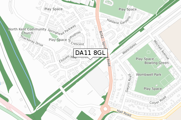
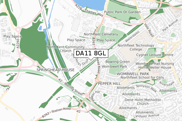
DA11 8GL is located in the Northfleet & Springhead electoral ward, within the local authority district of Gravesham and the English Parliamentary constituency of Gravesham. The Sub Integrated Care Board (ICB) Location is NHS Kent and Medway ICB - 91Q and the police force is Kent. This postcode has been in use since March 2019.


GetTheData
Source: OS Open Zoomstack (Ordnance Survey)
Licence: Open Government Licence (requires attribution)
Attribution: Contains OS data © Crown copyright and database right 2024
Source: Open Postcode Geo
Licence: Open Government Licence (requires attribution)
Attribution: Contains OS data © Crown copyright and database right 2024; Contains Royal Mail data © Royal Mail copyright and database right 2024; Source: Office for National Statistics licensed under the Open Government Licence v.3.0
| Easting | 562222 |
| Northing | 172828 |
| Latitude | 51.431235 |
| Longitude | 0.332268 |
GetTheData
Source: Open Postcode Geo
Licence: Open Government Licence
| Country | England |
| Postcode District | DA11 |
| ➜ DA11 open data dashboard ➜ See where DA11 is on a map ➜ Where is Northfleet? | |
GetTheData
Source: Land Registry Price Paid Data
Licence: Open Government Licence
| Ward | Northfleet & Springhead |
| Constituency | Gravesham |
GetTheData
Source: ONS Postcode Database
Licence: Open Government Licence
| January 2024 | Vehicle crime | On or near Fleet Road | 407m |
| October 2023 | Other theft | On or near Fleet Road | 407m |
| August 2023 | Vehicle crime | On or near Fleet Road | 407m |
| ➜ Get more crime data in our Crime section | |||
GetTheData
Source: data.police.uk
Licence: Open Government Licence
| Pepper Hill Sainsburys (On Grounds) | Northfleet | 121m |
| Gwynn Road (Waterdales) | Northfleet | 125m |
| Pepper Hill Sainsburys (Springhead Road) | Northfleet | 154m |
| Orchard Road (Springhead Road) | Northfleet | 154m |
| Gwynn Road (Waterdales) | Northfleet | 167m |
| Ebbsfleet International Station | 1.5km |
| Northfleet Station | 1.7km |
| Swanscombe Station | 2.5km |
GetTheData
Source: NaPTAN
Licence: Open Government Licence
| Percentage of properties with Next Generation Access | 100.0% |
| Percentage of properties with Superfast Broadband | 100.0% |
| Percentage of properties with Ultrafast Broadband | 100.0% |
| Percentage of properties with Full Fibre Broadband | 100.0% |
Superfast Broadband is between 30Mbps and 300Mbps
Ultrafast Broadband is > 300Mbps
| Percentage of properties unable to receive 2Mbps | 0.0% |
| Percentage of properties unable to receive 5Mbps | 0.0% |
| Percentage of properties unable to receive 10Mbps | 0.0% |
| Percentage of properties unable to receive 30Mbps | 0.0% |
GetTheData
Source: Ofcom
Licence: Ofcom Terms of Use (requires attribution)
GetTheData
Source: ONS Postcode Database
Licence: Open Government Licence


➜ Get more ratings from the Food Standards Agency
GetTheData
Source: Food Standards Agency
Licence: FSA terms & conditions
| Last Collection | |||
|---|---|---|---|
| Location | Mon-Fri | Sat | Distance |
| Waterdales | 17:30 | 11:45 | 114m |
| Waterdales Post Office | 17:30 | 11:45 | 387m |
| Mitchell Avenue | 17:30 | 11:30 | 535m |
GetTheData
Source: Dracos
Licence: Creative Commons Attribution-ShareAlike
| Facility | Distance |
|---|---|
| Wombwell Park Mitchell Avenue, Northfleet, Gravesend Grass Pitches, Outdoor Tennis Courts | 381m |
| Springhead Park School Springhead Parkway, Springhead Parkway, Northfleet, Gravesend Grass Pitches | 469m |
| Springhead Recreation Ground Springhead Road, Northfleet, Gravesend Grass Pitches | 481m |
GetTheData
Source: Active Places
Licence: Open Government Licence
| School | Phase of Education | Distance |
|---|---|---|
| Springhead Park Primary School Springhead Parkway, Springhead Park, Northfleet, DA11 8BY | Primary | 257m |
| Northfleet School for Girls Hall Road, Northfleet, Gravesend, DA11 8AQ | Secondary | 650m |
| Northfleet Technology College Colyer Road, Northfleet, Gravesend, DA11 8BG | Secondary | 812m |
GetTheData
Source: Edubase
Licence: Open Government Licence
The below table lists the International Territorial Level (ITL) codes (formerly Nomenclature of Territorial Units for Statistics (NUTS) codes) and Local Administrative Units (LAU) codes for DA11 8GL:
| ITL 1 Code | Name |
|---|---|
| TLJ | South East (England) |
| ITL 2 Code | Name |
| TLJ4 | Kent |
| ITL 3 Code | Name |
| TLJ43 | Kent Thames Gateway |
| LAU 1 Code | Name |
| E07000109 | Gravesham |
GetTheData
Source: ONS Postcode Directory
Licence: Open Government Licence
The below table lists the Census Output Area (OA), Lower Layer Super Output Area (LSOA), and Middle Layer Super Output Area (MSOA) for DA11 8GL:
| Code | Name | |
|---|---|---|
| OA | E00167468 | |
| LSOA | E01024280 | Gravesham 006A |
| MSOA | E02005060 | Gravesham 006 |
GetTheData
Source: ONS Postcode Directory
Licence: Open Government Licence
| DA11 8HS | Springhead Road | 124m |
| DA11 8FB | Bonham Way | 141m |
| DA11 8FD | Hindmarsh Crescent | 147m |
| DA11 8HT | Springhead Road | 152m |
| DA11 8JG | Springhead Road | 188m |
| DA11 8AD | Springhead Parkway | 192m |
| DA11 8HU | Orchard Road | 227m |
| DA11 8BF | Springhead Parkway | 232m |
| DA11 8JN | Waterdales | 234m |
| DA11 8AP | Gwynn Road | 237m |
GetTheData
Source: Open Postcode Geo; Land Registry Price Paid Data
Licence: Open Government Licence