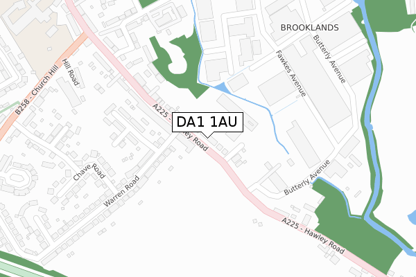
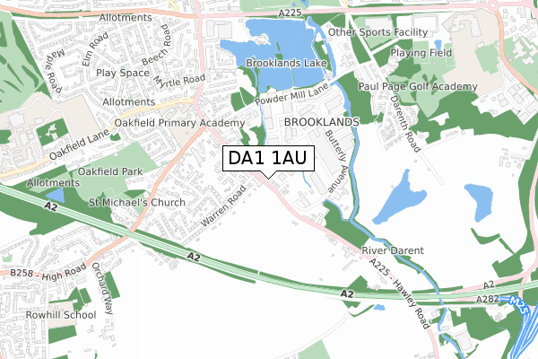
DA1 1AU is located in the Princes electoral ward, within the local authority district of Dartford and the English Parliamentary constituency of Dartford. The Sub Integrated Care Board (ICB) Location is NHS Kent and Medway ICB - 91Q and the police force is Kent. This postcode has been in use since January 2019.


GetTheData
Source: OS Open Zoomstack (Ordnance Survey)
Licence: Open Government Licence (requires attribution)
Attribution: Contains OS data © Crown copyright and database right 2024
Source: Open Postcode Geo
Licence: Open Government Licence (requires attribution)
Attribution: Contains OS data © Crown copyright and database right 2024; Contains Royal Mail data © Royal Mail copyright and database right 2024; Source: Office for National Statistics licensed under the Open Government Licence v.3.0
| Easting | 554439 |
| Northing | 172535 |
| Latitude | 51.430776 |
| Longitude | 0.220270 |
GetTheData
Source: Open Postcode Geo
Licence: Open Government Licence
| Country | England |
| Postcode District | DA1 |
| ➜ DA1 open data dashboard ➜ See where DA1 is on a map ➜ Where is Dartford? | |
GetTheData
Source: Land Registry Price Paid Data
Licence: Open Government Licence
| Ward | Princes |
| Constituency | Dartford |
GetTheData
Source: ONS Postcode Database
Licence: Open Government Licence
| December 2022 | Drugs | On or near Sackville Road | 404m |
| October 2022 | Criminal damage and arson | On or near Sackville Road | 404m |
| June 2022 | Violence and sexual offences | On or near Hawley Road | 83m |
| ➜ Get more crime data in our Crime section | |||
GetTheData
Source: data.police.uk
Licence: Open Government Licence
| Warren Road (Hawley Road) | Wilmington | 28m |
| Warren Road (Hawley Road) | Wilmington | 117m |
| Claremont Cottages (Hawley Road) | Wilmington | 194m |
| Claremont Cottages (Hawley Road) | Wilmington | 266m |
| Powder Mill Lane (Hawley Road) | Wilmington | 278m |
| Dartford Station | 1.8km |
| Farningham Road Station | 3.4km |
| Crayford Station | 3.5km |
GetTheData
Source: NaPTAN
Licence: Open Government Licence
| Percentage of properties with Next Generation Access | 100.0% |
| Percentage of properties with Superfast Broadband | 100.0% |
| Percentage of properties with Ultrafast Broadband | 100.0% |
| Percentage of properties with Full Fibre Broadband | 0.0% |
Superfast Broadband is between 30Mbps and 300Mbps
Ultrafast Broadband is > 300Mbps
| Percentage of properties unable to receive 2Mbps | 0.0% |
| Percentage of properties unable to receive 5Mbps | 0.0% |
| Percentage of properties unable to receive 10Mbps | 0.0% |
| Percentage of properties unable to receive 30Mbps | 0.0% |
GetTheData
Source: Ofcom
Licence: Ofcom Terms of Use (requires attribution)
GetTheData
Source: ONS Postcode Database
Licence: Open Government Licence


➜ Get more ratings from the Food Standards Agency
GetTheData
Source: Food Standards Agency
Licence: FSA terms & conditions
| Last Collection | |||
|---|---|---|---|
| Location | Mon-Fri | Sat | Distance |
| Dartford Trade Park | 18:30 | 12:00 | 252m |
| Hawley Road | 18:30 | 12:15 | 294m |
| The Close | 17:30 | 12:00 | 863m |
GetTheData
Source: Dracos
Licence: Creative Commons Attribution-ShareAlike
| Facility | Distance |
|---|---|
| Oakfield Park Dartford Grass Pitches | 702m |
| David Lloyd (Dartford) Darenth Road, Dartford Swimming Pool, Health and Fitness Gym, Indoor Tennis Centre, Studio, Squash Courts, Outdoor Tennis Courts | 885m |
| Princes Park Stadium Grassbanks, Dartford Artificial Grass Pitch, Golf, Grass Pitches, Squash Courts | 948m |
GetTheData
Source: Active Places
Licence: Open Government Licence
| School | Phase of Education | Distance |
|---|---|---|
| Oakfield Primary Academy Oakfield Lane, Dartford, DA1 2SW | Primary | 681m |
| The Leigh Academy Green Street Green Road, Dartford, DA1 1QE | Secondary | 1.2km |
| North Kent College Oakfield Lane, Dartford, DA1 2JT | 16 plus | 1.3km |
GetTheData
Source: Edubase
Licence: Open Government Licence
The below table lists the International Territorial Level (ITL) codes (formerly Nomenclature of Territorial Units for Statistics (NUTS) codes) and Local Administrative Units (LAU) codes for DA1 1AU:
| ITL 1 Code | Name |
|---|---|
| TLJ | South East (England) |
| ITL 2 Code | Name |
| TLJ4 | Kent |
| ITL 3 Code | Name |
| TLJ43 | Kent Thames Gateway |
| LAU 1 Code | Name |
| E07000107 | Dartford |
GetTheData
Source: ONS Postcode Directory
Licence: Open Government Licence
The below table lists the Census Output Area (OA), Lower Layer Super Output Area (LSOA), and Middle Layer Super Output Area (MSOA) for DA1 1AU:
| Code | Name | |
|---|---|---|
| OA | E00122696 | |
| LSOA | E01024167 | Dartford 009C |
| MSOA | E02005036 | Dartford 009 |
GetTheData
Source: ONS Postcode Directory
Licence: Open Government Licence
| DA1 1PT | Hawley Road | 54m |
| DA1 1PB | Hawley Road | 125m |
| DA1 1PH | Warren Road | 184m |
| DA1 1PA | Hawley Road | 213m |
| DA1 1PJ | Mitchell Close | 230m |
| DA1 1PU | Hawley Road | 261m |
| DA1 1PS | Warren Road | 295m |
| DA1 1NQ | Warwick Way | 296m |
| DA1 1NT | Powder Mill Lane | 323m |
| DA2 7ED | Chave Road | 328m |
GetTheData
Source: Open Postcode Geo; Land Registry Price Paid Data
Licence: Open Government Licence