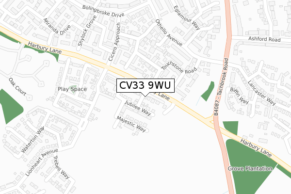
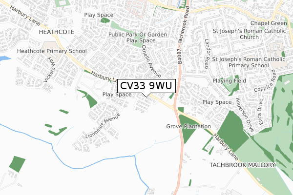
CV33 9WU maps, stats, and open data
CV33 9WU is located in the Bishop's Tachbrook electoral ward, within the local authority district of Warwick and the English Parliamentary constituency of Warwick and Leamington. The Sub Integrated Care Board (ICB) Location is NHS Coventry and Warwickshire ICB - B2M3M and the police force is Warwickshire. This postcode has been in use since December 2018.
CV33 9WU maps


Licence: Open Government Licence (requires attribution)
Attribution: Contains OS data © Crown copyright and database right 2025
Source: Open Postcode Geo
Licence: Open Government Licence (requires attribution)
Attribution: Contains OS data © Crown copyright and database right 2025; Contains Royal Mail data © Royal Mail copyright and database right 2025; Source: Office for National Statistics licensed under the Open Government Licence v.3.0
CV33 9WU geodata
| Easting | 431542 |
| Northing | 262719 |
| Latitude | 52.261752 |
| Longitude | -1.539264 |
Where is CV33 9WU?
| Country | England |
| Postcode District | CV33 |
Politics
| Ward | Bishop's Tachbrook |
|---|---|
| Constituency | Warwick And Leamington |
House Prices
Sales of detached houses in CV33 9WU
2024 14 OCT £379,950 |
2019 20 SEP £322,950 |
4, MAYAN CLOSE, BISHOPS TACHBROOK, LEAMINGTON SPA, CV33 9WU 2019 17 SEP £404,950 |
1, MAYAN CLOSE, BISHOPS TACHBROOK, LEAMINGTON SPA, CV33 9WU 2019 9 AUG £322,950 |
Licence: Contains HM Land Registry data © Crown copyright and database right 2025. This data is licensed under the Open Government Licence v3.0.
Transport
Nearest bus stops to CV33 9WU
| Touchstone Road (Othello Avenue) | Warwick Gates | 214m |
| Touchstone Road (Othello Avenue) | Warwick Gates | 239m |
| Ashford Road (Tachbrook Road) | Whitnash | 322m |
| Ashford Road (Tachbrook Road) | Whitnash | 348m |
| Tachbrook Road (Ashford Road) | Whitnash | 373m |
Nearest railway stations to CV33 9WU
| Leamington Spa Station | 2.5km |
| Warwick Station | 4km |
| Warwick Parkway Station | 5.7km |
Broadband
Broadband access in CV33 9WU (2020 data)
| Percentage of properties with Next Generation Access | 100.0% |
| Percentage of properties with Superfast Broadband | 100.0% |
| Percentage of properties with Ultrafast Broadband | 100.0% |
| Percentage of properties with Full Fibre Broadband | 100.0% |
Superfast Broadband is between 30Mbps and 300Mbps
Ultrafast Broadband is > 300Mbps
Broadband limitations in CV33 9WU (2020 data)
| Percentage of properties unable to receive 2Mbps | 0.0% |
| Percentage of properties unable to receive 5Mbps | 0.0% |
| Percentage of properties unable to receive 10Mbps | 0.0% |
| Percentage of properties unable to receive 30Mbps | 0.0% |
Deprivation
4.2% of English postcodes are less deprived than CV33 9WU:Food Standards Agency
Three nearest food hygiene ratings to CV33 9WU (metres)


➜ Get more ratings from the Food Standards Agency
Nearest post box to CV33 9WU
| Last Collection | |||
|---|---|---|---|
| Location | Mon-Fri | Sat | Distance |
| Romeo Arbour | 17:00 | 10:30 | 548m |
| Tachbrook Mallory | 16:00 | 07:30 | 555m |
| Cressida Close | 17:00 | 10:00 | 736m |
CV33 9WU ITL and CV33 9WU LAU
The below table lists the International Territorial Level (ITL) codes (formerly Nomenclature of Territorial Units for Statistics (NUTS) codes) and Local Administrative Units (LAU) codes for CV33 9WU:
| ITL 1 Code | Name |
|---|---|
| TLG | West Midlands (England) |
| ITL 2 Code | Name |
| TLG1 | Herefordshire, Worcestershire and Warwickshire |
| ITL 3 Code | Name |
| TLG13 | Warwickshire CC |
| LAU 1 Code | Name |
| E07000222 | Warwick |
CV33 9WU census areas
The below table lists the Census Output Area (OA), Lower Layer Super Output Area (LSOA), and Middle Layer Super Output Area (MSOA) for CV33 9WU:
| Code | Name | |
|---|---|---|
| OA | E00159386 | |
| LSOA | E01031259 | Warwick 014A |
| MSOA | E02006532 | Warwick 014 |
Nearest postcodes to CV33 9WU
| CV34 6EL | Laertes Grove | 71m |
| CV34 6EJ | Achilles Close | 109m |
| CV34 6EG | Trinculo Grove | 130m |
| CV34 6EE | Touchstone Road | 137m |
| CV34 6EQ | Reignier Place | 182m |
| CV34 6EH | Launce Grove | 198m |
| CV34 6EA | Cicero Approach | 199m |
| CV34 6EF | Dogberry Way | 236m |
| CV34 6FL | Calpurnia Avenue | 268m |
| CV34 6FN | Shylock Grove | 310m |