
CV33 8AB maps, stats, and open data
CV33 8AB is located in the Gaydon, Kineton & Upper Lighthorne electoral ward, within the local authority district of Stratford-on-Avon and the English Parliamentary constituency of Kenilworth and Southam. The Sub Integrated Care Board (ICB) Location is NHS Coventry and Warwickshire ICB - B2M3M and the police force is Warwickshire. This postcode has been in use since February 2022.
CV33 8AB geodata
| Easting | 435605 |
| Northing | 255793 |
| Latitude | 52.199241 |
| Longitude | -1.480463 |
Where is CV33 8AB?
| Country | England |
| Postcode District | CV33 |
Politics
| Ward | Gaydon, Kineton & Upper Lighthorne |
|---|---|
| Constituency | Kenilworth And Southam |
House Prices
Sales of detached houses in CV33 8AB
27, WHITE LIAS WAY, UPPER LIGHTHORNE, LEAMINGTON SPA, CV33 8AB 2025 28 MAR £440,000 |
73, WHITE LIAS WAY, UPPER LIGHTHORNE, LEAMINGTON SPA, CV33 8AB 2024 27 SEP £415,000 |
79, WHITE LIAS WAY, UPPER LIGHTHORNE, LEAMINGTON SPA, CV33 8AB 2024 27 SEP £439,046 |
75, WHITE LIAS WAY, UPPER LIGHTHORNE, LEAMINGTON SPA, CV33 8AB 2024 16 AUG £465,500 |
71, WHITE LIAS WAY, UPPER LIGHTHORNE, LEAMINGTON SPA, CV33 8AB 2024 28 JUN £389,500 |
69, WHITE LIAS WAY, UPPER LIGHTHORNE, LEAMINGTON SPA, CV33 8AB 2024 10 MAY £415,000 |
67, WHITE LIAS WAY, UPPER LIGHTHORNE, LEAMINGTON SPA, CV33 8AB 2023 3 NOV £465,900 |
47, WHITE LIAS WAY, UPPER LIGHTHORNE, LEAMINGTON SPA, CV33 8AB 2023 21 APR £369,070 |
53, WHITE LIAS WAY, UPPER LIGHTHORNE, LEAMINGTON SPA, CV33 8AB 2023 31 MAR £427,500 |
77, WHITE LIAS WAY, UPPER LIGHTHORNE, LEAMINGTON SPA, CV33 8AB 2023 27 JAN £585,000 |
➜ Lighthorne Heath house prices
Licence: Contains HM Land Registry data © Crown copyright and database right 2026. This data is licensed under the Open Government Licence v3.0.
Transport
Nearest bus stops to CV33 8AB
| Winyates Road (Banbury Road) | Lighthorne | 369m |
| Winyates Road (Banbury Road) | Lighthorne | 441m |
| Mallory Road (Leam Road) | Lighthorne | 551m |
| Heritage Motor Centre (Banbury Road) | Gaydon | 622m |
| Heritage Motor Centre (Banbury Road) | Gaydon | 628m |
Deprivation
48.5% of English postcodes are less deprived than CV33 8AB:Food Standards Agency
Three nearest food hygiene ratings to CV33 8AB (metres)
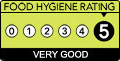
➜ Get more ratings from the Food Standards Agency
Nearest post box to CV33 8AB
| Last Collection | |||
|---|---|---|---|
| Location | Mon-Fri | Sat | Distance |
| Lighthorne Post Office | 16:30 | 11:00 | 1,800m |
| Gaydon | 16:00 | 08:45 | 2,021m |
| Ashorne Road | 17:15 | 10:15 | 2,254m |
CV33 8AB ITL and CV33 8AB LAU
The below table lists the International Territorial Level (ITL) codes (formerly Nomenclature of Territorial Units for Statistics (NUTS) codes) and Local Administrative Units (LAU) codes for CV33 8AB:
| ITL 1 Code | Name |
|---|---|
| TLG | West Midlands (England) |
| ITL 2 Code | Name |
| TLG1 | Herefordshire, Worcestershire and Warwickshire |
| ITL 3 Code | Name |
| TLG13 | Warwickshire CC |
| LAU 1 Code | Name |
| E07000221 | Stratford-on-Avon |
CV33 8AB census areas
The below table lists the Census Output Area (OA), Lower Layer Super Output Area (LSOA), and Middle Layer Super Output Area (MSOA) for CV33 8AB:
| Code | Name | |
|---|---|---|
| OA | E00159057 | |
| LSOA | E01031199 | Stratford-on-Avon 005C |
| MSOA | E02006508 | Stratford-on-Avon 005 |
Nearest postcodes to CV33 8AB
| CV35 0BE | Birdhaven Close | 319m |
| CV33 9TL | Compton Road | 342m |
| CV35 0BD | Oak Leigh | 358m |
| CV33 9TJ | Southam Crescent | 373m |
| CV33 9TH | Kenilworth Road | 390m |
| CV35 0BH | Chestnut Close | 390m |
| CV35 0AL | Bridle Road | 408m |
| CV33 9TG | Cromwell Place | 415m |
| CV33 9TP | Mallory Road | 420m |
| CV33 9TD | Marston Avenue | 471m |


- Contains OS data © Crown copyright and database right (2026)
- Contains Royal Mail data © Royal Mail copyright and Database right (2026)
- Contains National Statistics data © Crown copyright and database right (2026)
- Data produced by Land Registry © Crown copyright (2026)
- Contains Environment Agency data licensed under the Open Government Licence v3.0
- Everything else © GetTheData Publishing Limited (2026)
GetTheData.com is owned and operated by GetTheData Publishing Limited.
Company Number: 11075184 · Registered in England and Wales.
Registered Office: 3rd Floor, 86-90 Paul Street, London, England, EC2A 4NE
By accessing our site you agree to us using cookies, and sharing information about your use of our site, in accordance with our privacy policy.