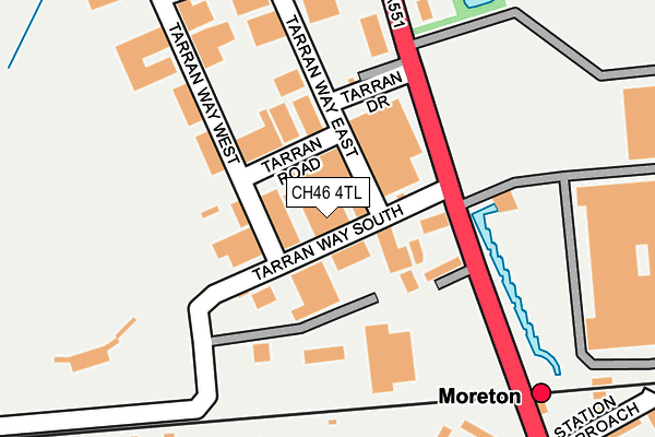
CH46 4TL is located in the Moreton West and Saughall Massie electoral ward, within the metropolitan district of Wirral and the English Parliamentary constituency of Wallasey. The Sub Integrated Care Board (ICB) Location is NHS Cheshire and Merseyside ICB - 12F and the police force is Merseyside. This postcode has been in use since June 1999.


GetTheData
Source: OS OpenMap – Local (Ordnance Survey)
Source: OS VectorMap District (Ordnance Survey)
Licence: Open Government Licence (requires attribution)
| Easting | 325825 |
| Northing | 390780 |
| Latitude | 53.408599 |
| Longitude | -3.117284 |
GetTheData
Source: Open Postcode Geo
Licence: Open Government Licence
| Country | England |
| Postcode District | CH46 |
| ➜ CH46 open data dashboard ➜ See where CH46 is on a map ➜ Where is Wallasey? | |
GetTheData
Source: Land Registry Price Paid Data
Licence: Open Government Licence
Elevation or altitude of CH46 4TL as distance above sea level:
| Metres | Feet | |
|---|---|---|
| Elevation | 10m | 33ft |
Elevation is measured from the approximate centre of the postcode, to the nearest point on an OS contour line from OS Terrain 50, which has contour spacing of ten vertical metres.
➜ How high above sea level am I? Find the elevation of your current position using your device's GPS.
GetTheData
Source: Open Postcode Elevation
Licence: Open Government Licence
| Ward | Moreton West And Saughall Massie |
| Constituency | Wallasey |
GetTheData
Source: ONS Postcode Database
Licence: Open Government Licence
| December 2023 | Violence and sexual offences | On or near Tarran Way North | 244m |
| September 2023 | Burglary | On or near Tarran Way North | 244m |
| September 2023 | Criminal damage and arson | On or near Tarran Way North | 244m |
| ➜ Get more crime data in our Crime section | |||
GetTheData
Source: data.police.uk
Licence: Open Government Licence
| Tarran Drive (Pasture Road) | Moreton | 111m |
| Tarran Way South (Pasture Road) | Moreton | 124m |
| Moreton Station (Pasture Road) | Moreton | 382m |
| Ditton Lane (Pasture Road) | Moreton | 387m |
| Ditton Lane (Pasture Road) | Moreton | 406m |
| Moreton (Merseyside) Station | 0.3km |
| Leasowe Station | 1.2km |
| Bidston Station | 2.6km |
GetTheData
Source: NaPTAN
Licence: Open Government Licence
GetTheData
Source: ONS Postcode Database
Licence: Open Government Licence


➜ Get more ratings from the Food Standards Agency
GetTheData
Source: Food Standards Agency
Licence: FSA terms & conditions
| Last Collection | |||
|---|---|---|---|
| Location | Mon-Fri | Sat | Distance |
| Millhouse Lane | 17:15 | 12:00 | 748m |
| Moreton Post Office | 18:00 | 12:00 | 936m |
| Leasowe Post Office | 17:11 | 12:00 | 1,022m |
GetTheData
Source: Dracos
Licence: Creative Commons Attribution-ShareAlike
| Facility | Distance |
|---|---|
| Premier Brands Playing Field (Closed) Wirral Grass Pitches | 231m |
| Moreton Hills Golf Centre Tarran Way South, Tarran Industrial Estate, Wirral Golf | 259m |
| Lingham Primary School Track (Closed) Townmeadow Lane, Wirral Athletics | 597m |
GetTheData
Source: Active Places
Licence: Open Government Licence
| School | Phase of Education | Distance |
|---|---|---|
| Lingham Primary School Townmeadow Lane, Moreton, Wirral, CH46 7UQ | Primary | 597m |
| Eastway Primary School Rossall Road, Moreton, Wirral, CH46 8TA | Primary | 781m |
| Sacred Heart Catholic Primary School Danger Lane, Moreton, Sacred Heart Catholic Primary School, Wirral, CH46 8UG | Primary | 1.1km |
GetTheData
Source: Edubase
Licence: Open Government Licence
| Risk of CH46 4TL flooding from rivers and sea | Very Low |
| ➜ CH46 4TL flood map | |
GetTheData
Source: Open Flood Risk by Postcode
Licence: Open Government Licence
The below table lists the International Territorial Level (ITL) codes (formerly Nomenclature of Territorial Units for Statistics (NUTS) codes) and Local Administrative Units (LAU) codes for CH46 4TL:
| ITL 1 Code | Name |
|---|---|
| TLD | North West (England) |
| ITL 2 Code | Name |
| TLD7 | Merseyside |
| ITL 3 Code | Name |
| TLD74 | Wirral |
| LAU 1 Code | Name |
| E08000015 | Wirral |
GetTheData
Source: ONS Postcode Directory
Licence: Open Government Licence
The below table lists the Census Output Area (OA), Lower Layer Super Output Area (LSOA), and Middle Layer Super Output Area (MSOA) for CH46 4TL:
| Code | Name | |
|---|---|---|
| OA | E00036606 | |
| LSOA | E01007227 | Wirral 012D |
| MSOA | E02001478 | Wirral 012 |
GetTheData
Source: ONS Postcode Directory
Licence: Open Government Licence
| CH46 4TG | Sunnyside | 118m |
| CH46 4TT | Tarran Way West | 228m |
| CH46 7UA | Berrylands Road | 235m |
| CH46 7UP | Bramble Way | 239m |
| CH46 4TD | Pasture Road | 257m |
| CH46 7TY | Berrylands Road | 270m |
| CH46 7TX | Berrylands Road | 305m |
| CH46 7UW | Meadfoot Road | 339m |
| CH46 7UL | Lingham Close | 354m |
| CH46 7UE | Harvest Lane | 379m |
GetTheData
Source: Open Postcode Geo; Land Registry Price Paid Data
Licence: Open Government Licence