Lingham Primary School Track (Closed) - Wirral
Lingham Primary School Track (Closed) is located in Wirral (CH46).
| Address | Townmeadow Lane, Wirral, CH46 7UQ |
| Car Park | Yes |
| Management Type | Not Known |
| Management Group | Not Known |
| Owner Type | Community school |
| Owner Group | Education |
| Education Phase | Primary |
| Closure Date | 1st May 2005 |
| Closure Reason | Unclassified |
Facilities
| Closure Date | 1st May 2005 |
| Closure Reason | Unclassified |
| Accessibility | Pay and Play |
| Management Type | Not Known |
| Changing Rooms | Yes |
| Date Record Checked | 25th Apr 2005 |
| Opening Times | Detailed Timings |
Facility specifics
| Floodlit | No |
| Infield Surface Type | Grass |
| Track Surface Type | Cinder |
Where is Lingham Primary School Track (Closed)?
| Sub Building Name | |
| Building Name | |
| Building Number | 0 |
| Dependent Thoroughfare | |
| Thoroughfare Name | Townmeadow Lane |
| Double Dependent Locality | |
| Dependent Locality | |
| PostTown | Wirral |
| Postcode | CH46 7UQ |
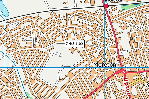
Lingham Primary School Track (Closed) on a map

Lingham Primary School Track (Closed) geodata
| Easting | 325720 |
| Northing | 390191.9 |
| Latitude | 53.403299 |
| Longitude | -3.118725 |
| Local Authority Name | Wirral |
| Local Authority Code | E08000015 |
| Parliamentary Constituency Name | Wallasey |
| Parliamentary Constituency Code | E14001010 |
| Region Name | North West |
| Region Code | E15000002 |
| Ward Name | Moreton West and Saughall Massie |
| Ward Code | E05000966 |
| Output Area Code | E00036613 |
About this data
This data is open data sourced from Active Places Power and licenced under the Active Places Open Data Licence.
| Created On | 14th Dec 2014 |
| Audited On | 26th Jan 2015 |
| Checked On | 25th Apr 2005 |
