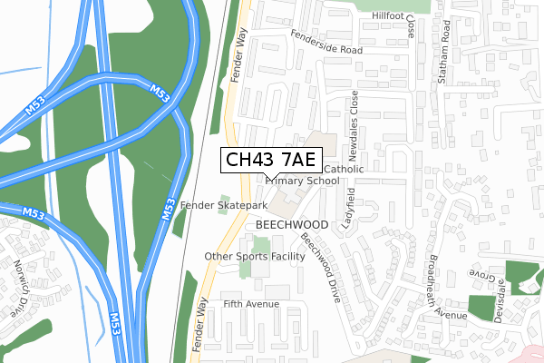
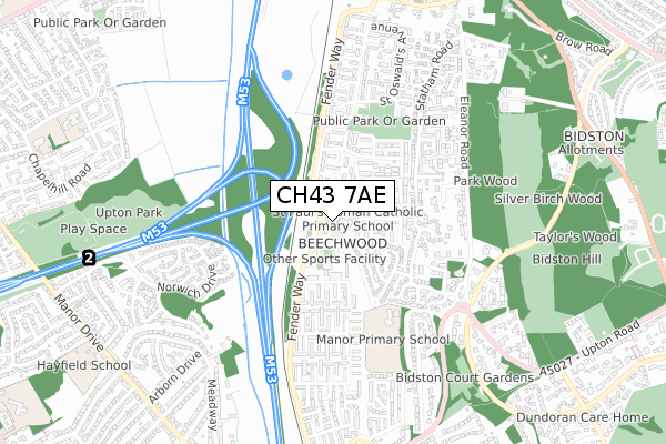
CH43 7AE is located in the Bidston and St James electoral ward, within the metropolitan district of Wirral and the English Parliamentary constituency of Birkenhead. The Sub Integrated Care Board (ICB) Location is NHS Cheshire and Merseyside ICB - 12F and the police force is Merseyside. This postcode has been in use since December 2018.


GetTheData
Source: OS Open Zoomstack (Ordnance Survey)
Licence: Open Government Licence (requires attribution)
Attribution: Contains OS data © Crown copyright and database right 2024
Source: Open Postcode Geo
Licence: Open Government Licence (requires attribution)
Attribution: Contains OS data © Crown copyright and database right 2024; Contains Royal Mail data © Royal Mail copyright and database right 2024; Source: Office for National Statistics licensed under the Open Government Licence v.3.0
| Easting | 328028 |
| Northing | 389413 |
| Latitude | 53.396637 |
| Longitude | -3.083837 |
GetTheData
Source: Open Postcode Geo
Licence: Open Government Licence
| Country | England |
| Postcode District | CH43 |
| ➜ CH43 open data dashboard ➜ See where CH43 is on a map ➜ Where is Birkenhead? | |
GetTheData
Source: Land Registry Price Paid Data
Licence: Open Government Licence
| Ward | Bidston And St James |
| Constituency | Birkenhead |
GetTheData
Source: ONS Postcode Database
Licence: Open Government Licence
| April 2023 | Burglary | On or near Broadheath Avenue | 343m |
| June 2022 | Violence and sexual offences | On or near Gaywood Close | 73m |
| June 2022 | Other crime | On or near Ladyfield | 148m |
| ➜ Get more crime data in our Crime section | |||
GetTheData
Source: data.police.uk
Licence: Open Government Licence
| Beechwood Drive (Fender Way) | Beechwood | 110m |
| Beechwood Drive (Fender Way) | Beechwood | 160m |
| Fifth Avenue (Fender Way) | Beechwood | 321m |
| Bidston Green Drive (Fender Way) | Beechwood | 344m |
| Fifth Avenue (Fender Way) | Beechwood | 347m |
| Upton Station | 1.1km |
| Bidston Station | 1.4km |
| Leasowe Station | 1.6km |
GetTheData
Source: NaPTAN
Licence: Open Government Licence
| Percentage of properties with Next Generation Access | 100.0% |
| Percentage of properties with Superfast Broadband | 100.0% |
| Percentage of properties with Ultrafast Broadband | 100.0% |
| Percentage of properties with Full Fibre Broadband | 0.0% |
Superfast Broadband is between 30Mbps and 300Mbps
Ultrafast Broadband is > 300Mbps
| Percentage of properties unable to receive 2Mbps | 0.0% |
| Percentage of properties unable to receive 5Mbps | 0.0% |
| Percentage of properties unable to receive 10Mbps | 0.0% |
| Percentage of properties unable to receive 30Mbps | 0.0% |
GetTheData
Source: Ofcom
Licence: Ofcom Terms of Use (requires attribution)
GetTheData
Source: ONS Postcode Database
Licence: Open Government Licence


➜ Get more ratings from the Food Standards Agency
GetTheData
Source: Food Standards Agency
Licence: FSA terms & conditions
| Last Collection | |||
|---|---|---|---|
| Location | Mon-Fri | Sat | Distance |
| Sandbrook Lane | 17:30 | 12:00 | 1,296m |
| Moreton Post Office | 18:00 | 12:00 | 1,943m |
| Buccleugh Street | 17:15 | 12:00 | 1,943m |
GetTheData
Source: Dracos
Licence: Creative Commons Attribution-ShareAlike
| Facility | Distance |
|---|---|
| Beechwood Recreation Centre Beechwood Drive, Prenton Sports Hall, Health and Fitness Gym, Studio | 156m |
| Manor Primary School (Prenton) Beechwood Drive, Prenton Grass Pitches | 409m |
| Hayfield School Manor Drive, Wirral Grass Pitches, Sports Hall | 1km |
GetTheData
Source: Active Places
Licence: Open Government Licence
| School | Phase of Education | Distance |
|---|---|---|
| St Paul's Catholic Primary School Farmfield Drive, Beechwood, Prenton, CH43 7TE | Primary | 37m |
| Manor Primary School Beechwood Drive, Birkenhead, Prenton, CH43 7ZU | Primary | 393m |
| The Observatory School Bidston Village Road, Bidston, Prenton, CH43 7QT | Not applicable | 898m |
GetTheData
Source: Edubase
Licence: Open Government Licence
The below table lists the International Territorial Level (ITL) codes (formerly Nomenclature of Territorial Units for Statistics (NUTS) codes) and Local Administrative Units (LAU) codes for CH43 7AE:
| ITL 1 Code | Name |
|---|---|
| TLD | North West (England) |
| ITL 2 Code | Name |
| TLD7 | Merseyside |
| ITL 3 Code | Name |
| TLD74 | Wirral |
| LAU 1 Code | Name |
| E08000015 | Wirral |
GetTheData
Source: ONS Postcode Directory
Licence: Open Government Licence
The below table lists the Census Output Area (OA), Lower Layer Super Output Area (LSOA), and Middle Layer Super Output Area (MSOA) for CH43 7AE:
| Code | Name | |
|---|---|---|
| OA | E00036088 | |
| LSOA | E01007124 | Wirral 011E |
| MSOA | E02001477 | Wirral 011 |
GetTheData
Source: ONS Postcode Directory
Licence: Open Government Licence
| CH43 7ZJ | Fender Way | 137m |
| CH43 7ZU | Beechwood Drive | 177m |
| CH43 7ZT | Farmfield Drive | 188m |
| CH43 7ZS | Newdales Close | 208m |
| CH43 7ND | Hartnup Way | 224m |
| CH43 7NA | Proudman Drive | 263m |
| CH43 9XL | Esher Close | 273m |
| CH43 9XJ | Everleigh Close | 285m |
| CH43 7NJ | Chelford Close | 292m |
| CH43 7ZL | Fenderside Road | 297m |
GetTheData
Source: Open Postcode Geo; Land Registry Price Paid Data
Licence: Open Government Licence