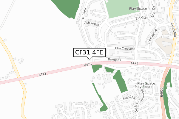
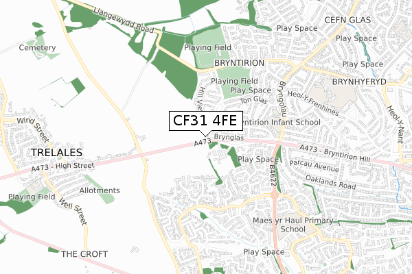
CF31 4FE is located in the Bryntirion, Laleston and Merthyr Mawr electoral ward, within the unitary authority of Bridgend and the Welsh Parliamentary constituency of Bridgend. The Local Health Board is Cwm Taf Morgannwg University and the police force is South Wales. This postcode has been in use since October 2019.


GetTheData
Source: OS Open Zoomstack (Ordnance Survey)
Licence: Open Government Licence (requires attribution)
Attribution: Contains OS data © Crown copyright and database right 2024
Source: Open Postcode Geo
Licence: Open Government Licence (requires attribution)
Attribution: Contains OS data © Crown copyright and database right 2024; Contains Royal Mail data © Royal Mail copyright and database right 2024; Source: Office for National Statistics licensed under the Open Government Licence v.3.0
| Easting | 288432 |
| Northing | 179979 |
| Latitude | 51.507693 |
| Longitude | -3.608993 |
GetTheData
Source: Open Postcode Geo
Licence: Open Government Licence
| Country | Wales |
| Postcode District | CF31 |
| ➜ CF31 open data dashboard ➜ See where CF31 is on a map ➜ Where is Bridgend? | |
GetTheData
Source: Land Registry Price Paid Data
Licence: Open Government Licence
| Ward | Bryntirion, Laleston And Merthyr Mawr |
| Constituency | Bridgend |
GetTheData
Source: ONS Postcode Database
Licence: Open Government Licence
| December 2023 | Other theft | On or near Blaen Y Cwm | 387m |
| October 2023 | Violence and sexual offences | On or near Chestnut Way | 265m |
| June 2023 | Public order | On or near Chestnut Way | 265m |
| ➜ Get more crime data in our Crime section | |||
GetTheData
Source: data.police.uk
Licence: Open Government Licence
| Ogmore Social Club (A473) | Bryntirion | 46m |
| Ogmore Social Club (A473) | Bryntirion | 98m |
| Broad Oak Way (Ton Glas) | Bryntirion | 224m |
| Broad Oak Way (Ton Glas) | Bryntirion | 227m |
| Mount Pleasant | Bryntirion | 348m |
| Bridgend Station | 2.3km |
| Wildmill Station | 2.5km |
| Sarn Station | 3.7km |
GetTheData
Source: NaPTAN
Licence: Open Government Licence
GetTheData
Source: ONS Postcode Database
Licence: Open Government Licence


➜ Get more ratings from the Food Standards Agency
GetTheData
Source: Food Standards Agency
Licence: FSA terms & conditions
| Last Collection | |||
|---|---|---|---|
| Location | Mon-Fri | Sat | Distance |
| Broadlands North | 17:00 | 11:30 | 499m |
| Shopping Centre Broadlands | 17:15 | 11:45 | 761m |
| Bryntirion Hill | 17:00 | 12:00 | 762m |
GetTheData
Source: Dracos
Licence: Creative Commons Attribution-ShareAlike
| School | Phase of Education | Distance |
|---|---|---|
| Bryntirion Infants School Bryngolau, Bryntirion, Bridgend, CF31 4DD | Not applicable | 438m |
| Maes yr Haul Primary School Broadlands, Ffordd Tirion, Bridgend, CF31 5EG | Not applicable | 728m |
| Llangewydd Junior School Llangewydd Road, Cefn Glas, Bridgend, CF31 4JT | Not applicable | 811m |
GetTheData
Source: Edubase
Licence: Open Government Licence
The below table lists the International Territorial Level (ITL) codes (formerly Nomenclature of Territorial Units for Statistics (NUTS) codes) and Local Administrative Units (LAU) codes for CF31 4FE:
| ITL 1 Code | Name |
|---|---|
| TLL | Wales |
| ITL 2 Code | Name |
| TLL1 | West Wales and The Valleys |
| ITL 3 Code | Name |
| TLL17 | Bridgend and Neath Port Talbot |
| LAU 1 Code | Name |
| W06000013 | Bridgend |
GetTheData
Source: ONS Postcode Directory
Licence: Open Government Licence
The below table lists the Census Output Area (OA), Lower Layer Super Output Area (LSOA), and Middle Layer Super Output Area (MSOA) for CF31 4FE:
| Code | Name | |
|---|---|---|
| OA | W00005243 | |
| LSOA | W01000990 | Bridgend 017B |
| MSOA | W02000234 | Bridgend 017 |
GetTheData
Source: ONS Postcode Directory
Licence: Open Government Licence
| CF31 4EA | Elm Crescent | 129m |
| CF31 4DX | 159m | |
| CF31 4EQ | Broad Oak Way | 171m |
| CF31 4ED | Hill View | 191m |
| CF31 4EE | Ash Grove | 220m |
| CF31 4ES | Bryn Glas | 239m |
| CF31 4EB | Hill View | 246m |
| CF31 4EF | Mount Pleasant | 276m |
| CF31 4ER | Chestnut Way | 276m |
| CF31 5AF | Ffridd Las | 284m |
GetTheData
Source: Open Postcode Geo; Land Registry Price Paid Data
Licence: Open Government Licence