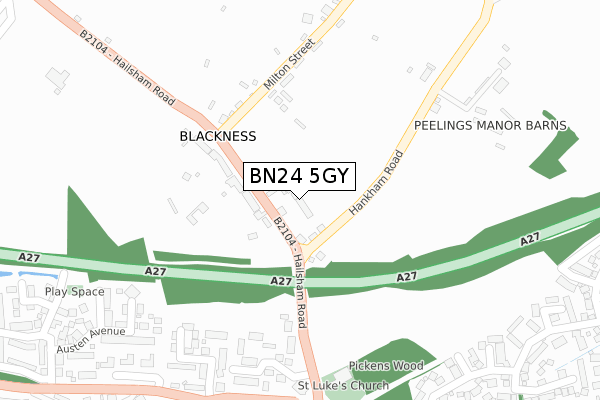
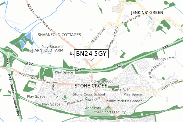
BN24 5GY is located in the Stone Cross electoral ward, within the local authority district of Wealden and the English Parliamentary constituency of Bexhill and Battle. The Sub Integrated Care Board (ICB) Location is NHS Sussex ICB - 97R and the police force is Sussex. This postcode has been in use since September 2019.


GetTheData
Source: OS Open Zoomstack (Ordnance Survey)
Licence: Open Government Licence (requires attribution)
Attribution: Contains OS data © Crown copyright and database right 2024
Source: Open Postcode Geo
Licence: Open Government Licence (requires attribution)
Attribution: Contains OS data © Crown copyright and database right 2024; Contains Royal Mail data © Royal Mail copyright and database right 2024; Source: Office for National Statistics licensed under the Open Government Licence v.3.0
| Easting | 561492 |
| Northing | 104779 |
| Latitude | 50.820036 |
| Longitude | 0.291312 |
GetTheData
Source: Open Postcode Geo
Licence: Open Government Licence
| Country | England |
| Postcode District | BN24 |
| ➜ BN24 open data dashboard ➜ See where BN24 is on a map ➜ Where is Blackness? | |
GetTheData
Source: Land Registry Price Paid Data
Licence: Open Government Licence
| Ward | Stone Cross |
| Constituency | Bexhill And Battle |
GetTheData
Source: ONS Postcode Database
Licence: Open Government Licence
| June 2022 | Other theft | On or near St Michaels Close | 321m |
| June 2022 | Violence and sexual offences | On or near St Michaels Close | 321m |
| June 2022 | Violence and sexual offences | On or near Milton Street | 342m |
| ➜ Get more crime data in our Crime section | |||
GetTheData
Source: data.police.uk
Licence: Open Government Licence
| Belle Vue (Hailsham Road) | Stone Cross | 42m |
| Belle Vue (Hailsham Road) | Stone Cross | 59m |
| Milton Street (Hailsham Road) | Stone Cross | 137m |
| Milton Street (Hailsham Road) | Stone Cross | 140m |
| Crossroads (Hailsham Road) | Stone Cross | 317m |
| Pevensey & Westham Station | 2.4km |
| Hampden Park (Sussex) Station | 2.8km |
| Polegate Station | 3.3km |
GetTheData
Source: NaPTAN
Licence: Open Government Licence
GetTheData
Source: ONS Postcode Database
Licence: Open Government Licence


➜ Get more ratings from the Food Standards Agency
GetTheData
Source: Food Standards Agency
Licence: FSA terms & conditions
| Last Collection | |||
|---|---|---|---|
| Location | Mon-Fri | Sat | Distance |
| Milton Place | 16:00 | 11:00 | 171m |
| Adur Drive | 16:00 | 11:00 | 388m |
| Stone Cross | 16:00 | 11:00 | 396m |
GetTheData
Source: Dracos
Licence: Creative Commons Attribution-ShareAlike
| Facility | Distance |
|---|---|
| Stone Cross School Adur Drive, Stone Cross, Pevensey Grass Pitches | 491m |
| Shinewater Sports & Community Centre Milfoil Drive, Eastbourne Sports Hall, Health and Fitness Gym | 1.3km |
| The Causeway School Larkspur Drive, Eastbourne Sports Hall, Grass Pitches, Studio, Outdoor Tennis Courts, Artificial Grass Pitch | 1.4km |
GetTheData
Source: Active Places
Licence: Open Government Licence
| School | Phase of Education | Distance |
|---|---|---|
| Stone Cross School Adur Drive, Stone Cross, Pevensey, BN24 5EF | Primary | 489m |
| Hankham Primary School Hankham Road, Hankham, Pevensey, BN24 5AY | Primary | 856m |
| Hazel Court School Larkspur Drive, Eastbourne, BN23 8EJ | Not applicable | 932m |
GetTheData
Source: Edubase
Licence: Open Government Licence
The below table lists the International Territorial Level (ITL) codes (formerly Nomenclature of Territorial Units for Statistics (NUTS) codes) and Local Administrative Units (LAU) codes for BN24 5GY:
| ITL 1 Code | Name |
|---|---|
| TLJ | South East (England) |
| ITL 2 Code | Name |
| TLJ2 | Surrey, East and West Sussex |
| ITL 3 Code | Name |
| TLJ22 | East Sussex CC |
| LAU 1 Code | Name |
| E07000065 | Wealden |
GetTheData
Source: ONS Postcode Directory
Licence: Open Government Licence
The below table lists the Census Output Area (OA), Lower Layer Super Output Area (LSOA), and Middle Layer Super Output Area (MSOA) for BN24 5GY:
| Code | Name | |
|---|---|---|
| OA | E00107739 | |
| LSOA | E01021208 | Wealden 020C |
| MSOA | E02004422 | Wealden 020 |
GetTheData
Source: ONS Postcode Directory
Licence: Open Government Licence
| BN24 5AR | Hankham Road | 66m |
| BN24 5AS | Hailsham Road | 86m |
| BN24 5BY | Hailsham Road | 185m |
| BN24 5AT | Milton Street | 209m |
| BN24 5BX | Hailsham Road | 220m |
| BN24 5EH | The Crossways | 250m |
| BN24 5EU | St Michaels Close | 311m |
| BN24 5EJ | The Crossways | 311m |
| BN24 5AU | Milton Street | 317m |
| BN24 5EL | Dittons Road | 343m |
GetTheData
Source: Open Postcode Geo; Land Registry Price Paid Data
Licence: Open Government Licence