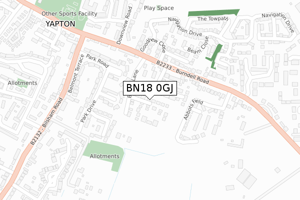
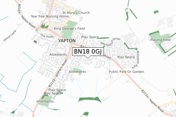
BN18 0GJ is located in the Yapton electoral ward, within the local authority district of Arun and the English Parliamentary constituency of Bognor Regis and Littlehampton. The Sub Integrated Care Board (ICB) Location is NHS Sussex ICB - 70F and the police force is Sussex. This postcode has been in use since February 2020.


GetTheData
Source: OS Open Zoomstack (Ordnance Survey)
Licence: Open Government Licence (requires attribution)
Attribution: Contains OS data © Crown copyright and database right 2024
Source: Open Postcode Geo
Licence: Open Government Licence (requires attribution)
Attribution: Contains OS data © Crown copyright and database right 2024; Contains Royal Mail data © Royal Mail copyright and database right 2024; Source: Office for National Statistics licensed under the Open Government Licence v.3.0
| Easting | 498338 |
| Northing | 102843 |
| Latitude | 50.816785 |
| Longitude | -0.605416 |
GetTheData
Source: Open Postcode Geo
Licence: Open Government Licence
| Country | England |
| Postcode District | BN18 |
| ➜ BN18 open data dashboard ➜ See where BN18 is on a map ➜ Where is Yapton? | |
GetTheData
Source: Land Registry Price Paid Data
Licence: Open Government Licence
| Ward | Yapton |
| Constituency | Bognor Regis And Littlehampton |
GetTheData
Source: ONS Postcode Database
Licence: Open Government Licence
47, LINSEED WAY, YAPTON, ARUNDEL, BN18 0GJ 2022 22 DEC £449,000 |
42, LINSEED WAY, YAPTON, ARUNDEL, BN18 0GJ 2022 16 SEP £489,000 |
50, LINSEED WAY, YAPTON, ARUNDEL, BN18 0GJ 2022 10 AUG £529,000 |
40, LINSEED WAY, YAPTON, ARUNDEL, BN18 0GJ 2022 29 JUL £484,000 |
28, LINSEED WAY, YAPTON, ARUNDEL, BN18 0GJ 2022 23 JUN £469,000 |
30, LINSEED WAY, YAPTON, ARUNDEL, BN18 0GJ 2022 19 MAY £499,000 |
35, LINSEED WAY, YAPTON, ARUNDEL, BN18 0GJ 2022 8 APR £485,000 |
29, LINSEED WAY, YAPTON, ARUNDEL, BN18 0GJ 2022 25 MAR £485,000 |
2022 27 JAN £405,000 |
38, LINSEED WAY, YAPTON, ARUNDEL, BN18 0GJ 2021 23 DEC £475,000 |
GetTheData
Source: HM Land Registry Price Paid Data
Licence: Contains HM Land Registry data © Crown copyright and database right 2024. This data is licensed under the Open Government Licence v3.0.
| January 2024 | Violence and sexual offences | On or near Foundry Road | 461m |
| December 2023 | Violence and sexual offences | On or near Foundry Road | 461m |
| November 2023 | Other theft | On or near Parking Area | 481m |
| ➜ Get more crime data in our Crime section | |||
GetTheData
Source: data.police.uk
Licence: Open Government Licence
| Fordwater Gardens (Burndell Road) | Yapton | 228m |
| Fordwater Gardens (Burndell Road) | Yapton | 253m |
| Sparks Corner (Bisham Road) | Yapton | 312m |
| Sparks Corner (Bilsham Road) | Yapton | 324m |
| Loveys Road (Bilsham Road) | Yapton | 427m |
| Ford Station | 2.4km |
| Barnham Station | 2.9km |
| Littlehampton Station | 4.3km |
GetTheData
Source: NaPTAN
Licence: Open Government Licence
GetTheData
Source: ONS Postcode Database
Licence: Open Government Licence


➜ Get more ratings from the Food Standards Agency
GetTheData
Source: Food Standards Agency
Licence: FSA terms & conditions
| Last Collection | |||
|---|---|---|---|
| Location | Mon-Fri | Sat | Distance |
| Burndell Road | 16:00 | 08:00 | 155m |
| Bilsham Road | 16:00 | 09:15 | 335m |
| Yapton Post Office | 16:15 | 09:30 | 413m |
GetTheData
Source: Dracos
Licence: Creative Commons Attribution-ShareAlike
| Facility | Distance |
|---|---|
| Yapton And Ford Village Hall Main Road, Yapton, Arundel Sports Hall, Grass Pitches | 533m |
| Arun Sports Arena Ford Airfield Industrial Estate, Ford, Arundel Artificial Grass Pitch | 744m |
| Ford Indoor Football Arena (Closed) Ford Airfield Industrial Estate, Ford, Arundel Artificial Grass Pitch | 962m |
GetTheData
Source: Active Places
Licence: Open Government Licence
| School | Phase of Education | Distance |
|---|---|---|
| Yapton CE Primary School North End Road, Yapton, Arundel, BN18 0DU | Primary | 981m |
| St Mary's CofE Primary School Brookpit Lane, Clymping, Littlehampton, BN17 5QU | Primary | 2.4km |
| Bishop Tufnell CofE Primary School, Felpham Pennyfields, Felpham, Bognor Regis, PO22 6BN | Primary | 3.1km |
GetTheData
Source: Edubase
Licence: Open Government Licence
The below table lists the International Territorial Level (ITL) codes (formerly Nomenclature of Territorial Units for Statistics (NUTS) codes) and Local Administrative Units (LAU) codes for BN18 0GJ:
| ITL 1 Code | Name |
|---|---|
| TLJ | South East (England) |
| ITL 2 Code | Name |
| TLJ2 | Surrey, East and West Sussex |
| ITL 3 Code | Name |
| TLJ27 | West Sussex (South West) |
| LAU 1 Code | Name |
| E07000224 | Arun |
GetTheData
Source: ONS Postcode Directory
Licence: Open Government Licence
The below table lists the Census Output Area (OA), Lower Layer Super Output Area (LSOA), and Middle Layer Super Output Area (MSOA) for BN18 0GJ:
| Code | Name | |
|---|---|---|
| OA | E00160501 | |
| LSOA | E01031471 | Arun 006B |
| MSOA | E02006547 | Arun 006 |
GetTheData
Source: ONS Postcode Directory
Licence: Open Government Licence
| BN18 0HW | Fellows Gardens | 83m |
| BN18 0JH | Fairholme Drive | 183m |
| BN18 0JF | Park Drive | 187m |
| BN18 0JA | Goodhew Close | 207m |
| BN18 0JE | Park Road | 218m |
| BN18 0HT | Burndell Road | 237m |
| BN18 0FT | Beam Close | 245m |
| BN18 0HP | Burndell Road | 251m |
| BN18 0JQ | Belmont Terrace | 275m |
| BN18 0HS | Downview Road | 276m |
GetTheData
Source: Open Postcode Geo; Land Registry Price Paid Data
Licence: Open Government Licence