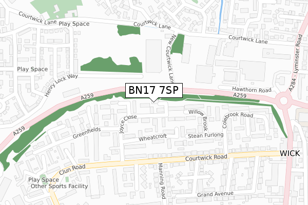
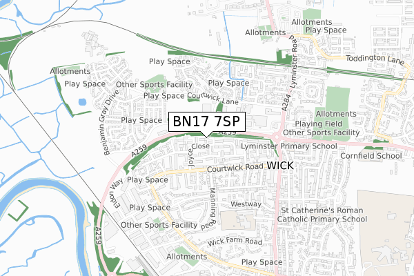
BN17 7SP is located in the Courtwick with Toddington electoral ward, within the local authority district of Arun and the English Parliamentary constituency of Bognor Regis and Littlehampton. The Sub Integrated Care Board (ICB) Location is NHS Sussex ICB - 70F and the police force is Sussex. This postcode has been in use since June 2018.


GetTheData
Source: OS Open Zoomstack (Ordnance Survey)
Licence: Open Government Licence (requires attribution)
Attribution: Contains OS data © Crown copyright and database right 2024
Source: Open Postcode Geo
Licence: Open Government Licence (requires attribution)
Attribution: Contains OS data © Crown copyright and database right 2024; Contains Royal Mail data © Royal Mail copyright and database right 2024; Source: Office for National Statistics licensed under the Open Government Licence v.3.0
| Easting | 502225 |
| Northing | 103436 |
| Latitude | 50.821444 |
| Longitude | -0.550091 |
GetTheData
Source: Open Postcode Geo
Licence: Open Government Licence
| Country | England |
| Postcode District | BN17 |
| ➜ BN17 open data dashboard ➜ See where BN17 is on a map ➜ Where is Wick? | |
GetTheData
Source: Land Registry Price Paid Data
Licence: Open Government Licence
| Ward | Courtwick With Toddington |
| Constituency | Bognor Regis And Littlehampton |
GetTheData
Source: ONS Postcode Database
Licence: Open Government Licence
| January 2024 | Burglary | On or near Greenfields | 272m |
| January 2024 | Violence and sexual offences | On or near Greenfields | 272m |
| January 2024 | Other crime | On or near Parking Area | 435m |
| ➜ Get more crime data in our Crime section | |||
GetTheData
Source: data.police.uk
Licence: Open Government Licence
| The Crossways (Courtwick Road) | Littlehampton | 210m |
| The Crossways (Courtwick Road) | Littlehampton | 238m |
| Elspring Mead (Clun Road) | Littlehampton | 279m |
| Elspring Mead (Clun Road) | Littlehampton | 292m |
| Selwyn Avenue (Courtwick Road) | Littlehampton | 414m |
| Littlehampton Station | 1.3km |
| Ford Station | 2.2km |
| Arundel Station | 3km |
GetTheData
Source: NaPTAN
Licence: Open Government Licence
| Percentage of properties with Next Generation Access | 100.0% |
| Percentage of properties with Superfast Broadband | 100.0% |
| Percentage of properties with Ultrafast Broadband | 0.0% |
| Percentage of properties with Full Fibre Broadband | 0.0% |
Superfast Broadband is between 30Mbps and 300Mbps
Ultrafast Broadband is > 300Mbps
| Percentage of properties unable to receive 2Mbps | 0.0% |
| Percentage of properties unable to receive 5Mbps | 0.0% |
| Percentage of properties unable to receive 10Mbps | 0.0% |
| Percentage of properties unable to receive 30Mbps | 0.0% |
GetTheData
Source: Ofcom
Licence: Ofcom Terms of Use (requires attribution)
GetTheData
Source: ONS Postcode Database
Licence: Open Government Licence


➜ Get more ratings from the Food Standards Agency
GetTheData
Source: Food Standards Agency
Licence: FSA terms & conditions
| Last Collection | |||
|---|---|---|---|
| Location | Mon-Fri | Sat | Distance |
| Wickbourne | 17:15 | 12:00 | 565m |
| Lansdowne Road | 17:15 | 12:15 | 713m |
| Lyminster Road | 16:00 | 09:00 | 886m |
GetTheData
Source: Dracos
Licence: Creative Commons Attribution-ShareAlike
| Facility | Distance |
|---|---|
| Kingley Gate Playing Field Benjamin Gray Drive, Benjamin Gray Drive, Littlehampton Grass Pitches | 545m |
| White Meadows Primary Academy Whitelea Road, Wick, Littlehampton Swimming Pool, Grass Pitches | 571m |
| Worthing Road Recreation Ground Worthing Road, Wick, Littlehampton Grass Pitches | 675m |
GetTheData
Source: Active Places
Licence: Open Government Licence
| School | Phase of Education | Distance |
|---|---|---|
| Lyminster Primary School Wick Street, Littlehampton, BN17 7JZ | Primary | 497m |
| White Meadows Primary Academy Whitelea Road, Wick, Littlehampton, BN17 7JL | Primary | 571m |
| St Catherine's Catholic Primary School, Littlehampton Highdown Drive, St Catherine's Catholic Primary School, Littlehampton, BN17 6HL | Primary | 852m |
GetTheData
Source: Edubase
Licence: Open Government Licence
The below table lists the International Territorial Level (ITL) codes (formerly Nomenclature of Territorial Units for Statistics (NUTS) codes) and Local Administrative Units (LAU) codes for BN17 7SP:
| ITL 1 Code | Name |
|---|---|
| TLJ | South East (England) |
| ITL 2 Code | Name |
| TLJ2 | Surrey, East and West Sussex |
| ITL 3 Code | Name |
| TLJ27 | West Sussex (South West) |
| LAU 1 Code | Name |
| E07000224 | Arun |
GetTheData
Source: ONS Postcode Directory
Licence: Open Government Licence
The below table lists the Census Output Area (OA), Lower Layer Super Output Area (LSOA), and Middle Layer Super Output Area (MSOA) for BN17 7SP:
| Code | Name | |
|---|---|---|
| OA | E00160249 | |
| LSOA | E01031429 | Arun 004B |
| MSOA | E02006545 | Arun 004 |
GetTheData
Source: ONS Postcode Directory
Licence: Open Government Licence
| BN17 7JG | Joyce Close | 33m |
| BN17 7NY | Wheatcroft | 127m |
| BN17 7NW | Willow Brook | 155m |
| BN17 7NR | Courtwick Road | 176m |
| BN17 7NX | Courtwick Road | 186m |
| BN17 7JF | Greenfields | 190m |
| BN17 7NP | Courtwick Road | 191m |
| BN17 7RN | Courtwick Lane | 195m |
| BN17 7NN | Stean Furlong | 199m |
| BN17 7HF | Greenfields | 244m |
GetTheData
Source: Open Postcode Geo; Land Registry Price Paid Data
Licence: Open Government Licence