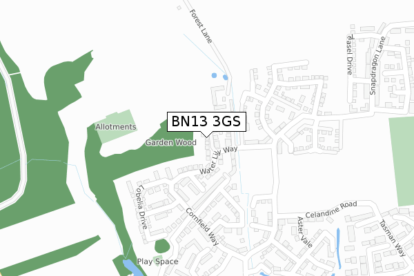
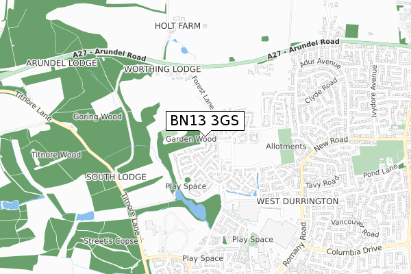
BN13 3GS is located in the Northbrook electoral ward, within the local authority district of Worthing and the English Parliamentary constituency of Worthing West. The Sub Integrated Care Board (ICB) Location is NHS Sussex ICB - 70F and the police force is Sussex. This postcode has been in use since June 2018.


GetTheData
Source: OS Open Zoomstack (Ordnance Survey)
Licence: Open Government Licence (requires attribution)
Attribution: Contains OS data © Crown copyright and database right 2024
Source: Open Postcode Geo
Licence: Open Government Licence (requires attribution)
Attribution: Contains OS data © Crown copyright and database right 2024; Contains Royal Mail data © Royal Mail copyright and database right 2024; Source: Office for National Statistics licensed under the Open Government Licence v.3.0
| Easting | 510675 |
| Northing | 105238 |
| Latitude | 50.836093 |
| Longitude | -0.429631 |
GetTheData
Source: Open Postcode Geo
Licence: Open Government Licence
| Country | England |
| Postcode District | BN13 |
| ➜ BN13 open data dashboard ➜ See where BN13 is on a map ➜ Where is Worthing? | |
GetTheData
Source: Land Registry Price Paid Data
Licence: Open Government Licence
| Ward | Northbrook |
| Constituency | Worthing West |
GetTheData
Source: ONS Postcode Database
Licence: Open Government Licence
7, HIBISCUS CLOSE, WORTHING, BN13 3GS 2019 20 DEC £460,000 |
3, HIBISCUS CLOSE, WORTHING, BN13 3GS 2019 16 DEC £465,995 |
5, HIBISCUS CLOSE, WORTHING, BN13 3GS 2019 16 DEC £469,995 |
2, HIBISCUS CLOSE, WORTHING, BN13 3GS 2019 13 DEC £370,000 |
4, HIBISCUS CLOSE, WORTHING, BN13 3GS 2019 11 DEC £514,995 |
6, HIBISCUS CLOSE, WORTHING, BN13 3GS 2019 10 DEC £519,995 |
1, HIBISCUS CLOSE, WORTHING, BN13 3GS 2019 2 DEC £469,995 |
GetTheData
Source: HM Land Registry Price Paid Data
Licence: Contains HM Land Registry data © Crown copyright and database right 2024. This data is licensed under the Open Government Licence v3.0.
| June 2022 | Public order | On or near Forest Lane | 259m |
| June 2022 | Public order | On or near Forest Lane | 259m |
| June 2022 | Violence and sexual offences | On or near Hobart Close | 437m |
| ➜ Get more crime data in our Crime section | |||
GetTheData
Source: data.police.uk
Licence: Open Government Licence
| Castle Goring Mews (Arundel Road) | Clapham | 483m |
| Castle Goring Mews (Arundel Road) | Clapham | 505m |
| Coach And Horses (Arundel Road) | Clapham | 515m |
| Coach And Horses (Arundel Road) | Clapham | 598m |
| Cherwell Road (Adur Avenue) | Durrington | 601m |
| Goring-by-Sea Station | 2.1km |
| Durrington-on-Sea Station | 2.4km |
| West Worthing Station | 3.3km |
GetTheData
Source: NaPTAN
Licence: Open Government Licence
| Percentage of properties with Next Generation Access | 100.0% |
| Percentage of properties with Superfast Broadband | 100.0% |
| Percentage of properties with Ultrafast Broadband | 100.0% |
| Percentage of properties with Full Fibre Broadband | 100.0% |
Superfast Broadband is between 30Mbps and 300Mbps
Ultrafast Broadband is > 300Mbps
| Percentage of properties unable to receive 2Mbps | 0.0% |
| Percentage of properties unable to receive 5Mbps | 0.0% |
| Percentage of properties unable to receive 10Mbps | 0.0% |
| Percentage of properties unable to receive 30Mbps | 0.0% |
GetTheData
Source: Ofcom
Licence: Ofcom Terms of Use (requires attribution)
GetTheData
Source: ONS Postcode Database
Licence: Open Government Licence


➜ Get more ratings from the Food Standards Agency
GetTheData
Source: Food Standards Agency
Licence: FSA terms & conditions
| Last Collection | |||
|---|---|---|---|
| Location | Mon-Fri | Sat | Distance |
| Tesco | 18:00 | 11:30 | 550m |
| Adur Avenue | 16:30 | 11:30 | 846m |
| Ivydore Avenue | 16:30 | 11:30 | 1,062m |
GetTheData
Source: Dracos
Licence: Creative Commons Attribution-ShareAlike
| Facility | Distance |
|---|---|
| West Worthing Tennis And Squash Club Titnore Way, Worthing Indoor Tennis Centre, Squash Courts, Outdoor Tennis Courts | 655m |
| Durrington Community Centre Romany Road, Worthing Studio | 772m |
| Northbrook Recreation Ground Romany Road, Northbrook, Worthing Grass Pitches | 1.1km |
GetTheData
Source: Active Places
Licence: Open Government Licence
| School | Phase of Education | Distance |
|---|---|---|
| The Laurels Primary School, Worthing Winterbourne Way, West Durrington, Worthing, BN13 3QH | Primary | 763m |
| Hawthorns Primary School Poplar Road, Durrington, Worthing, BN13 3EZ | Primary | 939m |
| Hawthorns Primary School, Durrington Poplar Road, Durrington, Worthing, BN13 3EZ | Primary | 1km |
GetTheData
Source: Edubase
Licence: Open Government Licence
The below table lists the International Territorial Level (ITL) codes (formerly Nomenclature of Territorial Units for Statistics (NUTS) codes) and Local Administrative Units (LAU) codes for BN13 3GS:
| ITL 1 Code | Name |
|---|---|
| TLJ | South East (England) |
| ITL 2 Code | Name |
| TLJ2 | Surrey, East and West Sussex |
| ITL 3 Code | Name |
| TLJ27 | West Sussex (South West) |
| LAU 1 Code | Name |
| E07000229 | Worthing |
GetTheData
Source: ONS Postcode Directory
Licence: Open Government Licence
The below table lists the Census Output Area (OA), Lower Layer Super Output Area (LSOA), and Middle Layer Super Output Area (MSOA) for BN13 3GS:
| Code | Name | |
|---|---|---|
| OA | E00162255 | |
| LSOA | E01031819 | Worthing 006E |
| MSOA | E02006626 | Worthing 006 |
GetTheData
Source: ONS Postcode Directory
Licence: Open Government Licence
| BN13 3FD | Forest Barn Mews | 118m |
| BN13 3UN | Castle Goring Way | 405m |
| BN13 3UD | Castle Goring Mews | 435m |
| BN13 3HL | Hobart Close | 445m |
| BN13 3HJ | Brisbane Close | 500m |
| BN13 3ST | Rees Close | 518m |
| BN13 3HN | Adelaide Close | 535m |
| BN13 3UA | Arundel Road | 541m |
| BN13 3SN | Varey Road | 554m |
| BN13 3ND | Adur Avenue | 554m |
GetTheData
Source: Open Postcode Geo; Land Registry Price Paid Data
Licence: Open Government Licence