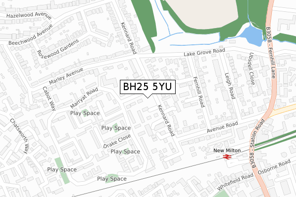
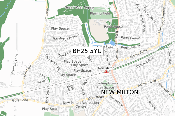
BH25 5YU is located in the Ballard electoral ward, within the local authority district of New Forest and the English Parliamentary constituency of New Forest West. The Sub Integrated Care Board (ICB) Location is NHS Hampshire and Isle of Wight ICB - D9Y0V and the police force is Hampshire. This postcode has been in use since April 2020.


GetTheData
Source: OS Open Zoomstack (Ordnance Survey)
Licence: Open Government Licence (requires attribution)
Attribution: Contains OS data © Crown copyright and database right 2024
Source: Open Postcode Geo
Licence: Open Government Licence (requires attribution)
Attribution: Contains OS data © Crown copyright and database right 2024; Contains Royal Mail data © Royal Mail copyright and database right 2024; Source: Office for National Statistics licensed under the Open Government Licence v.3.0
| Easting | 423971 |
| Northing | 95381 |
| Latitude | 50.757524 |
| Longitude | -1.661521 |
GetTheData
Source: Open Postcode Geo
Licence: Open Government Licence
| Country | England |
| Postcode District | BH25 |
| ➜ BH25 open data dashboard ➜ See where BH25 is on a map ➜ Where is New Milton? | |
GetTheData
Source: Land Registry Price Paid Data
Licence: Open Government Licence
| Ward | Ballard |
| Constituency | New Forest West |
GetTheData
Source: ONS Postcode Database
Licence: Open Government Licence
| July 2023 | Drugs | On or near Park/Open Space | 412m |
| June 2023 | Public order | On or near Park/Open Space | 412m |
| April 2023 | Violence and sexual offences | On or near Park/Open Space | 412m |
| ➜ Get more crime data in our Crime section | |||
GetTheData
Source: data.police.uk
Licence: Open Government Licence
| Kennard Court (Kennard Road) | New Milton | 36m |
| Kennard Court (Kennard Road) | New Milton | 38m |
| Marryat Road (Kennard Court) | New Milton | 81m |
| Marryat Road (Kennard Court) | New Milton | 82m |
| Leigh Road (Avenue Road) | New Milton | 313m |
| New Milton Station | 0.3km |
| Hinton Admiral Station | 3.8km |
| Sway Station | 4.7km |
GetTheData
Source: NaPTAN
Licence: Open Government Licence
GetTheData
Source: ONS Postcode Database
Licence: Open Government Licence


➜ Get more ratings from the Food Standards Agency
GetTheData
Source: Food Standards Agency
Licence: FSA terms & conditions
| Last Collection | |||
|---|---|---|---|
| Location | Mon-Fri | Sat | Distance |
| Marley Ave | 17:00 | 12:00 | 137m |
| Broadway | 17:30 | 11:30 | 421m |
| Station Road (Leos) | 17:30 | 12:00 | 474m |
GetTheData
Source: Dracos
Licence: Creative Commons Attribution-ShareAlike
| Facility | Distance |
|---|---|
| New Milton Indoor Bowls Club Whitefield Road, New Milton Indoor Bowls | 423m |
| Ballard School Fernhill Lane, New Milton Grass Pitches, Sports Hall, Swimming Pool, Studio, Artificial Grass Pitch, Outdoor Tennis Courts | 538m |
| New Milton Cricket Club Fernhill Lane, New Milton Grass Pitches | 654m |
GetTheData
Source: Active Places
Licence: Open Government Licence
| School | Phase of Education | Distance |
|---|---|---|
| Ballard School Fernhill Lane, New Milton, BH25 5SU | Not applicable | 533m |
| The Arnewood School Gore Road, New Milton, BH25 6RS | Secondary | 787m |
| The Eaglewood School Culver Road, New Milton, BH25 6SY | Not applicable | 904m |
GetTheData
Source: Edubase
Licence: Open Government Licence
The below table lists the International Territorial Level (ITL) codes (formerly Nomenclature of Territorial Units for Statistics (NUTS) codes) and Local Administrative Units (LAU) codes for BH25 5YU:
| ITL 1 Code | Name |
|---|---|
| TLJ | South East (England) |
| ITL 2 Code | Name |
| TLJ3 | Hampshire and Isle of Wight |
| ITL 3 Code | Name |
| TLJ36 | Central Hampshire |
| LAU 1 Code | Name |
| E07000091 | New Forest |
GetTheData
Source: ONS Postcode Directory
Licence: Open Government Licence
The below table lists the Census Output Area (OA), Lower Layer Super Output Area (LSOA), and Middle Layer Super Output Area (MSOA) for BH25 5YU:
| Code | Name | |
|---|---|---|
| OA | E00116959 | |
| LSOA | E01023018 | New Forest 020B |
| MSOA | E02004798 | New Forest 020 |
GetTheData
Source: ONS Postcode Directory
Licence: Open Government Licence
| BH25 5LN | Kennard Court | 37m |
| BH25 5JU | Kennard Road | 52m |
| BH25 5PA | Brooklyn Court | 70m |
| BH25 5NS | Alexander Close | 90m |
| BH25 5JS | Kennard Road | 105m |
| BH25 5JW | Walnut Close | 109m |
| BH25 5WW | The Ferns | 117m |
| BH25 5WP | Kennard Place | 135m |
| BH25 5LP | Raleigh Close | 141m |
| BH25 5JF | Marryat Road | 148m |
GetTheData
Source: Open Postcode Geo; Land Registry Price Paid Data
Licence: Open Government Licence