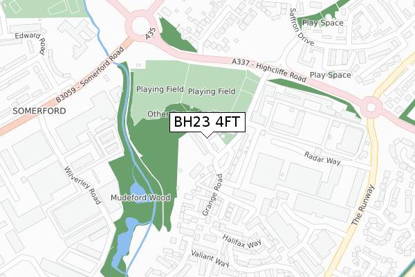
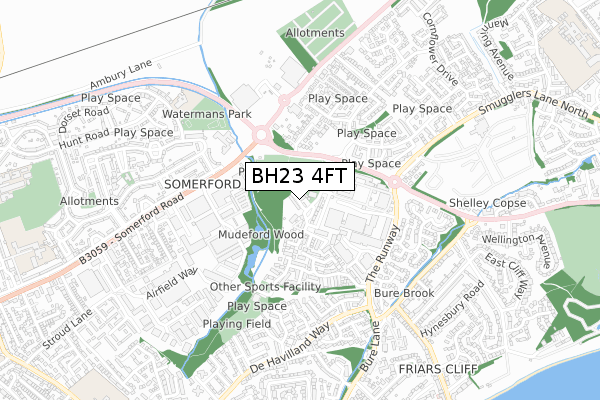
BH23 4FT is located in the Mudeford, Stanpit & West Highcliffe electoral ward, within the unitary authority of Bournemouth, Christchurch and Poole and the English Parliamentary constituency of Christchurch. The Sub Integrated Care Board (ICB) Location is NHS Dorset ICB - 11J and the police force is Dorset. This postcode has been in use since January 2018.


GetTheData
Source: OS Open Zoomstack (Ordnance Survey)
Licence: Open Government Licence (requires attribution)
Attribution: Contains OS data © Crown copyright and database right 2024
Source: Open Postcode Geo
Licence: Open Government Licence (requires attribution)
Attribution: Contains OS data © Crown copyright and database right 2024; Contains Royal Mail data © Royal Mail copyright and database right 2024; Source: Office for National Statistics licensed under the Open Government Licence v.3.0
| Easting | 418538 |
| Northing | 93453 |
| Latitude | 50.740384 |
| Longitude | -1.738641 |
GetTheData
Source: Open Postcode Geo
Licence: Open Government Licence
| Country | England |
| Postcode District | BH23 |
| ➜ BH23 open data dashboard ➜ See where BH23 is on a map ➜ Where is Christchurch? | |
GetTheData
Source: Land Registry Price Paid Data
Licence: Open Government Licence
| Ward | Mudeford, Stanpit & West Highcliffe |
| Constituency | Christchurch |
GetTheData
Source: ONS Postcode Database
Licence: Open Government Licence
| June 2023 | Anti-social behaviour | On or near Parking Area | 400m |
| July 2022 | Anti-social behaviour | On or near Pipers Drive | 349m |
| June 2022 | Vehicle crime | On or near Grange Road | 69m |
| ➜ Get more crime data in our Crime section | |||
GetTheData
Source: data.police.uk
Licence: Open Government Licence
| Honeysuckle Way | Somerford | 273m |
| Somerford Hotel (Somerford Road) | Somerford | 312m |
| Somerford Hotel (Somerford Road) | Somerford | 389m |
| Edward Road | Somerford | 396m |
| Edward Road | Somerford | 398m |
| Hinton Admiral Station | 2.2km |
| Christchurch Station | 3.2km |
GetTheData
Source: NaPTAN
Licence: Open Government Licence
| Percentage of properties with Next Generation Access | 100.0% |
| Percentage of properties with Superfast Broadband | 100.0% |
| Percentage of properties with Ultrafast Broadband | 80.0% |
| Percentage of properties with Full Fibre Broadband | 80.0% |
Superfast Broadband is between 30Mbps and 300Mbps
Ultrafast Broadband is > 300Mbps
| Percentage of properties unable to receive 2Mbps | 0.0% |
| Percentage of properties unable to receive 5Mbps | 0.0% |
| Percentage of properties unable to receive 10Mbps | 0.0% |
| Percentage of properties unable to receive 30Mbps | 0.0% |
GetTheData
Source: Ofcom
Licence: Ofcom Terms of Use (requires attribution)
GetTheData
Source: ONS Postcode Database
Licence: Open Government Licence


➜ Get more ratings from the Food Standards Agency
GetTheData
Source: Food Standards Agency
Licence: FSA terms & conditions
| Last Collection | |||
|---|---|---|---|
| Location | Mon-Fri | Sat | Distance |
| Highcliffe Road | 17:15 | 12:00 | 226m |
| Hoborne Lane | 17:15 | 12:00 | 461m |
| Sainsburys | 16:30 | 12:00 | 504m |
GetTheData
Source: Dracos
Licence: Creative Commons Attribution-ShareAlike
| Facility | Distance |
|---|---|
| East Christchurch Sports And Social Club Grange Road, Christchurch Grass Pitches, Outdoor Tennis Courts | 132m |
| Curves For Women (Christchurch) (Closed) Wilverley Road, Christchurch Health and Fitness Gym | 279m |
| Mudeford Wood Community Centre Pipers Drive, Christchurch Sports Hall, Grass Pitches, Outdoor Tennis Courts | 444m |
GetTheData
Source: Active Places
Licence: Open Government Licence
| School | Phase of Education | Distance |
|---|---|---|
| St Joseph's Catholic Primary School, Christchurch Dorset Road, Somerford, Christchurch, BH23 3DA | Primary | 645m |
| Somerford Primary School Draper Road, Christchurch, BH23 3AS | Primary | 1.1km |
| Mudeford Junior School Mudeford Lane, Mudeford, Christchurch, BH23 3HP | Primary | 1.2km |
GetTheData
Source: Edubase
Licence: Open Government Licence
The below table lists the International Territorial Level (ITL) codes (formerly Nomenclature of Territorial Units for Statistics (NUTS) codes) and Local Administrative Units (LAU) codes for BH23 4FT:
| ITL 1 Code | Name |
|---|---|
| TLK | South West (England) |
| ITL 2 Code | Name |
| TLK2 | Dorset and Somerset |
| ITL 3 Code | Name |
| TLK24 | Bournemouth, Christchurch and Poole |
| LAU 1 Code | Name |
| E06000058 | Bournemouth, Christchurch and Poole |
GetTheData
Source: ONS Postcode Directory
Licence: Open Government Licence
The below table lists the Census Output Area (OA), Lower Layer Super Output Area (LSOA), and Middle Layer Super Output Area (MSOA) for BH23 4FT:
| Code | Name | |
|---|---|---|
| OA | E00103230 | |
| LSOA | E01020370 | Christchurch 004B |
| MSOA | E02004239 | Christchurch 004 |
GetTheData
Source: ONS Postcode Directory
Licence: Open Government Licence
| BH23 4FF | Cherry Mews | 107m |
| BH23 4JD | Grange Road | 111m |
| BH23 4TU | Delta Close | 194m |
| BH23 4HZ | Highcliffe Road | 222m |
| BH23 4TX | Halifax Way | 264m |
| BH23 4TW | Valiant Way | 267m |
| BH23 4TR | Pipers Drive | 269m |
| BH23 4TT | Hunter Close | 287m |
| BH23 4JA | Somerford Avenue | 299m |
| BH23 4NJ | Gardner Place | 309m |
GetTheData
Source: Open Postcode Geo; Land Registry Price Paid Data
Licence: Open Government Licence