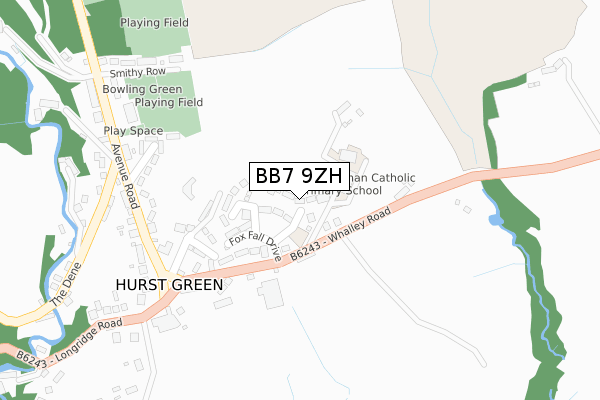
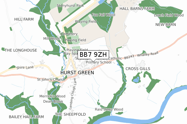
BB7 9ZH is located in the Hurst Green & Whitewell electoral ward, within the local authority district of Ribble Valley and the English Parliamentary constituency of Ribble Valley. The Sub Integrated Care Board (ICB) Location is NHS Lancashire and South Cumbria ICB - 01A and the police force is Lancashire. This postcode has been in use since September 2019.


GetTheData
Source: OS Open Zoomstack (Ordnance Survey)
Licence: Open Government Licence (requires attribution)
Attribution: Contains OS data © Crown copyright and database right 2024
Source: Open Postcode Geo
Licence: Open Government Licence (requires attribution)
Attribution: Contains OS data © Crown copyright and database right 2024; Contains Royal Mail data © Royal Mail copyright and database right 2024; Source: Office for National Statistics licensed under the Open Government Licence v.3.0
| Easting | 368744 |
| Northing | 438061 |
| Latitude | 53.837867 |
| Longitude | -2.476456 |
GetTheData
Source: Open Postcode Geo
Licence: Open Government Licence
| Country | England |
| Postcode District | BB7 |
| ➜ BB7 open data dashboard ➜ See where BB7 is on a map ➜ Where is Hurst Green? | |
GetTheData
Source: Land Registry Price Paid Data
Licence: Open Government Licence
| Ward | Hurst Green & Whitewell |
| Constituency | Ribble Valley |
GetTheData
Source: ONS Postcode Database
Licence: Open Government Licence
3, JUMBLES VIEW, HURST GREEN, CLITHEROE, BB7 9ZH 2021 22 MAR £555,000 |
2, JUMBLES VIEW, HURST GREEN, CLITHEROE, BB7 9ZH 2021 5 MAR £630,000 |
10, JUMBLES VIEW, HURST GREEN, CLITHEROE, BB7 9ZH 2020 16 OCT £645,000 |
4, JUMBLES VIEW, HURST GREEN, CLITHEROE, BB7 9ZH 2020 30 SEP £562,800 |
1, JUMBLES VIEW, HURST GREEN, CLITHEROE, BB7 9ZH 2020 9 SEP £562,000 |
6, JUMBLES VIEW, HURST GREEN, CLITHEROE, BB7 9ZH 2019 28 OCT £730,000 |
8, JUMBLES VIEW, HURST GREEN, CLITHEROE, BB7 9ZH 2019 23 SEP £620,000 |
GetTheData
Source: HM Land Registry Price Paid Data
Licence: Contains HM Land Registry data © Crown copyright and database right 2024. This data is licensed under the Open Government Licence v3.0.
| June 2022 | Violence and sexual offences | On or near Warren Fold | 180m |
| June 2022 | Violence and sexual offences | On or near Warren Fold | 180m |
| May 2022 | Violence and sexual offences | On or near Avenue Road | 281m |
| ➜ Get more crime data in our Crime section | |||
GetTheData
Source: data.police.uk
Licence: Open Government Licence
| St Josephs Rcps (Whalley Road) | Hurst Green | 81m |
| Shireburn Arms (Whalley Road) | Hurst Green | 268m |
| Shireburn Arms (Longridge Road) | Hurst Green | 299m |
| St Johns Church (Longridge Road) | Hurst Green | 665m |
| Punch Bowl Hotel (Longridge Road) | Hurst Green | 1,348m |
| Langho Station | 4.1km |
| Whalley Station | 4.5km |
GetTheData
Source: NaPTAN
Licence: Open Government Licence
GetTheData
Source: ONS Postcode Database
Licence: Open Government Licence


➜ Get more ratings from the Food Standards Agency
GetTheData
Source: Food Standards Agency
Licence: FSA terms & conditions
| Last Collection | |||
|---|---|---|---|
| Location | Mon-Fri | Sat | Distance |
| Hurst Green Post Office | 16:00 | 11:30 | 236m |
| The Cross | 12:00 | 11:30 | 362m |
| Walker Fold, Chaigley | 12:00 | 10:30 | 4,098m |
GetTheData
Source: Dracos
Licence: Creative Commons Attribution-ShareAlike
| Facility | Distance |
|---|---|
| Hurst Green Football Club Smithy Row, Hurst Green Grass Pitches | 324m |
| Valley Field Smithy Row, Hurst Green, Clitheroe Grass Pitches | 565m |
| Stonyhurst Park Golf Club Stonyhurst, Clitheroe Golf | 1km |
GetTheData
Source: Active Places
Licence: Open Government Licence
| School | Phase of Education | Distance |
|---|---|---|
| St Joseph's Roman Catholic Primary School, Hurst Green Whalley Road, Hurst Green, Clitheroe, BB7 9QJ | Primary | 90m |
| Stonyhurst College Stonyhurst, Clitheroe, Lancashire, BB7 9PZ | Not applicable | 1km |
| Langho and Billington St Leonards Church of England Primary School Whalley Road, Langho, Blackburn, BB6 8AB | Primary | 3.9km |
GetTheData
Source: Edubase
Licence: Open Government Licence
The below table lists the International Territorial Level (ITL) codes (formerly Nomenclature of Territorial Units for Statistics (NUTS) codes) and Local Administrative Units (LAU) codes for BB7 9ZH:
| ITL 1 Code | Name |
|---|---|
| TLD | North West (England) |
| ITL 2 Code | Name |
| TLD4 | Lancashire |
| ITL 3 Code | Name |
| TLD45 | Mid Lancashire |
| LAU 1 Code | Name |
| E07000124 | Ribble Valley |
GetTheData
Source: ONS Postcode Directory
Licence: Open Government Licence
The below table lists the Census Output Area (OA), Lower Layer Super Output Area (LSOA), and Middle Layer Super Output Area (MSOA) for BB7 9ZH:
| Code | Name | |
|---|---|---|
| OA | E00174075 | |
| LSOA | E01025315 | Ribble Valley 001A |
| MSOA | E02005270 | Ribble Valley 001 |
GetTheData
Source: ONS Postcode Directory
Licence: Open Government Licence
| BB7 9QJ | Whalley Road | 81m |
| BB7 9QH | 166m | |
| BB7 9QS | Warren Fold | 184m |
| BB7 9QG | Bilsberry Cottages | 258m |
| BB7 9QB | Avenue Road | 307m |
| BB7 9QA | Smithy Row | 354m |
| BB7 9QF | The Dene | 363m |
| BB7 9QE | Silver Street | 368m |
| BB7 9QD | Quality Row | 384m |
| BB7 9QN | Lambing Clough Lane | 558m |
GetTheData
Source: Open Postcode Geo; Land Registry Price Paid Data
Licence: Open Government Licence