BA12 6FP maps, stats, and open data
BA12 6FP is located in the Mere electoral ward, within the unitary authority of Wiltshire and the English Parliamentary constituency of South West Wiltshire. The Sub Integrated Care Board (ICB) Location is NHS Bath and North East Somerset, Swindon and Wiltshire ICB - 92 and the police force is Wiltshire. This postcode has been in use since November 2019.
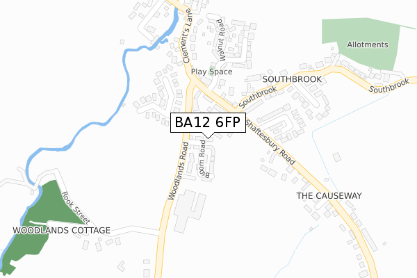
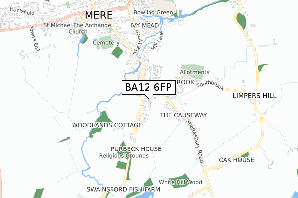
BA12 6FP maps


Licence: Open Government Licence (requires attribution)
Attribution: Contains OS data © Crown copyright and database right 2025
Source: Open Postcode Geo
Licence: Open Government Licence (requires attribution)
Attribution: Contains OS data © Crown copyright and database right 2025; Contains Royal Mail data © Royal Mail copyright and database right 2025; Source: Office for National Statistics licensed under the Open Government Licence v.3.0
BA12 6FP geodata
| Easting | 381719 |
| Northing | 131660 |
| Latitude | 51.083956 |
| Longitude | -2.262362 |
Where is BA12 6FP?
| Country | England |
| Postcode District | BA12 |
Politics
| Ward | Mere |
|---|---|
| Constituency | South West Wiltshire |
House Prices
Sales of detached houses in BA12 6FP
2024 12 JUL £390,000 |
2020 7 OCT £315,000 |
9, BRUSH WALK, MERE, WARMINSTER, BA12 6FP 2020 21 AUG £385,000 |
Licence: Contains HM Land Registry data © Crown copyright and database right 2025. This data is licensed under the Open Government Licence v3.0.
Transport
Nearest bus stops to BA12 6FP
| Southbrook (Shaftesbury Road) | Mere | 83m |
| Southbrook (Shaftesbury Road) | Mere | 92m |
| Edge Bridge (Clements Lane) | Mere | 272m |
| Edge Bridge (Clements Lane) | Mere | 284m |
| Turning Circle (Boar Street) | Mere | 806m |
Deprivation
9% of English postcodes are less deprived than BA12 6FP:Food Standards Agency
Three nearest food hygiene ratings to BA12 6FP (metres)

➜ Get more ratings from the Food Standards Agency
Nearest post box to BA12 6FP
| Last Collection | |||
|---|---|---|---|
| Location | Mon-Fri | Sat | Distance |
| Causeway | 12:00 | 10:30 | 254m |
| Edge Bridge | 12:00 | 10:30 | 381m |
| Water Street | 12:00 | 11:15 | 776m |
BA12 6FP ITL and BA12 6FP LAU
The below table lists the International Territorial Level (ITL) codes (formerly Nomenclature of Territorial Units for Statistics (NUTS) codes) and Local Administrative Units (LAU) codes for BA12 6FP:
| ITL 1 Code | Name |
|---|---|
| TLK | South West (England) |
| ITL 2 Code | Name |
| TLK1 | Gloucestershire, Wiltshire and Bath/Bristol area |
| ITL 3 Code | Name |
| TLK15 | Wiltshire |
| LAU 1 Code | Name |
| E06000054 | Wiltshire |
BA12 6FP census areas
The below table lists the Census Output Area (OA), Lower Layer Super Output Area (LSOA), and Middle Layer Super Output Area (MSOA) for BA12 6FP:
| Code | Name | |
|---|---|---|
| OA | E00163404 | |
| LSOA | E01032035 | Wiltshire 050B |
| MSOA | E02006665 | Wiltshire 050 |
Nearest postcodes to BA12 6FP
| BA12 6BH | Shaftesbury Road | 107m |
| BA12 6BZ | Lordsmead Road | 147m |
| BA12 6DX | The Bartletts | 166m |
| BA12 6BP | Whitemarsh | 167m |
| BA12 6BX | Ash Grove | 185m |
| BA12 6DF | Clements Lane | 223m |
| BA12 6FG | Walnut Road | 228m |
| BA12 6FJ | Oak Lane | 247m |
| BA12 6BE | Southbrook Gardens | 276m |
| BA12 6BG | Southbrook | 290m |