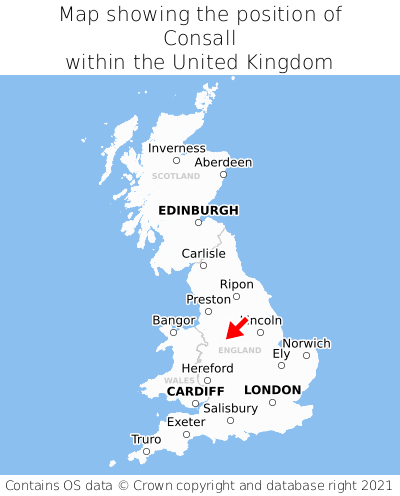
Where is Consall?
Consall is located in the county of Staffordshire, West Midlands, four miles north-west of the town of Cheadle, six miles east of the major city of Stoke-on-Trent, 118 miles north-east of Cardiff, and 132 miles north-west of London. Consall falls within the district council of Staffordshire Moorlands, under the county council of Staffordshire. It is in the ST9 postcode district. The post town for Consall is Stoke-on-Trent.
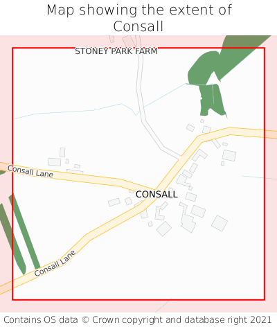
Consall on a map
Which county is Consall in?
Consall is in the ceremonial county of Staffordshire, the historic county of Staffordshire, and the administrative county of Staffordshire.
| Ceremonial County | Staffordshire |
|---|---|
| Historic County | Staffordshire |
| Administrative County | Staffordshire |
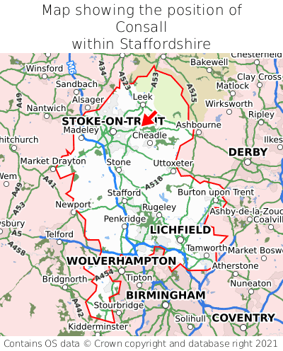
Where is Consall in Staffordshire?
Consall is situated towards the northernmost extremity of Staffordshire, and roughly centrally between the easternmost and westernmost extremities of Staffordshire.
What is the postcode for Consall?
The nearest postcode to the centre of Consall is ST9 0AE.
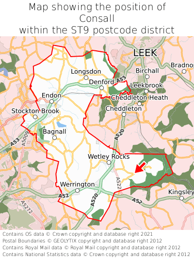
Where is Consall in ST9?
Consall is situated towards the southernmost extremity of the ST9 postcode district, and towards the easternmost extremity of the ST9 postcode district.
What is the post town for Consall?
The post town for Consall is Stoke-on-Trent. Consall is in the ST9 postcode district, which corresponds to the post town of Stoke-on-Trent.
What is the latitude and longitude of Consall?
The centre of Consall is located at position 53.03436° latitude and -2.0321° longitude.
| Latitude | 53.03436° |
|---|---|
| Longitude | -2.0321° |
What is the easting and northing of Consall?
The centre of Consall is located at the grid reference easting 397945 and northing 348565 within the British National Grid (OSGB36) system.
| Easting | 397945 |
|---|---|
| Northing | 348565 |
What are the nearest towns to Consall?
Position of Consall relative to nearby towns. Distance is measured from the centre of Consall to the centre of the town.
What are the nearest cities to Consall?
Position of Consall relative to nearby cities. Distance is measured from the centre of Consall to the centre of the city.
- Contains OS data © Crown copyright and database right (2026)
- Contains Royal Mail data © Royal Mail copyright and Database right (2026)
- Contains National Statistics data © Crown copyright and database right (2026)
- Data produced by Land Registry © Crown copyright (2026)
- Contains Environment Agency data licensed under the Open Government Licence v3.0
- Everything else © GetTheData Publishing Limited (2026)
GetTheData.com is owned and operated by GetTheData Publishing Limited.
Company Number: 11075184 · Registered in England and Wales.
Registered Office: 3rd Floor, 86-90 Paul Street, London, England, EC2A 4NE
By accessing our site you agree to us using cookies, and sharing information about your use of our site, in accordance with our privacy policy.