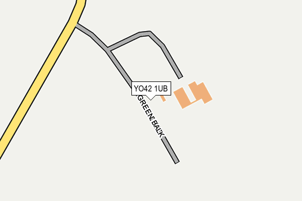
YO42 1UB is in Millington, York. YO42 1UB is located in the Wolds Weighton electoral ward, within the unitary authority of East Riding of Yorkshire and the English Parliamentary constituency of East Yorkshire. The Sub Integrated Care Board (ICB) Location is NHS Humber and North Yorkshire ICB - 03Q and the police force is Humberside. This postcode has been in use since June 1998.


GetTheData
Source: OS OpenMap – Local (Ordnance Survey)
Source: OS VectorMap District (Ordnance Survey)
Licence: Open Government Licence (requires attribution)
| Easting | 483562 |
| Northing | 454259 |
| Latitude | 53.977666 |
| Longitude | -0.727394 |
GetTheData
Source: Open Postcode Geo
Licence: Open Government Licence
| Locality | Millington |
| Town/City | York |
| Country | England |
| Postcode District | YO42 |
| ➜ YO42 open data dashboard ➜ See where YO42 is on a map | |
GetTheData
Source: Land Registry Price Paid Data
Licence: Open Government Licence
Elevation or altitude of YO42 1UB as distance above sea level:
| Metres | Feet | |
|---|---|---|
| Elevation | 210m | 689ft |
Elevation is measured from the approximate centre of the postcode, to the nearest point on an OS contour line from OS Terrain 50, which has contour spacing of ten vertical metres.
➜ How high above sea level am I? Find the elevation of your current position using your device's GPS.
GetTheData
Source: Open Postcode Elevation
Licence: Open Government Licence
| Ward | Wolds Weighton |
| Constituency | East Yorkshire |
GetTheData
Source: ONS Postcode Database
Licence: Open Government Licence
| Percentage of properties with Next Generation Access | 100.0% |
| Percentage of properties with Superfast Broadband | 16.7% |
| Percentage of properties with Ultrafast Broadband | 0.0% |
| Percentage of properties with Full Fibre Broadband | 0.0% |
Superfast Broadband is between 30Mbps and 300Mbps
Ultrafast Broadband is > 300Mbps
| Percentage of properties unable to receive 2Mbps | 83.3% |
| Percentage of properties unable to receive 5Mbps | 83.3% |
| Percentage of properties unable to receive 10Mbps | 83.3% |
| Percentage of properties unable to receive 30Mbps | 83.3% |
GetTheData
Source: Ofcom
Licence: Ofcom Terms of Use (requires attribution)
GetTheData
Source: ONS Postcode Database
Licence: Open Government Licence
| Last Collection | |||
|---|---|---|---|
| Location | Mon-Fri | Sat | Distance |
| 62 Denison Road Pocklington | 17:10 | 11:30 | 5,415m |
| 30 The Mile Pocklington | 17:00 | 11:00 | 5,585m |
| Algarth Pocklington | 17:00 | 11:00 | 5,618m |
GetTheData
Source: Dracos
Licence: Creative Commons Attribution-ShareAlike
| Facility | Distance |
|---|---|
| Bishop Wilton Hall Worsendale Road, Bishop Wilton, York Grass Pitches, Outdoor Tennis Courts | 3.8km |
| The Kp Kilnwick Percy, York Golf, Studio, Health and Fitness Gym | 4.7km |
| Warter Recreation Field (Closed) Westbeck Hill, Warter, York Grass Pitches | 5.1km |
GetTheData
Source: Active Places
Licence: Open Government Licence
| School | Phase of Education | Distance |
|---|---|---|
| Bishop Wilton Church of England Voluntary Controlled Primary School Main Street, Bishop Wilton, York, YO42 1SP | Primary | 3.7km |
| Warter Church of England Primary School Addlekel, Warter, York, YO42 1XR | Primary | 5.1km |
| Pocklington Church of England Voluntary Controlled Infant School Maxwell Road, York, YO42 2HE | Primary | 5.7km |
GetTheData
Source: Edubase
Licence: Open Government Licence
The below table lists the International Territorial Level (ITL) codes (formerly Nomenclature of Territorial Units for Statistics (NUTS) codes) and Local Administrative Units (LAU) codes for YO42 1UB:
| ITL 1 Code | Name |
|---|---|
| TLE | Yorkshire and The Humber |
| ITL 2 Code | Name |
| TLE1 | East Yorkshire and Northern Lincolnshire |
| ITL 3 Code | Name |
| TLE12 | East Riding of Yorkshire |
| LAU 1 Code | Name |
| E06000011 | East Riding of Yorkshire |
GetTheData
Source: ONS Postcode Directory
Licence: Open Government Licence
The below table lists the Census Output Area (OA), Lower Layer Super Output Area (LSOA), and Middle Layer Super Output Area (MSOA) for YO42 1UB:
| Code | Name | |
|---|---|---|
| OA | E00066233 | |
| LSOA | E01013119 | East Riding of Yorkshire 011G |
| MSOA | E02002694 | East Riding of Yorkshire 011 |
GetTheData
Source: ONS Postcode Directory
Licence: Open Government Licence
| YO42 1XD | 2188m | |
| YO42 1TL | Great Givendale | 2404m |
| YO42 1TX | 2524m | |
| YO42 1TY | Wold View | 2556m |
| YO42 1TS | Grimthorpe Manor Cottages | 2596m |
| YO42 1TH | Kilnwick Percy Lane | 2771m |
| YO42 1YR | 2943m | |
| YO42 1RY | Worsendale Road | 3445m |
| YO42 1TR | Ousethorpe | 3586m |
| YO42 1SS | Park Lane | 3722m |
GetTheData
Source: Open Postcode Geo; Land Registry Price Paid Data
Licence: Open Government Licence