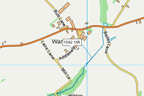
Warter Recreation Field (Closed)
Warter Recreation Field (Closed) is located in Warter, York (YO42).
| Address | Westbeck Hill, Warter, York, YO42 1XR |
| Car Park | Yes |
| Car Park Capacity | 20 |
| Management Type | Commercial Management |
| Management Group | Commercial |
| Owner Type | Commercial |
| Owner Group | Commercial |
| Education Phase | Not Known |
| Closure Date | 22nd Dec 2015 |
| Closure Reason | Strategic Review - facility/site not being replaced |
Facilities
| Closure Date | 22nd Dec 2015 |
| Closure Reason | Strategic Review - facility/site not being replaced |
| Accessibility | Free Public Access |
| Management Type | Commercial Management |
| Changing Rooms | No |
| Date Record Checked | 22nd Dec 2015 |
| Opening Times | Dawn To Dusk |
Facility specifics
Disabled access
| Disabled Access | Yes |
| Disabled Parking | Yes |
| Finding/Reaching Entrance | Yes |
| Activity Areas | Yes |
| Spectator Areas | Yes |
| Emergency Exits | Yes |
Contact
Disabled access
Disabled access for Warter Recreation Field (Closed)
| Disabled Access | Yes |
| Disabled Parking | Yes |
| Finding/Reaching Entrance | Yes |
| Activity Areas | Yes |
| Spectator Areas | Yes |
| Emergency Exits | Yes |
Where is Warter Recreation Field (Closed)?
| Sub Building Name | |
| Building Name | |
| Building Number | 0 |
| Dependent Thoroughfare | |
| Thoroughfare Name | Westbeck Hill |
| Double Dependent Locality | |
| Dependent Locality | Warter |
| PostTown | York |
| Postcode | YO42 1XR |
Warter Recreation Field (Closed) on a map

Warter Recreation Field (Closed) geodata
| Easting | 486762 |
| Northing | 450274.41 |
| Latitude | 53.941319 |
| Longitude | -0.679739 |
| Local Authority Name | East Riding of Yorkshire |
| Local Authority Code | E06000011 |
| Parliamentary Constituency Name | East Yorkshire |
| Parliamentary Constituency Code | E14000683 |
| Region Name | Yorkshire and the Humber |
| Region Code | E15000003 |
| Ward Name | Wolds Weighton |
| Ward Code | E05001712 |
| Output Area Code | E00066243 |
About this data
This data is open data sourced from Active Places Power and licenced under the Active Places Open Data Licence.
| Created On | 5th Jun 2009 |
| Audited On | 26th Jan 2015 |
| Checked On | 17th Dec 2014 |
