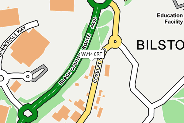
WV14 0RT is located in the Bilston South electoral ward, within the metropolitan district of Wolverhampton and the English Parliamentary constituency of Wolverhampton South East. The Sub Integrated Care Board (ICB) Location is NHS Black Country ICB - D2P2L and the police force is West Midlands. This postcode has been in use since December 2011.


GetTheData
Source: OS OpenMap – Local (Ordnance Survey)
Source: OS VectorMap District (Ordnance Survey)
Licence: Open Government Licence (requires attribution)
| Easting | 394506 |
| Northing | 295837 |
| Latitude | 52.560354 |
| Longitude | -2.082468 |
GetTheData
Source: Open Postcode Geo
Licence: Open Government Licence
| Country | England |
| Postcode District | WV14 |
| ➜ WV14 open data dashboard ➜ See where WV14 is on a map ➜ Where is Bilston? | |
GetTheData
Source: Land Registry Price Paid Data
Licence: Open Government Licence
Elevation or altitude of WV14 0RT as distance above sea level:
| Metres | Feet | |
|---|---|---|
| Elevation | 140m | 459ft |
Elevation is measured from the approximate centre of the postcode, to the nearest point on an OS contour line from OS Terrain 50, which has contour spacing of ten vertical metres.
➜ How high above sea level am I? Find the elevation of your current position using your device's GPS.
GetTheData
Source: Open Postcode Elevation
Licence: Open Government Licence
| Ward | Bilston South |
| Constituency | Wolverhampton South East |
GetTheData
Source: ONS Postcode Database
Licence: Open Government Licence
| January 2024 | Criminal damage and arson | On or near Carder Crescent | 440m |
| December 2023 | Criminal damage and arson | On or near Carder Crescent | 440m |
| December 2023 | Violence and sexual offences | On or near Carder Crescent | 440m |
| ➜ Get more crime data in our Crime section | |||
GetTheData
Source: data.police.uk
Licence: Open Government Licence
| Industrial Park (Broad Lanes) | Bilston | 60m |
| Industrial Park (Broad Lanes) | Bilston | 233m |
| Mecca Bingo (Springvale Way) | Bilston | 256m |
| Hickman Rd (Millfields Rd) | Bilston | 373m |
| Hartshorn St (High St) | Bilston | 392m |
| Bilston Central (Midland Metro Stop) (Church St) | Bilston | 797m |
| The Crescent (Midland Metro Stop) (The Crescent) | Bilston | 853m |
| Loxdale (Midland Metro Stop) (Loxdale St) | Bradley | 1,152m |
| Priestfield (Midland Metro Stop) (Junction Rd) | Priestfield | 1,623m |
| Coseley Station | 1.7km |
| Tipton Station | 3.5km |
| Wolverhampton Station | 4km |
GetTheData
Source: NaPTAN
Licence: Open Government Licence
GetTheData
Source: ONS Postcode Database
Licence: Open Government Licence


➜ Get more ratings from the Food Standards Agency
GetTheData
Source: Food Standards Agency
Licence: FSA terms & conditions
| Last Collection | |||
|---|---|---|---|
| Location | Mon-Fri | Sat | Distance |
| High Street Post Office | 19:00 | 11:45 | 418m |
| Village Way | 19:00 | 12:00 | 631m |
| Wellington Road | 16:45 | 11:15 | 881m |
GetTheData
Source: Dracos
Licence: Creative Commons Attribution-ShareAlike
| Facility | Distance |
|---|---|
| Parkfield High School Sports Centre (Bilston) (Closed) Prosser Street, Bilston Sports Hall | 261m |
| Ormiston Swb Academy Dudley Street, Bilston Studio, Artificial Grass Pitch, Grass Pitches | 304m |
| Wv Active Bilston (Bert Williams Leisure Centre) Nettlefolds Way, Bilston Health and Fitness Gym, Swimming Pool, Squash Courts, Sports Hall, Studio | 417m |
GetTheData
Source: Active Places
Licence: Open Government Licence
| School | Phase of Education | Distance |
|---|---|---|
| Ormiston SWB Academy Dudley Street, Bilston, WV14 0LN | Secondary | 307m |
| Bilston Nursery School Wolverhampton Street, Bilston, WV14 0LT | Nursery | 512m |
| Loxdale Primary School Dudley Street, Bilston, WV14 0AU | Primary | 540m |
GetTheData
Source: Edubase
Licence: Open Government Licence
| Risk of WV14 0RT flooding from rivers and sea | Low |
| ➜ WV14 0RT flood map | |
GetTheData
Source: Open Flood Risk by Postcode
Licence: Open Government Licence
The below table lists the International Territorial Level (ITL) codes (formerly Nomenclature of Territorial Units for Statistics (NUTS) codes) and Local Administrative Units (LAU) codes for WV14 0RT:
| ITL 1 Code | Name |
|---|---|
| TLG | West Midlands (England) |
| ITL 2 Code | Name |
| TLG3 | West Midlands |
| ITL 3 Code | Name |
| TLG39 | Wolverhampton |
| LAU 1 Code | Name |
| E08000031 | Wolverhampton |
GetTheData
Source: ONS Postcode Directory
Licence: Open Government Licence
The below table lists the Census Output Area (OA), Lower Layer Super Output Area (LSOA), and Middle Layer Super Output Area (MSOA) for WV14 0RT:
| Code | Name | |
|---|---|---|
| OA | E00052788 | |
| LSOA | E01010451 | Wolverhampton 029C |
| MSOA | E02002177 | Wolverhampton 029 |
GetTheData
Source: ONS Postcode Directory
Licence: Open Government Licence
| WV14 0RH | Broad Lanes | 155m |
| WV14 0RN | Broadmoor Road | 312m |
| WV14 0RS | Broad Lanes | 313m |
| WV14 0RW | Broadmoor Close | 330m |
| WV14 0QE | Linton Croft | 336m |
| WV14 0RR | Horning Drive | 386m |
| WV14 0HH | High Street | 394m |
| WV14 0QJ | Millfields Road | 420m |
| WV14 0RP | Broadmoor Road | 424m |
| WV14 0RY | Broad Lanes | 430m |
GetTheData
Source: Open Postcode Geo; Land Registry Price Paid Data
Licence: Open Government Licence