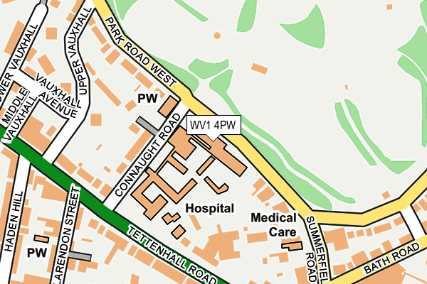
WV1 4PW is located in the Park electoral ward, within the metropolitan district of Wolverhampton and the English Parliamentary constituency of Wolverhampton South West. The Sub Integrated Care Board (ICB) Location is NHS Black Country ICB - D2P2L and the police force is West Midlands. This postcode has been in use since January 1980.


GetTheData
Source: OS OpenMap – Local (Ordnance Survey)
Source: OS VectorMap District (Ordnance Survey)
Licence: Open Government Licence (requires attribution)
| Easting | 390527 |
| Northing | 298896 |
| Latitude | 52.587783 |
| Longitude | -2.141256 |
GetTheData
Source: Open Postcode Geo
Licence: Open Government Licence
| Country | England |
| Postcode District | WV1 |
| ➜ WV1 open data dashboard ➜ See where WV1 is on a map ➜ Where is Wolverhampton? | |
GetTheData
Source: Land Registry Price Paid Data
Licence: Open Government Licence
Elevation or altitude of WV1 4PW as distance above sea level:
| Metres | Feet | |
|---|---|---|
| Elevation | 130m | 427ft |
Elevation is measured from the approximate centre of the postcode, to the nearest point on an OS contour line from OS Terrain 50, which has contour spacing of ten vertical metres.
➜ How high above sea level am I? Find the elevation of your current position using your device's GPS.
GetTheData
Source: Open Postcode Elevation
Licence: Open Government Licence
| Ward | Park |
| Constituency | Wolverhampton South West |
GetTheData
Source: ONS Postcode Database
Licence: Open Government Licence
| January 2024 | Vehicle crime | On or near Upper Vauxhall | 204m |
| January 2024 | Violence and sexual offences | On or near Upper Vauxhall | 204m |
| January 2024 | Violence and sexual offences | On or near Upper Vauxhall | 204m |
| ➜ Get more crime data in our Crime section | |||
GetTheData
Source: data.police.uk
Licence: Open Government Licence
| Connaught Rd (Tettenhall Rd) | Merridale | 164m |
| Connaught Rd (Tettenhall Rd) | Merridale | 184m |
| Compton Rd (Tettenhall Rd) | Merridale | 209m |
| Merridale Rd (Compton Rd) | Merridale | 241m |
| Merridale Rd (Compton Rd) | Merridale | 254m |
| Wolverhampton St George's (Midland Metro Stop) (Bilston St) | Wolverhampton | 1,224m |
| Wolverhampton Station | 1.5km |
| Bilbrook Station | 5km |
| Codsall Station | 6km |
GetTheData
Source: NaPTAN
Licence: Open Government Licence
GetTheData
Source: ONS Postcode Database
Licence: Open Government Licence


➜ Get more ratings from the Food Standards Agency
GetTheData
Source: Food Standards Agency
Licence: FSA terms & conditions
| Last Collection | |||
|---|---|---|---|
| Location | Mon-Fri | Sat | Distance |
| Connaught Road | 18:30 | 12:30 | 176m |
| Park Road East | 19:00 | 12:30 | 347m |
| Chapel Ash Post Office | 18:15 | 12:25 | 372m |
GetTheData
Source: Dracos
Licence: Creative Commons Attribution-ShareAlike
| Facility | Distance |
|---|---|
| West Park (Wolverhampton) Park Road East, Wolverhampton Outdoor Tennis Courts | 312m |
| Wv Active Central Bath Avenue, Wolverhampton Swimming Pool, Health and Fitness Gym, Studio | 429m |
| Wolverhampton Electricity Sport & Social Club St. Marks Road, Wolverhampton Sports Hall | 466m |
GetTheData
Source: Active Places
Licence: Open Government Licence
| School | Phase of Education | Distance |
|---|---|---|
| Broadmeadow Special School Lansdowne Road, Whitmore Reans, Wolverhampton, WV1 4AL | Not applicable | 473m |
| West Park Primary School Devon Road, Whitmore Reans, Wolverhampton, WV1 4BE | Primary | 501m |
| Wolverhampton Grammar School Compton Road, Wolverhampton, WV3 9RB | Not applicable | 590m |
GetTheData
Source: Edubase
Licence: Open Government Licence
The below table lists the International Territorial Level (ITL) codes (formerly Nomenclature of Territorial Units for Statistics (NUTS) codes) and Local Administrative Units (LAU) codes for WV1 4PW:
| ITL 1 Code | Name |
|---|---|
| TLG | West Midlands (England) |
| ITL 2 Code | Name |
| TLG3 | West Midlands |
| ITL 3 Code | Name |
| TLG39 | Wolverhampton |
| LAU 1 Code | Name |
| E08000031 | Wolverhampton |
GetTheData
Source: ONS Postcode Directory
Licence: Open Government Licence
The below table lists the Census Output Area (OA), Lower Layer Super Output Area (LSOA), and Middle Layer Super Output Area (MSOA) for WV1 4PW:
| Code | Name | |
|---|---|---|
| OA | E00053069 | |
| LSOA | E01010508 | Wolverhampton 017B |
| MSOA | E02002165 | Wolverhampton 017 |
GetTheData
Source: ONS Postcode Directory
Licence: Open Government Licence
| WV1 4SQ | Connaught Road | 101m |
| WV1 4SA | Tettenhall Road | 122m |
| WV1 4PP | Park Road West | 130m |
| WV1 4SB | Tettenhall Road | 158m |
| WV1 4SY | Upper Vauxhall | 167m |
| WV1 4PN | Park Road West | 168m |
| WV1 4SZ | Upper Vauxhall | 169m |
| WV3 9NB | Tettenhall Road | 189m |
| WV1 4SL | Tettenhall Road | 216m |
| WV1 4PR | Summerfield Road | 218m |
GetTheData
Source: Open Postcode Geo; Land Registry Price Paid Data
Licence: Open Government Licence