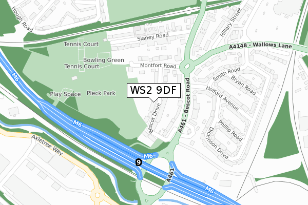
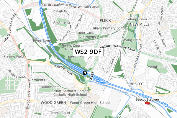
WS2 9DF lies on Bescot Drive in Walsall. WS2 9DF is located in the Pleck electoral ward, within the metropolitan district of Walsall and the English Parliamentary constituency of Walsall South. The Sub Integrated Care Board (ICB) Location is NHS Black Country ICB - D2P2L and the police force is West Midlands. This postcode has been in use since January 1980.


GetTheData
Source: OS Open Zoomstack (Ordnance Survey)
Licence: Open Government Licence (requires attribution)
Attribution: Contains OS data © Crown copyright and database right 2025
Source: Open Postcode Geo
Licence: Open Government Licence (requires attribution)
Attribution: Contains OS data © Crown copyright and database right 2025; Contains Royal Mail data © Royal Mail copyright and database right 2025; Source: Office for National Statistics licensed under the Open Government Licence v.3.0
| Easting | 399869 |
| Northing | 296754 |
| Latitude | 52.568611 |
| Longitude | -2.003365 |
GetTheData
Source: Open Postcode Geo
Licence: Open Government Licence
| Street | Bescot Drive |
| Town/City | Walsall |
| Country | England |
| Postcode District | WS2 |
➜ See where WS2 is on a map ➜ Where is Walsall? | |
GetTheData
Source: Land Registry Price Paid Data
Licence: Open Government Licence
Elevation or altitude of WS2 9DF as distance above sea level:
| Metres | Feet | |
|---|---|---|
| Elevation | 120m | 394ft |
Elevation is measured from the approximate centre of the postcode, to the nearest point on an OS contour line from OS Terrain 50, which has contour spacing of ten vertical metres.
➜ How high above sea level am I? Find the elevation of your current position using your device's GPS.
GetTheData
Source: Open Postcode Elevation
Licence: Open Government Licence
| Ward | Pleck |
| Constituency | Walsall South |
GetTheData
Source: ONS Postcode Database
Licence: Open Government Licence
8, BESCOT DRIVE, WALSALL, WS2 9DF 2022 24 JUN £296,000 |
38, BESCOT DRIVE, WALSALL, WS2 9DF 2021 17 DEC £297,500 |
31, BESCOT DRIVE, WALSALL, WS2 9DF 2018 15 JUN £300,000 |
2017 4 MAY £207,000 |
13, BESCOT DRIVE, WALSALL, WS2 9DF 2017 20 JAN £215,000 |
6, BESCOT DRIVE, WALSALL, WS2 9DF 2014 5 NOV £173,000 |
2011 8 NOV £249,500 |
13, BESCOT DRIVE, WALSALL, WS2 9DF 2011 14 OCT £149,995 |
11, BESCOT DRIVE, WALSALL, WS2 9DF 2007 4 DEC £235,000 |
2007 12 OCT £165,000 |
GetTheData
Source: HM Land Registry Price Paid Data
Licence: Contains HM Land Registry data © Crown copyright and database right 2025. This data is licensed under the Open Government Licence v3.0.
| Wallows Lane (Bescot Rd) | Bescot | 119m |
| Pleck Motorway Island (Bescot Rd) | Wood Green | 126m |
| Wallows Lane (Bescot Rd) | Bescot | 230m |
| Pc World (Axletree Way) | Wood Green | 335m |
| Pc World (Axletree Way) | Wood Green | 342m |
| Bescot Stadium Station | 1km |
| Walsall Station | 2.2km |
| Tame Bridge Parkway Station | 2.5km |
GetTheData
Source: NaPTAN
Licence: Open Government Licence
| Percentage of properties with Next Generation Access | 100.0% |
| Percentage of properties with Superfast Broadband | 100.0% |
| Percentage of properties with Ultrafast Broadband | 100.0% |
| Percentage of properties with Full Fibre Broadband | 0.0% |
Superfast Broadband is between 30Mbps and 300Mbps
Ultrafast Broadband is > 300Mbps
| Median download speed | 39.9Mbps |
| Average download speed | 48.4Mbps |
| Maximum download speed | 100.00Mbps |
| Median upload speed | 6.9Mbps |
| Average upload speed | 7.5Mbps |
| Maximum upload speed | 20.00Mbps |
| Percentage of properties unable to receive 2Mbps | 0.0% |
| Percentage of properties unable to receive 5Mbps | 0.0% |
| Percentage of properties unable to receive 10Mbps | 0.0% |
| Percentage of properties unable to receive 30Mbps | 0.0% |
GetTheData
Source: Ofcom
Licence: Ofcom Terms of Use (requires attribution)
Estimated total energy consumption in WS2 9DF by fuel type, 2015.
| Consumption (kWh) | 759,235 |
|---|---|
| Meter count | 39 |
| Mean (kWh/meter) | 19,468 |
| Median (kWh/meter) | 18,833 |
| Consumption (kWh) | 131,194 |
|---|---|
| Meter count | 35 |
| Mean (kWh/meter) | 3,748 |
| Median (kWh/meter) | 3,371 |
GetTheData
Source: Postcode level gas estimates: 2015 (experimental)
Source: Postcode level electricity estimates: 2015 (experimental)
Licence: Open Government Licence
GetTheData
Source: ONS Postcode Database
Licence: Open Government Licence


➜ Get more ratings from the Food Standards Agency
GetTheData
Source: Food Standards Agency
Licence: FSA terms & conditions
| Last Collection | |||
|---|---|---|---|
| Location | Mon-Fri | Sat | Distance |
| Bescot Road | 16:00 | 12:00 | 558m |
| Aldis Road | 16:00 | 12:00 | 563m |
| Wood Green | 17:30 | 12:00 | 687m |
GetTheData
Source: Dracos
Licence: Creative Commons Attribution-ShareAlike
The below table lists the International Territorial Level (ITL) codes (formerly Nomenclature of Territorial Units for Statistics (NUTS) codes) and Local Administrative Units (LAU) codes for WS2 9DF:
| ITL 1 Code | Name |
|---|---|
| TLG | West Midlands (England) |
| ITL 2 Code | Name |
| TLG3 | West Midlands |
| ITL 3 Code | Name |
| TLG38 | Walsall |
| LAU 1 Code | Name |
| E08000030 | Walsall |
GetTheData
Source: ONS Postcode Directory
Licence: Open Government Licence
The below table lists the Census Output Area (OA), Lower Layer Super Output Area (LSOA), and Middle Layer Super Output Area (MSOA) for WS2 9DF:
| Code | Name | |
|---|---|---|
| OA | E00052369 | |
| LSOA | E01010361 | Walsall 031A |
| MSOA | E02002140 | Walsall 031 |
GetTheData
Source: ONS Postcode Directory
Licence: Open Government Licence
| WS2 9DG | Bescot Road | 86m |
| WS2 9DE | Montfort Road | 143m |
| WS2 9DT | Fellows Park Gardens | 150m |
| WS2 9AF | Slaney Road | 201m |
| WS2 9AG | Slaney Road | 207m |
| WS2 9BU | Wallows Lane | 209m |
| WS2 9BZ | Wallows Lane | 230m |
| WS2 9DH | Holford Avenue | 231m |
| WS2 9DP | Dickinson Drive | 246m |
| WS2 9DJ | Smith Road | 250m |
GetTheData
Source: Open Postcode Geo; Land Registry Price Paid Data
Licence: Open Government Licence