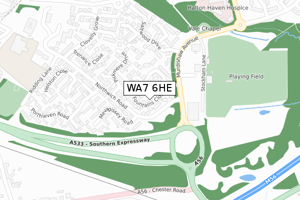
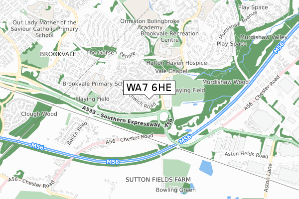
WA7 6HE lies on Fountains Close in Brookvale, Runcorn. WA7 6HE is located in the Norton South & Preston Brook electoral ward, within the unitary authority of Halton and the English Parliamentary constituency of Weaver Vale. The Sub Integrated Care Board (ICB) Location is NHS Cheshire and Merseyside ICB - 01F and the police force is Cheshire. This postcode has been in use since January 1983.


GetTheData
Source: OS Open Zoomstack (Ordnance Survey)
Licence: Open Government Licence (requires attribution)
Attribution: Contains OS data © Crown copyright and database right 2024
Source: Open Postcode Geo
Licence: Open Government Licence (requires attribution)
Attribution: Contains OS data © Crown copyright and database right 2024; Contains Royal Mail data © Royal Mail copyright and database right 2024; Source: Office for National Statistics licensed under the Open Government Licence v.3.0
| Easting | 355226 |
| Northing | 380092 |
| Latitude | 53.315855 |
| Longitude | -2.673531 |
GetTheData
Source: Open Postcode Geo
Licence: Open Government Licence
| Street | Fountains Close |
| Locality | Brookvale |
| Town/City | Runcorn |
| Country | England |
| Postcode District | WA7 |
| ➜ WA7 open data dashboard ➜ See where WA7 is on a map ➜ Where is Runcorn? | |
GetTheData
Source: Land Registry Price Paid Data
Licence: Open Government Licence
Elevation or altitude of WA7 6HE as distance above sea level:
| Metres | Feet | |
|---|---|---|
| Elevation | 50m | 164ft |
Elevation is measured from the approximate centre of the postcode, to the nearest point on an OS contour line from OS Terrain 50, which has contour spacing of ten vertical metres.
➜ How high above sea level am I? Find the elevation of your current position using your device's GPS.
GetTheData
Source: Open Postcode Elevation
Licence: Open Government Licence
| Ward | Norton South & Preston Brook |
| Constituency | Weaver Vale |
GetTheData
Source: ONS Postcode Database
Licence: Open Government Licence
14, FOUNTAINS CLOSE, BROOKVALE, RUNCORN, WA7 6HE 2022 31 MAR £185,000 |
2013 23 SEP £120,000 |
18, FOUNTAINS CLOSE, BROOKVALE, RUNCORN, WA7 6HE 2012 5 OCT £119,000 |
2003 21 MAR £98,000 |
30, FOUNTAINS CLOSE, BROOKVALE, RUNCORN, WA7 6HE 2000 4 AUG £49,000 |
12, FOUNTAINS CLOSE, BROOKVALE, RUNCORN, WA7 6HE 2000 17 MAR £30,000 |
GetTheData
Source: HM Land Registry Price Paid Data
Licence: Contains HM Land Registry data © Crown copyright and database right 2024. This data is licensed under the Open Government Licence v3.0.
| January 2024 | Other crime | On or near Porthleven Road | 300m |
| January 2024 | Violence and sexual offences | On or near Porthleven Road | 300m |
| December 2023 | Possession of weapons | On or near Porthleven Road | 300m |
| ➜ Fountains Close crime map and outcomes | |||
GetTheData
Source: data.police.uk
Licence: Open Government Licence
| Halton Arms (Murdishaw Avenue) | Murdishaw | 119m |
| Halton Arms (Murdishaw Avenue) | Murdishaw | 124m |
| Southern Expressway (Chester Road) | Sutton Weaver | 328m |
| Halton High (Busway (Brookvale)) | Brookvale | 343m |
| Halton High (Busway (Brookvale)) | Brookvale | 359m |
| Runcorn East Station | 1.4km |
| Frodsham Station | 4km |
| Runcorn Station | 5.1km |
GetTheData
Source: NaPTAN
Licence: Open Government Licence
➜ Broadband speed and availability dashboard for WA7 6HE
| Percentage of properties with Next Generation Access | 100.0% |
| Percentage of properties with Superfast Broadband | 100.0% |
| Percentage of properties with Ultrafast Broadband | 0.0% |
| Percentage of properties with Full Fibre Broadband | 0.0% |
Superfast Broadband is between 30Mbps and 300Mbps
Ultrafast Broadband is > 300Mbps
| Median download speed | 13.0Mbps |
| Average download speed | 19.4Mbps |
| Maximum download speed | 39.85Mbps |
| Median upload speed | 1.2Mbps |
| Average upload speed | 3.3Mbps |
| Maximum upload speed | 7.62Mbps |
| Percentage of properties unable to receive 2Mbps | 0.0% |
| Percentage of properties unable to receive 5Mbps | 0.0% |
| Percentage of properties unable to receive 10Mbps | 0.0% |
| Percentage of properties unable to receive 30Mbps | 0.0% |
➜ Broadband speed and availability dashboard for WA7 6HE
GetTheData
Source: Ofcom
Licence: Ofcom Terms of Use (requires attribution)
Estimated total energy consumption in WA7 6HE by fuel type, 2015.
| Consumption (kWh) | 312,977 |
|---|---|
| Meter count | 31 |
| Mean (kWh/meter) | 10,096 |
| Median (kWh/meter) | 10,382 |
| Consumption (kWh) | 106,903 |
|---|---|
| Meter count | 29 |
| Mean (kWh/meter) | 3,686 |
| Median (kWh/meter) | 3,326 |
GetTheData
Source: Postcode level gas estimates: 2015 (experimental)
Source: Postcode level electricity estimates: 2015 (experimental)
Licence: Open Government Licence
GetTheData
Source: ONS Postcode Database
Licence: Open Government Licence


➜ Get more ratings from the Food Standards Agency
GetTheData
Source: Food Standards Agency
Licence: FSA terms & conditions
| Last Collection | |||
|---|---|---|---|
| Location | Mon-Fri | Sat | Distance |
| Sutton Park | 17:00 | 11:00 | 176m |
| Woodhatch Road | 16:45 | 11:00 | 671m |
| Bodmin Close | 16:45 | 11:00 | 675m |
GetTheData
Source: Dracos
Licence: Creative Commons Attribution-ShareAlike
| Facility | Distance |
|---|---|
| Runcorn Linnets Fc (The Apec Taxis Stadium) Stockham Lane, Murdishaw Avenue, Murdishaw, Runcorn Grass Pitches | 199m |
| Halton Sports Playing Field (John Mills Ballpark) Stockham Lane, Murdishaw, Runcorn Grass Pitches | 219m |
| Ormiston Bolingbroke Academy Barnfield Avenue, Murdishaw, Runcorn Grass Pitches | 421m |
GetTheData
Source: Active Places
Licence: Open Government Licence
| School | Phase of Education | Distance |
|---|---|---|
| Ormiston Bolingbroke Academy Barnfield Avenue, Murdishaw, Runcorn, WA7 6EP | Secondary | 421m |
| Brookvale Primary School Northwich Road, Brookvale, Runcorn, WA7 6BZ | Primary | 482m |
| Murdishaw West Community Primary School Barnfield Avenue, Murdishaw, Runcorn, WA7 6EP | Primary | 850m |
GetTheData
Source: Edubase
Licence: Open Government Licence
The below table lists the International Territorial Level (ITL) codes (formerly Nomenclature of Territorial Units for Statistics (NUTS) codes) and Local Administrative Units (LAU) codes for WA7 6HE:
| ITL 1 Code | Name |
|---|---|
| TLD | North West (England) |
| ITL 2 Code | Name |
| TLD7 | Merseyside |
| ITL 3 Code | Name |
| TLD71 | East Merseyside |
| LAU 1 Code | Name |
| E06000006 | Halton |
GetTheData
Source: ONS Postcode Directory
Licence: Open Government Licence
The below table lists the Census Output Area (OA), Lower Layer Super Output Area (LSOA), and Middle Layer Super Output Area (MSOA) for WA7 6HE:
| Code | Name | |
|---|---|---|
| OA | E00062731 | |
| LSOA | E01012440 | Halton 014E |
| MSOA | E02002587 | Halton 014 |
GetTheData
Source: ONS Postcode Directory
Licence: Open Government Licence
| WA7 6HB | Pickmere Drive | 50m |
| WA7 6HD | Linwood Close | 108m |
| WA7 6HF | Abington Walk | 118m |
| WA7 6HA | Pickmere Drive | 135m |
| WA7 6BD | Mevagissey Road | 137m |
| WA7 6LS | Granby Close | 146m |
| WA7 6HG | Calverley Close | 181m |
| WA7 6LT | Halsall Close | 230m |
| WA7 6LR | Backford Close | 232m |
| WA7 6EG | Trenance Close | 238m |
GetTheData
Source: Open Postcode Geo; Land Registry Price Paid Data
Licence: Open Government Licence