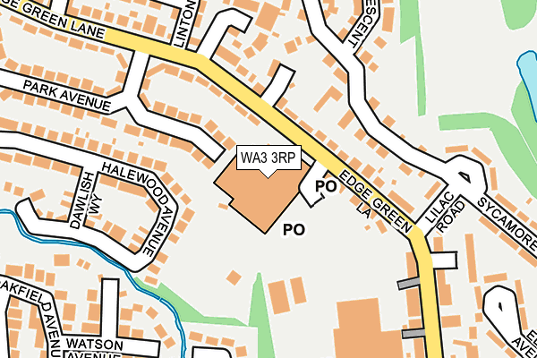
WA3 3RP is located in the Golborne & Lowton West electoral ward, within the metropolitan district of Wigan and the English Parliamentary constituency of Leigh. The Sub Integrated Care Board (ICB) Location is NHS Greater Manchester ICB - 02H and the police force is Greater Manchester. This postcode has been in use since June 1997.


GetTheData
Source: OS OpenMap – Local (Ordnance Survey)
Source: OS VectorMap District (Ordnance Survey)
Licence: Open Government Licence (requires attribution)
| Easting | 359950 |
| Northing | 398430 |
| Latitude | 53.481058 |
| Longitude | -2.604961 |
GetTheData
Source: Open Postcode Geo
Licence: Open Government Licence
| Country | England |
| Postcode District | WA3 |
| ➜ WA3 open data dashboard ➜ See where WA3 is on a map ➜ Where is Golborne? | |
GetTheData
Source: Land Registry Price Paid Data
Licence: Open Government Licence
Elevation or altitude of WA3 3RP as distance above sea level:
| Metres | Feet | |
|---|---|---|
| Elevation | 40m | 131ft |
Elevation is measured from the approximate centre of the postcode, to the nearest point on an OS contour line from OS Terrain 50, which has contour spacing of ten vertical metres.
➜ How high above sea level am I? Find the elevation of your current position using your device's GPS.
GetTheData
Source: Open Postcode Elevation
Licence: Open Government Licence
| Ward | Golborne & Lowton West |
| Constituency | Leigh |
GetTheData
Source: ONS Postcode Database
Licence: Open Government Licence
| September 2021 | Anti-social behaviour | On or near York Street | 303m |
| ➜ Get more crime data in our Crime section | |||
GetTheData
Source: data.police.uk
Licence: Open Government Licence
| Edge Green Ln/Asda (Edge Green Ln) | Golborne | 55m |
| Edge Green Ln/Asda (Edge Green Ln) | Golborne | 88m |
| Edge Green Ln/Prescott Ave (Edge Green Ln) | Golborne | 196m |
| Edge Green Ln/Prescott Ave (Edge Green Ln) | Golborne | 222m |
| Helen St/Halewood Ave (Helen St) | Golborne | 321m |
| Newton-le-Willows Station | 3.2km |
| Bryn Station | 3.5km |
| Earlestown Station | 4km |
GetTheData
Source: NaPTAN
Licence: Open Government Licence
GetTheData
Source: ONS Postcode Database
Licence: Open Government Licence


➜ Get more ratings from the Food Standards Agency
GetTheData
Source: Food Standards Agency
Licence: FSA terms & conditions
| Last Collection | |||
|---|---|---|---|
| Location | Mon-Fri | Sat | Distance |
| Edge Green S.o. | 17:00 | 12:00 | 43m |
| 156 Harvey Lane | 17:00 | 11:00 | 499m |
| Golborne S.o. | 17:30 | 12:00 | 623m |
GetTheData
Source: Dracos
Licence: Creative Commons Attribution-ShareAlike
| Facility | Distance |
|---|---|
| Iconic Fitness Golborne Enterprise Park, Golborne, Warrington Health and Fitness Gym | 467m |
| The Sycamores Golf Centre Ashton Road, Golborne Golf | 516m |
| Golborne Junior & Infant School (Closed) Talbot Street, Golborne, Warrington Grass Pitches | 617m |
GetTheData
Source: Active Places
Licence: Open Government Licence
| School | Phase of Education | Distance |
|---|---|---|
| Golborne Community Primary School Talbot Street, Golborne, Warrington, WA3 3NN | Primary | 577m |
| St Thomas CofE Junior and Infant School Church Street, Golborne, Warrington, WA3 3TH | Primary | 768m |
| All Saints Catholic Primary School, Golborne, Wigan Hazel Grove, Golborne, Warrington, WA3 3LU | Primary | 938m |
GetTheData
Source: Edubase
Licence: Open Government Licence
The below table lists the International Territorial Level (ITL) codes (formerly Nomenclature of Territorial Units for Statistics (NUTS) codes) and Local Administrative Units (LAU) codes for WA3 3RP:
| ITL 1 Code | Name |
|---|---|
| TLD | North West (England) |
| ITL 2 Code | Name |
| TLD3 | Greater Manchester |
| ITL 3 Code | Name |
| TLD36 | Greater Manchester North West |
| LAU 1 Code | Name |
| E08000010 | Wigan |
GetTheData
Source: ONS Postcode Directory
Licence: Open Government Licence
The below table lists the Census Output Area (OA), Lower Layer Super Output Area (LSOA), and Middle Layer Super Output Area (MSOA) for WA3 3RP:
| Code | Name | |
|---|---|---|
| OA | E00031535 | |
| LSOA | E01006227 | Wigan 038A |
| MSOA | E02001324 | Wigan 038 |
GetTheData
Source: ONS Postcode Directory
Licence: Open Government Licence
| WA3 3SP | Edge Green Lane | 66m |
| WA3 3TA | Edge Green Lane | 74m |
| WA3 3RQ | Halewood Avenue | 116m |
| WA3 3WD | Hartswell Close | 117m |
| WA3 3WQ | Pennybutts Close | 127m |
| WA3 3WE | Swanfield Walk | 164m |
| WA3 3TD | Slaidburn Crescent | 169m |
| WA3 3ST | Park Avenue | 186m |
| WA3 3SR | Prescott Avenue | 201m |
| WA3 3SW | Bank Street | 202m |
GetTheData
Source: Open Postcode Geo; Land Registry Price Paid Data
Licence: Open Government Licence