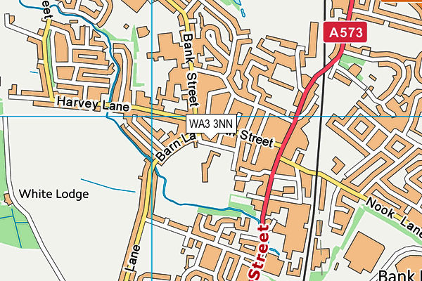
Golborne Community Primary School is located in Golborne, Warrington and falls under the local authority of Wigan. This mixed-sex primary school has 331 pupils, with a capacity of 315, aged from three up to eleven, and the type of establishment is academy converter. The most recend Ofsted inspection was 15th February 2023 resulting in an good rating.
| Address | Golborne Community Primary School Talbot Street Golborne Warrington Cheshire WA3 3NN |
| Website | http://www.golborneprimary.co.uk/ |
| Headteacher | Mr Andrew Hunt |
GetTheData
Source: Get Information About Schools
Licence: Open Government Licence
| Phase of Education | Primary |
| Type of Establishment | Academy converter |
| Admissions Policy | Not applicable |
| Statutory Low Age | 3 |
| Statutory High Age | 11 |
| Boarders | No boarders |
| Official Sixth Form | Does not have a sixth form |
| Gender | Mixed |
| Religious Character | Does not apply |
| Diocese | Not applicable |
| Special Classes | No Special Classes |
GetTheData
Source: Get Information About Schools
Licence: Open Government Licence
| Census Date | 19th January 2023 | |
| School Capacity | 315 | |
| Number of Pupils | 331 | 105% capacity |
| Number of Boys | 186 | 56% |
| Number of Girls | 145 | 44% |
| Free School Meals (%) | 34.80% |
GetTheData
Source: Get Information About Schools
Licence: Open Government Licence
| Street Address | Talbot Street |
| Locality | Golborne |
| Town | Warrington |
| County | Cheshire |
| Postcode | WA3 3NN |
| ➜ More WA3 3NN open data | |
GetTheData
Source: Get Information About Schools
Licence: Open Government Licence

GetTheData
Source: OS VectorMap District (Ordnance Survey)
Licence: Open Government Licence (requires attribution)
| Ofsted Last Inspection | 15th February 2023 |
| Ofsted Rating | Good |
| Ofsted Special Measures | Not applicable |
GetTheData
Source: Get Information About Schools
Licence: Open Government Licence
| Establishment Name | Golborne Community Primary School |
| Establishment Number | 2037 |
| Unique Reference Number | 147101 |
| Local Authority | Wigan |
| Local Authority Code | 359 |
| Previous Local Authority Code | 999 |
| Government Statistical Service Local Authority Code | E08000010 |
| Government Office Region | North West |
| District | Wigan |
| District Code | E08000010 |
| Ward | Golborne & Lowton West |
| Parliamentary Constituency | Leigh |
| Urban/Rural Description | (England/Wales) Urban major conurbation |
| Middle Super Output Area | Wigan 038 |
| Lower Super Output Area | Wigan 038E |
GetTheData
Source: Get Information About Schools
Licence: Open Government Licence
| Establishment Status | Open |
| Last Changed Date | 22nd January 2024 |
| Reason Establishment Opened | Academy Converter |
| Open Date | 1st July 2019 |
GetTheData
Source: Get Information About Schools
Licence: Open Government Licence
| Teenage Mothers | Not applicable |
| Child Care Facilities | Not applicable |
| Special Educational Needs (SEN) Provision in Primary Care Unit | Not applicable |
| Pupil Referral Unit (PRU) Provides for Educational and Behavioural Difficulties (EBD) | Not applicable |
| Pupil Referral Unit (PRU) Offers Tuition by Another Provider | Not applicable |
GetTheData
Source: Get Information About Schools
Licence: Open Government Licence
| Section 41 Approved | Not applicable |
GetTheData
Source: Get Information About Schools
Licence: Open Government Licence
| Trust flag | Supported by a multi-academy trust |
| Trust | MOSAIC LEARNING TRUST |
| School Sponsor flag | - |
GetTheData
Source: Get Information About Schools
Licence: Open Government Licence
| Federation flag | Not applicable |
GetTheData
Source: Get Information About Schools
Licence: Open Government Licence
| UK Provider Reference Number | 10083649 |
| Further Education Type | Not applicable |
GetTheData
Source: Get Information About Schools
Licence: Open Government Licence
| Easting | 360213 |
| Northing | 397916 |
| Latitude | 53.47645 |
| Longitude | -2.60094 |
GetTheData
Source: Get Information About Schools
Licence: Open Government Licence
| School | Phase of Education | Distance |
|---|---|---|
| All Saints Catholic Primary School, Golborne, Wigan Hazel Grove, Golborne, Warrington, WA3 3LU | Primary | 466m |
| St Thomas CofE Junior and Infant School Church Street, Golborne, Warrington, WA3 3TH | Primary | 504m |
| The Parks School Market Street, Hindley, WN2 3AN | Not applicable | 673m |
| Golborne High School Lowton Road, Golborne, Warrington, WA3 3EL | Secondary | 1km |
| Lowton West Primary School Slag Lane, Lowton, Warrington, WA3 2ED | Primary | 1.3km |
| St Luke's CofE Primary School Church Lane, Lowton, Warrington, WA3 2PW | Primary | 1.9km |
| St Catherine's Catholic Primary School, Lowton Cranham Avenue, Lowton, Warrington, WA3 2PQ | Primary | 2.1km |
| St Wilfrids Catholic Primary School Golborne Road, Ashton-in-Makerfield, Wigan, WN4 8SJ | Primary | 2.2km |
| Hope Academy Ashton Road, Newton-le-Willows, WA12 0AQ | Secondary | 2.3km |
| St Thomas CofE Primary School Hodnet Drive, Ashton-in-Makerfield, Wigan, WN4 8PQ | Primary | 2.5km |
GetTheData
Source: Get Information About Schools
Licence: Open Government Licence