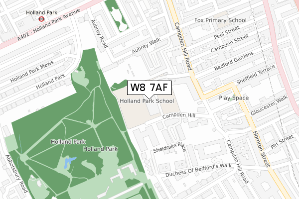
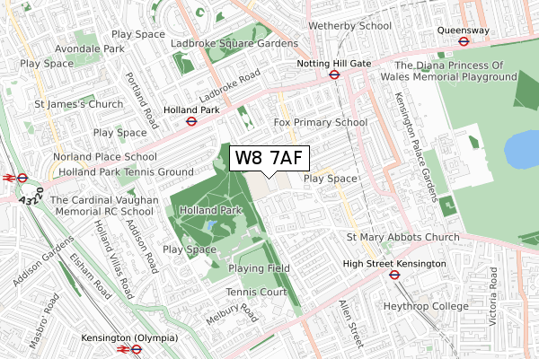
W8 7AF is located in the Campden electoral ward, within the London borough of Kensington and Chelsea and the English Parliamentary constituency of Kensington. The Sub Integrated Care Board (ICB) Location is NHS North West London ICB - W2U3Z and the police force is Metropolitan Police. This postcode has been in use since January 1980.


GetTheData
Source: OS Open Zoomstack (Ordnance Survey)
Licence: Open Government Licence (requires attribution)
Attribution: Contains OS data © Crown copyright and database right 2024
Source: Open Postcode Geo
Licence: Open Government Licence (requires attribution)
Attribution: Contains OS data © Crown copyright and database right 2024; Contains Royal Mail data © Royal Mail copyright and database right 2024; Source: Office for National Statistics licensed under the Open Government Licence v.3.0
| Easting | 524982 |
| Northing | 179974 |
| Latitude | 51.504888 |
| Longitude | -0.200623 |
GetTheData
Source: Open Postcode Geo
Licence: Open Government Licence
| Country | England |
| Postcode District | W8 |
| ➜ W8 open data dashboard ➜ See where W8 is on a map ➜ Where is Kensington? | |
GetTheData
Source: Land Registry Price Paid Data
Licence: Open Government Licence
Elevation or altitude of W8 7AF as distance above sea level:
| Metres | Feet | |
|---|---|---|
| Elevation | 40m | 131ft |
Elevation is measured from the approximate centre of the postcode, to the nearest point on an OS contour line from OS Terrain 50, which has contour spacing of ten vertical metres.
➜ How high above sea level am I? Find the elevation of your current position using your device's GPS.
GetTheData
Source: Open Postcode Elevation
Licence: Open Government Licence
| Ward | Campden |
| Constituency | Kensington |
GetTheData
Source: ONS Postcode Database
Licence: Open Government Licence
| January 2024 | Violence and sexual offences | On or near Campden Hill Road | 209m |
| October 2023 | Criminal damage and arson | On or near Campden Hill Road | 209m |
| October 2023 | Other theft | On or near Campden Hill Road | 209m |
| ➜ Get more crime data in our Crime section | |||
GetTheData
Source: data.police.uk
Licence: Open Government Licence
| Holland Park (Holland Park Avenue) | Holland Park | 371m |
| Holland Park (Holland Park Avenue) | Holland Park | 421m |
| Holland Park (Holland Park Avenue) | Holland Park | 446m |
| Notting Hill Gate Hillgate St | Notting Hill | 447m |
| Sheffield Terrace (Kensington Church Street) | Kensington | 448m |
| Holland Park Underground Station | Holland Park | 431m |
| Notting Hill Gate Underground Station | Notting Hill | 566m |
| High Street Kensington Underground Station | High Street Kensington | 691m |
| Kensington (Olympia) Underground Station | Olympia | 1,038m |
| Queensway Underground Station | Queensway | 1,113m |
| Kensington (Olympia) Station | 1km |
| Shepherds Bush Station | 1.2km |
| West Brompton Station | 2km |
GetTheData
Source: NaPTAN
Licence: Open Government Licence
GetTheData
Source: ONS Postcode Database
Licence: Open Government Licence


➜ Get more ratings from the Food Standards Agency
GetTheData
Source: Food Standards Agency
Licence: FSA terms & conditions
| Last Collection | |||
|---|---|---|---|
| Location | Mon-Fri | Sat | Distance |
| Bedford Gardens | 17:30 | 12:00 | 205m |
| Campden Hill Square | 17:30 | 12:00 | 235m |
| Aubrey Walk | 17:30 | 12:00 | 243m |
GetTheData
Source: Dracos
Licence: Creative Commons Attribution-ShareAlike
| Facility | Distance |
|---|---|
| Holland Park School Airlie Gardens, London Health and Fitness Gym, Sports Hall, Swimming Pool, Studio, Artificial Grass Pitch, Outdoor Tennis Courts | 0m |
| Campden Hill Lawn Tennis Club Aubrey Walk, London Indoor Tennis Centre, Outdoor Tennis Courts | 130m |
| Holland Park Kensington High Street, London Grass Pitches, Outdoor Tennis Courts | 445m |
GetTheData
Source: Active Places
Licence: Open Government Licence
| School | Phase of Education | Distance |
|---|---|---|
| Holland Park School Airlie Gardens, London, W8 7AF | Secondary | 0m |
| Fox Primary School Fox Primary School , Kensington Place, London, W8 7PP | Primary | 374m |
| St Mary Abbots CofE Primary School 2 Kensington Church Court, Kensington, London, W8 4SP | Primary | 660m |
GetTheData
Source: Edubase
Licence: Open Government Licence
The below table lists the International Territorial Level (ITL) codes (formerly Nomenclature of Territorial Units for Statistics (NUTS) codes) and Local Administrative Units (LAU) codes for W8 7AF:
| ITL 1 Code | Name |
|---|---|
| TLI | London |
| ITL 2 Code | Name |
| TLI3 | Inner London - West |
| ITL 3 Code | Name |
| TLI33 | Kensington & Chelsea and Hammersmith & Fulham |
| LAU 1 Code | Name |
| E09000020 | Kensington and Chelsea |
GetTheData
Source: ONS Postcode Directory
Licence: Open Government Licence
The below table lists the Census Output Area (OA), Lower Layer Super Output Area (LSOA), and Middle Layer Super Output Area (MSOA) for W8 7AF:
| Code | Name | |
|---|---|---|
| OA | E00014124 | |
| LSOA | E01002825 | Kensington and Chelsea 008B |
| MSOA | E02000584 | Kensington and Chelsea 008 |
GetTheData
Source: ONS Postcode Directory
Licence: Open Government Licence
| W8 7AN | Airlie Gardens | 95m |
| W8 7EB | Thornwood Gardens | 96m |
| W8 7ER | Thornwood Gardens | 113m |
| W8 7AW | Airlie Gardens | 116m |
| W8 7EW | Thornwood Gardens | 123m |
| W8 7EY | Thornwood Gardens | 134m |
| W8 7AL | Airlie Gardens | 138m |
| W8 7AJ | Airlie Gardens | 142m |
| W8 7BD | Campden Hill Road | 151m |
| W8 7EA | Thornwood Gardens | 154m |
GetTheData
Source: Open Postcode Geo; Land Registry Price Paid Data
Licence: Open Government Licence