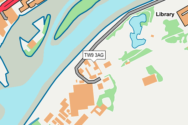
TW9 3AG is located in the Kew electoral ward, within the London borough of Richmond upon Thames and the English Parliamentary constituency of Richmond Park. The Sub Integrated Care Board (ICB) Location is NHS South West London ICB - 36L and the police force is Metropolitan Police. This postcode has been in use since January 1980.


GetTheData
Source: OS OpenMap – Local (Ordnance Survey)
Source: OS VectorMap District (Ordnance Survey)
Licence: Open Government Licence (requires attribution)
| Easting | 518441 |
| Northing | 177481 |
| Latitude | 51.483890 |
| Longitude | -0.295657 |
GetTheData
Source: Open Postcode Geo
Licence: Open Government Licence
| Country | England |
| Postcode District | TW9 |
| ➜ TW9 open data dashboard ➜ See where TW9 is on a map ➜ Where is London? | |
GetTheData
Source: Land Registry Price Paid Data
Licence: Open Government Licence
Elevation or altitude of TW9 3AG as distance above sea level:
| Metres | Feet | |
|---|---|---|
| Elevation | 10m | 33ft |
Elevation is measured from the approximate centre of the postcode, to the nearest point on an OS contour line from OS Terrain 50, which has contour spacing of ten vertical metres.
➜ How high above sea level am I? Find the elevation of your current position using your device's GPS.
GetTheData
Source: Open Postcode Elevation
Licence: Open Government Licence
| Ward | Kew |
| Constituency | Richmond Park |
GetTheData
Source: ONS Postcode Database
Licence: Open Government Licence
| January 2024 | Criminal damage and arson | On or near Parking Area | 411m |
| December 2023 | Public order | On or near Albany Place | 492m |
| November 2023 | Vehicle crime | On or near Parking Area | 411m |
| ➜ Get more crime data in our Crime section | |||
GetTheData
Source: data.police.uk
Licence: Open Government Licence
| Watermans Centre (Brentford High Street) | Brentford | 284m |
| Watermans Centre | Brentford | 322m |
| The Musical Museum (Brentford High Street) | Brentford | 358m |
| Goat Wharf (Brentford High Street) | Brentford | 366m |
| Albany Road Brentford | Brentford | 384m |
| Kew Gardens Underground Station | Kew Gardens | 1,049m |
| Gunnersbury Underground Station | Gunnersbury | 1,667m |
| Kew Bridge Station | 0.9km |
| Brentford Station | 1.1km |
| Kew Gardens Station | 1.1km |
GetTheData
Source: NaPTAN
Licence: Open Government Licence
GetTheData
Source: ONS Postcode Database
Licence: Open Government Licence


➜ Get more ratings from the Food Standards Agency
GetTheData
Source: Food Standards Agency
Licence: FSA terms & conditions
| Last Collection | |||
|---|---|---|---|
| Location | Mon-Fri | Sat | Distance |
| 13 Albany Parade | 17:15 | 11:45 | 395m |
| Royal Botanical Gardens | 17:00 | 11:00 | 431m |
| The Cage, High Street | 17:45 | 12:15 | 467m |
GetTheData
Source: Dracos
Licence: Creative Commons Attribution-ShareAlike
| Facility | Distance |
|---|---|
| Kew Cricket Club Kew Green, Richmond Grass Pitches | 562m |
| Cruyff Court Brentford Towers Pump House Crescent, Pump House Crescent, Brentford Artificial Grass Pitch | 572m |
| Brentford Fc (Griffin Park) (Closed) Braemar Road, Brentford Grass Pitches | 642m |
GetTheData
Source: Active Places
Licence: Open Government Licence
| School | Phase of Education | Distance |
|---|---|---|
| Green Dragon Primary School North Road, Green Dragon Primary School, Brentford, TW8 0BJ | Primary | 439m |
| Kew Green Preparatory School Layton House, Ferry Lane, Kew Green, Richmond, TW9 3AF | Not applicable | 441m |
| St Paul's CofE Primary School St Paul's Road, Brentford, TW8 0PN | Primary | 653m |
GetTheData
Source: Edubase
Licence: Open Government Licence
| Risk of TW9 3AG flooding from rivers and sea | Very Low |
| ➜ TW9 3AG flood map | |
GetTheData
Source: Open Flood Risk by Postcode
Licence: Open Government Licence
The below table lists the International Territorial Level (ITL) codes (formerly Nomenclature of Territorial Units for Statistics (NUTS) codes) and Local Administrative Units (LAU) codes for TW9 3AG:
| ITL 1 Code | Name |
|---|---|
| TLI | London |
| ITL 2 Code | Name |
| TLI7 | Outer London - West and North West |
| ITL 3 Code | Name |
| TLI75 | Hounslow and Richmond upon Thames |
| LAU 1 Code | Name |
| E09000027 | Richmond upon Thames |
GetTheData
Source: ONS Postcode Directory
Licence: Open Government Licence
The below table lists the Census Output Area (OA), Lower Layer Super Output Area (LSOA), and Middle Layer Super Output Area (MSOA) for TW9 3AG:
| Code | Name | |
|---|---|---|
| OA | E00019350 | |
| LSOA | E01003847 | Richmond upon Thames 002B |
| MSOA | E02000785 | Richmond upon Thames 002 |
GetTheData
Source: ONS Postcode Directory
Licence: Open Government Licence
| TW8 0FT | High Street | 310m |
| TW8 0FR | High Street | 325m |
| TW8 0AS | Goat Wharf | 336m |
| TW8 0AT | Ferry Lane | 363m |
| TW8 0JY | Walnut Tree Road | 365m |
| TW8 0AW | Ferry Lane | 369m |
| TW8 0DD | Point Wharf Lane | 371m |
| TW8 8QH | Justin Close | 386m |
| TW8 0SE | Pottery Road | 386m |
| TW8 0BT | Soaphouse Lane | 389m |
GetTheData
Source: Open Postcode Geo; Land Registry Price Paid Data
Licence: Open Government Licence