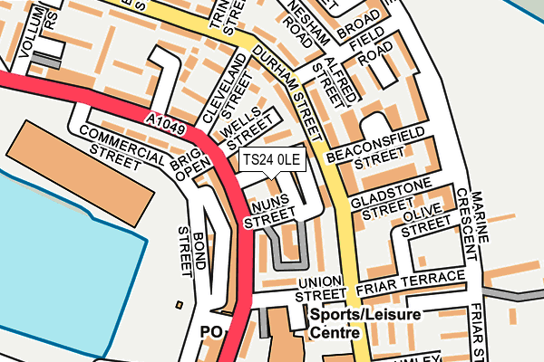
TS24 0LE is located in the Headland & Harbour electoral ward, within the unitary authority of Hartlepool and the English Parliamentary constituency of Hartlepool. The Sub Integrated Care Board (ICB) Location is NHS North East and North Cumbria ICB - 16C and the police force is Cleveland. This postcode has been in use since January 1980.


GetTheData
Source: OS OpenMap – Local (Ordnance Survey)
Source: OS VectorMap District (Ordnance Survey)
Licence: Open Government Licence (requires attribution)
| Easting | 452714 |
| Northing | 533977 |
| Latitude | 54.698084 |
| Longitude | -1.183619 |
GetTheData
Source: Open Postcode Geo
Licence: Open Government Licence
| Country | England |
| Postcode District | TS24 |
| ➜ TS24 open data dashboard ➜ See where TS24 is on a map ➜ Where is Hartlepool? | |
GetTheData
Source: Land Registry Price Paid Data
Licence: Open Government Licence
Elevation or altitude of TS24 0LE as distance above sea level:
| Metres | Feet | |
|---|---|---|
| Elevation | 10m | 33ft |
Elevation is measured from the approximate centre of the postcode, to the nearest point on an OS contour line from OS Terrain 50, which has contour spacing of ten vertical metres.
➜ How high above sea level am I? Find the elevation of your current position using your device's GPS.
GetTheData
Source: Open Postcode Elevation
Licence: Open Government Licence
| Ward | Headland & Harbour |
| Constituency | Hartlepool |
GetTheData
Source: ONS Postcode Database
Licence: Open Government Licence
| December 2023 | Other theft | On or near Abbey Street | 171m |
| November 2023 | Public order | On or near Abbey Street | 171m |
| October 2023 | Shoplifting | On or near Abbey Street | 171m |
| ➜ Get more crime data in our Crime section | |||
GetTheData
Source: data.police.uk
Licence: Open Government Licence
| Northgate | The Headland | 65m |
| Gladstone Street (Durham Street) | The Headland | 124m |
| Cleveland Street (Durham Street) | The Headland | 161m |
| Middlegate Town Square (Northgate) | The Headland | 248m |
| Church Close (Durham Street) | The Headland | 256m |
| Hartlepool Station | 2km |
| Seaton Carew Station | 4.6km |
GetTheData
Source: NaPTAN
Licence: Open Government Licence
GetTheData
Source: ONS Postcode Database
Licence: Open Government Licence


➜ Get more ratings from the Food Standards Agency
GetTheData
Source: Food Standards Agency
Licence: FSA terms & conditions
| Last Collection | |||
|---|---|---|---|
| Location | Mon-Fri | Sat | Distance |
| Navigation Point | 17:45 | 12:30 | 1,113m |
| Church Street | 18:30 | 12:00 | 1,921m |
| Brougham Terrace | 18:00 | 12:15 | 2,230m |
GetTheData
Source: Dracos
Licence: Creative Commons Attribution-ShareAlike
| Facility | Distance |
|---|---|
| Headland Sports Centre Groves Street, Hartlepool Sports Hall, Health and Fitness Gym | 159m |
| Town Moor Marine Crescent, Hartlepool Outdoor Tennis Courts | 285m |
| Old Friarage Field Moor Terrace, Moor Terrace, Hartlepool Grass Pitches | 391m |
GetTheData
Source: Active Places
Licence: Open Government Licence
| School | Phase of Education | Distance |
|---|---|---|
| St Helen's Primary School Durham Street, Hartlepool, TS24 0HG | Primary | 337m |
| St Bega's Catholic Primary School, Hartlepool Thorpe Street, Hartlepool, TS24 0DX | Primary | 882m |
| Brougham Primary School Brougham Terrace, Hartlepool, TS24 8EY | Primary | 2.1km |
GetTheData
Source: Edubase
Licence: Open Government Licence
| Risk of TS24 0LE flooding from rivers and sea | Low |
| ➜ TS24 0LE flood map | |
GetTheData
Source: Open Flood Risk by Postcode
Licence: Open Government Licence
The below table lists the International Territorial Level (ITL) codes (formerly Nomenclature of Territorial Units for Statistics (NUTS) codes) and Local Administrative Units (LAU) codes for TS24 0LE:
| ITL 1 Code | Name |
|---|---|
| TLC | North East (England) |
| ITL 2 Code | Name |
| TLC1 | Tees Valley and Durham |
| ITL 3 Code | Name |
| TLC11 | Hartlepool and Stockton-on-Tees |
| LAU 1 Code | Name |
| E06000001 | Hartlepool |
GetTheData
Source: ONS Postcode Directory
Licence: Open Government Licence
The below table lists the Census Output Area (OA), Lower Layer Super Output Area (LSOA), and Middle Layer Super Output Area (MSOA) for TS24 0LE:
| Code | Name | |
|---|---|---|
| OA | E00060484 | |
| LSOA | E01011991 | Hartlepool 002C |
| MSOA | E02002484 | Hartlepool 002 |
GetTheData
Source: ONS Postcode Directory
Licence: Open Government Licence
| TS24 0LG | Throston Street | 16m |
| TS24 0LQ | Darlington Street | 29m |
| TS24 0JY | Northgate | 43m |
| TS24 0HT | Durham Street | 55m |
| TS24 0HR | Durham Street | 72m |
| TS24 0JX | Northgate | 81m |
| TS24 0HS | Durham Street | 81m |
| TS24 0HU | Durham Street | 85m |
| TS24 0NU | Alfred Street | 112m |
| TS24 0LH | Gibb Square | 115m |
GetTheData
Source: Open Postcode Geo; Land Registry Price Paid Data
Licence: Open Government Licence