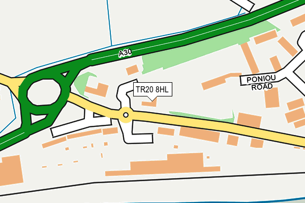
TR20 8HL is located in the Long Rock, Marazion & St Erth electoral ward, within the unitary authority of Cornwall and the English Parliamentary constituency of St Ives. The Sub Integrated Care Board (ICB) Location is NHS Cornwall and the Isles of Scilly ICB - 11N and the police force is Devon & Cornwall. This postcode has been in use since December 1997.


GetTheData
Source: OS OpenMap – Local (Ordnance Survey)
Source: OS VectorMap District (Ordnance Survey)
Licence: Open Government Licence (requires attribution)
| Easting | 149261 |
| Northing | 31368 |
| Latitude | 50.129275 |
| Longitude | -5.509766 |
GetTheData
Source: Open Postcode Geo
Licence: Open Government Licence
| Country | England |
| Postcode District | TR20 |
| ➜ TR20 open data dashboard ➜ See where TR20 is on a map ➜ Where is Longrock? | |
GetTheData
Source: Land Registry Price Paid Data
Licence: Open Government Licence
Elevation or altitude of TR20 8HL as distance above sea level:
| Metres | Feet | |
|---|---|---|
| Elevation | 10m | 33ft |
Elevation is measured from the approximate centre of the postcode, to the nearest point on an OS contour line from OS Terrain 50, which has contour spacing of ten vertical metres.
➜ How high above sea level am I? Find the elevation of your current position using your device's GPS.
GetTheData
Source: Open Postcode Elevation
Licence: Open Government Licence
| Ward | Long Rock, Marazion & St Erth |
| Constituency | St Ives |
GetTheData
Source: ONS Postcode Database
Licence: Open Government Licence
| June 2022 | Vehicle crime | On or near Poniou Road | 245m |
| June 2022 | Anti-social behaviour | On or near Poniou Lane | 265m |
| June 2022 | Public order | On or near Supermarket | 305m |
| ➜ Get more crime data in our Crime section | |||
GetTheData
Source: data.police.uk
Licence: Open Government Licence
| Morrisons | Long Rock | 97m |
| Morrisons | Long Rock | 107m |
| B And Q (Jelbert Way) | Penzance | 520m |
| B And Q | Penzance | 520m |
| Mexico Inn (Riverside) | Long Rock | 663m |
| Penzance Station | 1.8km |
| St Erth Station | 6.6km |
GetTheData
Source: NaPTAN
Licence: Open Government Licence
| Median download speed | 39.4Mbps |
| Average download speed | 39.2Mbps |
| Maximum download speed | 46.39Mbps |
| Median upload speed | 12.5Mbps |
| Average upload speed | 11.3Mbps |
| Maximum upload speed | 17.27Mbps |
GetTheData
Source: Ofcom
Licence: Ofcom Terms of Use (requires attribution)
GetTheData
Source: ONS Postcode Database
Licence: Open Government Licence


➜ Get more ratings from the Food Standards Agency
GetTheData
Source: Food Standards Agency
Licence: FSA terms & conditions
| Last Collection | |||
|---|---|---|---|
| Location | Mon-Fri | Sat | Distance |
| Chy An Mor | 10:15 | 10:15 | 228m |
| Long Rock Post Office | 17:15 | 10:45 | 725m |
| Gulval Post Office | 17:15 | 11:30 | 1,311m |
GetTheData
Source: Dracos
Licence: Creative Commons Attribution-ShareAlike
| Facility | Distance |
|---|---|
| Rydall Rock (Closed) Mike Courtney, Long Rock, Penzance Grass Pitches | 935m |
| Gulval Cricket Club Four Moors, Higher Kenegie, Gulval Grass Pitches | 1.5km |
| Ultimate Goals (Closed) Market Jew Street, Penzance Health and Fitness Gym | 1.9km |
GetTheData
Source: Active Places
Licence: Open Government Licence
| School | Phase of Education | Distance |
|---|---|---|
| Gulval School School Lane, Gulval, Penzance, TR18 3BJ | Primary | 1.1km |
| St Mary's Catholic School, Penzance Peverell Road, Penzance, TR18 2AT | Primary | 2km |
| Penwith Alternative Provision Academy Penbrea Road, Penzance, TR18 3NX | Not applicable | 2.1km |
GetTheData
Source: Edubase
Licence: Open Government Licence
| Risk of TR20 8HL flooding from rivers and sea | Very Low |
| ➜ TR20 8HL flood map | |
GetTheData
Source: Open Flood Risk by Postcode
Licence: Open Government Licence
The below table lists the International Territorial Level (ITL) codes (formerly Nomenclature of Territorial Units for Statistics (NUTS) codes) and Local Administrative Units (LAU) codes for TR20 8HL:
| ITL 1 Code | Name |
|---|---|
| TLK | South West (England) |
| ITL 2 Code | Name |
| TLK3 | Cornwall and Isles of Scilly |
| ITL 3 Code | Name |
| TLK30 | Cornwall and Isles of Scilly |
| LAU 1 Code | Name |
| E06000052 | Cornwall |
GetTheData
Source: ONS Postcode Directory
Licence: Open Government Licence
The below table lists the Census Output Area (OA), Lower Layer Super Output Area (LSOA), and Middle Layer Super Output Area (MSOA) for TR20 8HL:
| Code | Name | |
|---|---|---|
| OA | E00095921 | |
| LSOA | E01018988 | Cornwall 065A |
| MSOA | E02003947 | Cornwall 065 |
GetTheData
Source: ONS Postcode Directory
Licence: Open Government Licence
| TR20 8HT | Long Rock Business Park | 104m |
| TR20 8HW | Chy An Mor | 160m |
| TR20 8HX | Long Rock Industrial Estate | 349m |
| TR20 8HZ | Bay Villas | 563m |
| TR20 8JQ | 606m | |
| TR20 8YG | 610m | |
| TR20 8JA | 635m | |
| TR20 8JB | Gladstone Terrace | 638m |
| TR20 8AD | Castle View | 660m |
| TR20 8JJ | Tolverth Terrace | 689m |
GetTheData
Source: Open Postcode Geo; Land Registry Price Paid Data
Licence: Open Government Licence