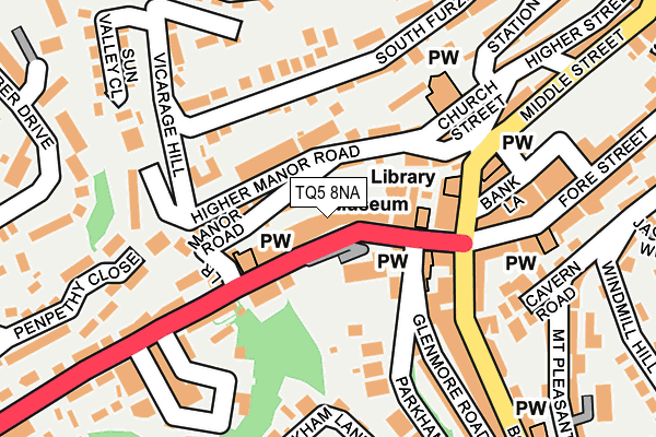
TQ5 8NA is located in the Furzeham with Summercombe electoral ward, within the unitary authority of Torbay and the English Parliamentary constituency of Totnes. The Sub Integrated Care Board (ICB) Location is NHS Devon ICB - 15N and the police force is Devon & Cornwall. This postcode has been in use since January 1980.


GetTheData
Source: OS OpenMap – Local (Ordnance Survey)
Source: OS VectorMap District (Ordnance Survey)
Licence: Open Government Licence (requires attribution)
| Easting | 292223 |
| Northing | 56038 |
| Latitude | 50.394313 |
| Longitude | -3.517636 |
GetTheData
Source: Open Postcode Geo
Licence: Open Government Licence
| Country | England |
| Postcode District | TQ5 |
| ➜ TQ5 open data dashboard ➜ See where TQ5 is on a map | |
GetTheData
Source: Land Registry Price Paid Data
Licence: Open Government Licence
Elevation or altitude of TQ5 8NA as distance above sea level:
| Metres | Feet | |
|---|---|---|
| Elevation | 10m | 33ft |
Elevation is measured from the approximate centre of the postcode, to the nearest point on an OS contour line from OS Terrain 50, which has contour spacing of ten vertical metres.
➜ How high above sea level am I? Find the elevation of your current position using your device's GPS.
GetTheData
Source: Open Postcode Elevation
Licence: Open Government Licence
| Ward | Furzeham With Summercombe |
| Constituency | Totnes |
GetTheData
Source: ONS Postcode Database
Licence: Open Government Licence
| September 2022 | Anti-social behaviour | On or near Higher Street | 295m |
| August 2022 | Vehicle crime | On or near Higher Street | 295m |
| June 2022 | Shoplifting | On or near Lower Manor Road | 60m |
| ➜ Get more crime data in our Crime section | |||
GetTheData
Source: data.police.uk
Licence: Open Government Licence
| Lower Manor Road (New Road) | Brixham | 79m |
| Museum (New Road) | Brixham | 89m |
| Opposite Lower Manor Road (New Road) | Brixham | 106m |
| Museum | Brixham | 109m |
| Town Square (Bank Lane) | Brixham | 149m |
| Paignton Station | 5.6km |
GetTheData
Source: NaPTAN
Licence: Open Government Licence
GetTheData
Source: ONS Postcode Database
Licence: Open Government Licence


➜ Get more ratings from the Food Standards Agency
GetTheData
Source: Food Standards Agency
Licence: FSA terms & conditions
| Last Collection | |||
|---|---|---|---|
| Location | Mon-Fri | Sat | Distance |
| Brixham Delivery Office | 18:00 | 12:15 | 91m |
| New Road | 16:45 | 11:45 | 262m |
| Mount Pleasant Road | 16:45 | 12:00 | 351m |
GetTheData
Source: Dracos
Licence: Creative Commons Attribution-ShareAlike
| Facility | Distance |
|---|---|
| Furzeham Recreation Ground Higher Furzeham Road, Brixham Grass Pitches | 315m |
| Brixham College Sports Centre Lytes Road, Berry Head With Furzeham, Brixham Sports Hall, Health and Fitness Gym, Studio, Squash Courts, Outdoor Tennis Courts, Grass Pitches | 602m |
| Brixham Community College Higher Ranscombe Road, Brixham Grass Pitches | 684m |
GetTheData
Source: Active Places
Licence: Open Government Licence
| School | Phase of Education | Distance |
|---|---|---|
| Furzeham Primary School Higher Furzeham Road, Brixham, TQ5 8BL | Primary | 304m |
| Brixham Church of England Primary School Higher Ranscombe Road, Brixham, TQ5 9HF | Primary | 673m |
| Brixham College Higher Ranscombe Road, Brixham, TQ5 9HF | Secondary | 684m |
GetTheData
Source: Edubase
Licence: Open Government Licence
| Risk of TQ5 8NA flooding from rivers and sea | Medium |
| ➜ TQ5 8NA flood map | |
GetTheData
Source: Open Flood Risk by Postcode
Licence: Open Government Licence
The below table lists the International Territorial Level (ITL) codes (formerly Nomenclature of Territorial Units for Statistics (NUTS) codes) and Local Administrative Units (LAU) codes for TQ5 8NA:
| ITL 1 Code | Name |
|---|---|
| TLK | South West (England) |
| ITL 2 Code | Name |
| TLK4 | Devon |
| ITL 3 Code | Name |
| TLK42 | Torbay |
| LAU 1 Code | Name |
| E06000027 | Torbay |
GetTheData
Source: ONS Postcode Directory
Licence: Open Government Licence
The below table lists the Census Output Area (OA), Lower Layer Super Output Area (LSOA), and Middle Layer Super Output Area (MSOA) for TQ5 8NA:
| Code | Name | |
|---|---|---|
| OA | E00076749 | |
| LSOA | E01015185 | Torbay 017C |
| MSOA | E02003170 | Torbay 017 |
GetTheData
Source: ONS Postcode Directory
Licence: Open Government Licence
| TQ5 8LZ | New Road | 39m |
| TQ5 8NB | New Road | 50m |
| TQ5 8NH | New Road | 57m |
| TQ5 8HF | Lower Manor Road | 59m |
| TQ5 8HA | Higher Manor Road | 63m |
| TQ5 8HB | Manor Terrace | 76m |
| TQ5 8NE | New Road | 80m |
| TQ5 8EY | Church Hill West | 93m |
| TQ5 8EZ | Church Street | 96m |
| TQ5 8HE | Rocklands Terrace | 105m |
GetTheData
Source: Open Postcode Geo; Land Registry Price Paid Data
Licence: Open Government Licence