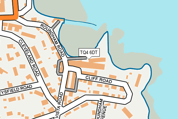
TQ4 6DT is located in the Roundham with Hyde electoral ward, within the unitary authority of Torbay and the English Parliamentary constituency of Torbay. The Sub Integrated Care Board (ICB) Location is NHS Devon ICB - 15N and the police force is Devon & Cornwall. This postcode has been in use since January 1980.


GetTheData
Source: OS OpenMap – Local (Ordnance Survey)
Source: OS VectorMap District (Ordnance Survey)
Licence: Open Government Licence (requires attribution)
| Easting | 289554 |
| Northing | 60239 |
| Latitude | 50.431569 |
| Longitude | -3.556424 |
GetTheData
Source: Open Postcode Geo
Licence: Open Government Licence
| Country | England |
| Postcode District | TQ4 |
| ➜ TQ4 open data dashboard ➜ See where TQ4 is on a map ➜ Where is Paignton? | |
GetTheData
Source: Land Registry Price Paid Data
Licence: Open Government Licence
Elevation or altitude of TQ4 6DT as distance above sea level:
| Metres | Feet | |
|---|---|---|
| Elevation | 10m | 33ft |
Elevation is measured from the approximate centre of the postcode, to the nearest point on an OS contour line from OS Terrain 50, which has contour spacing of ten vertical metres.
➜ How high above sea level am I? Find the elevation of your current position using your device's GPS.
GetTheData
Source: Open Postcode Elevation
Licence: Open Government Licence
| Ward | Roundham With Hyde |
| Constituency | Torbay |
GetTheData
Source: ONS Postcode Database
Licence: Open Government Licence
| June 2022 | Other theft | On or near Parking Area | 35m |
| June 2022 | Anti-social behaviour | On or near Parking Area | 35m |
| June 2022 | Other theft | On or near Parking Area | 35m |
| ➜ Get more crime data in our Crime section | |||
GetTheData
Source: data.police.uk
Licence: Open Government Licence
| Harbour (Roundham Road) | Paignton | 133m |
| Harbour (Roundham Road) | Paignton | 156m |
| Alta Vista Road | Paignton | 271m |
| Alta Vista Road | Roundham Head | 386m |
| Sands Road | Paignton | 414m |
| Paignton (Paignton And Dartmouth Railway) (Great Western Road) | Paignton | 684m |
| Goodrington (Paignton And Dartmouth Railway) (Tanners Road) | Paignton | 795m |
| Paignton Station | 0.7km |
| Torquay Station | 3.4km |
| Torre Station | 4.7km |
GetTheData
Source: NaPTAN
Licence: Open Government Licence
Estimated total energy consumption in TQ4 6DT by fuel type, 2015.
| Consumption (kWh) | 52,094 |
|---|---|
| Meter count | 7 |
| Mean (kWh/meter) | 7,442 |
| Median (kWh/meter) | 1,789 |
GetTheData
Source: Postcode level gas estimates: 2015 (experimental)
Source: Postcode level electricity estimates: 2015 (experimental)
Licence: Open Government Licence
GetTheData
Source: ONS Postcode Database
Licence: Open Government Licence

➜ Get more ratings from the Food Standards Agency
GetTheData
Source: Food Standards Agency
Licence: FSA terms & conditions
| Last Collection | |||
|---|---|---|---|
| Location | Mon-Fri | Sat | Distance |
| The Harbour Post Office | 17:00 | 12:00 | 276m |
| Sands Road | 17:30 | 12:00 | 280m |
| Alta Vista | 17:30 | 12:00 | 327m |
GetTheData
Source: Dracos
Licence: Creative Commons Attribution-ShareAlike
| Facility | Distance |
|---|---|
| Queens Park Sports Club Queens Road, Paignton Grass Pitches | 521m |
| Genisis Health Suite Esplanade Road, Paignton Health and Fitness Gym, Swimming Pool | 835m |
| Splashdown Quaywest Tanners Road, Paignton Swimming Pool | 849m |
GetTheData
Source: Active Places
Licence: Open Government Licence
| School | Phase of Education | Distance |
|---|---|---|
| Curledge Street Academy Curledge Street, Paignton, TQ4 5BA | Primary | 886m |
| St Michael's Church of England Academy Fisher Street, Paignton, TQ4 5EW | Primary | 1km |
| Preston Bridge School 1 Lower Polsham Road, Paignton, Devon, TQ3 2AF | Not applicable | 1.2km |
GetTheData
Source: Edubase
Licence: Open Government Licence
| Risk of TQ4 6DT flooding from rivers and sea | Low |
| ➜ TQ4 6DT flood map | |
GetTheData
Source: Open Flood Risk by Postcode
Licence: Open Government Licence
The below table lists the International Territorial Level (ITL) codes (formerly Nomenclature of Territorial Units for Statistics (NUTS) codes) and Local Administrative Units (LAU) codes for TQ4 6DT:
| ITL 1 Code | Name |
|---|---|
| TLK | South West (England) |
| ITL 2 Code | Name |
| TLK4 | Devon |
| ITL 3 Code | Name |
| TLK42 | Torbay |
| LAU 1 Code | Name |
| E06000027 | Torbay |
GetTheData
Source: ONS Postcode Directory
Licence: Open Government Licence
The below table lists the Census Output Area (OA), Lower Layer Super Output Area (LSOA), and Middle Layer Super Output Area (MSOA) for TQ4 6DT:
| Code | Name | |
|---|---|---|
| OA | E00076968 | |
| LSOA | E01015235 | Torbay 014F |
| MSOA | E02003167 | Torbay 014 |
GetTheData
Source: ONS Postcode Directory
Licence: Open Government Licence
| TQ4 6DX | Roundham Road | 61m |
| TQ4 6DL | Cliff Road | 77m |
| TQ4 6DH | Cliff Road | 93m |
| TQ4 6DW | Roundham Road | 100m |
| TQ4 6DJ | Cliff Mews | 109m |
| TQ4 6DS | Roundham Road | 134m |
| TQ4 6DG | Cliff Road | 144m |
| TQ4 6EW | Cleveland Road | 163m |
| TQ4 6EL | Cleveland Road | 175m |
| TQ4 6DQ | Cliff Road | 178m |
GetTheData
Source: Open Postcode Geo; Land Registry Price Paid Data
Licence: Open Government Licence