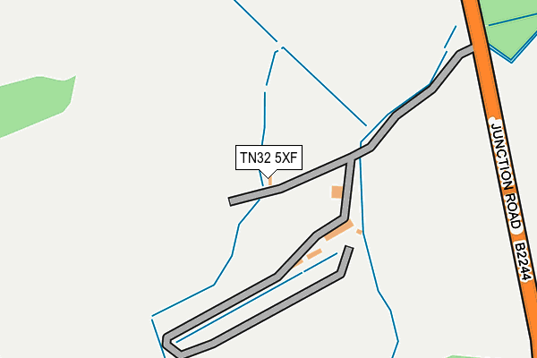
TN32 5XF is located in the Northern Rother electoral ward, within the local authority district of Rother and the English Parliamentary constituency of Bexhill and Battle. The Sub Integrated Care Board (ICB) Location is NHS Sussex ICB - 97R and the police force is Sussex. This postcode has been in use since August 2015.


GetTheData
Source: OS OpenMap – Local (Ordnance Survey)
Source: OS VectorMap District (Ordnance Survey)
Licence: Open Government Licence (requires attribution)
| Easting | 576786 |
| Northing | 124575 |
| Latitude | 50.993419 |
| Longitude | 0.517774 |
GetTheData
Source: Open Postcode Geo
Licence: Open Government Licence
| Country | England |
| Postcode District | TN32 |
| ➜ TN32 open data dashboard ➜ See where TN32 is on a map | |
GetTheData
Source: Land Registry Price Paid Data
Licence: Open Government Licence
Elevation or altitude of TN32 5XF as distance above sea level:
| Metres | Feet | |
|---|---|---|
| Elevation | 10m | 33ft |
Elevation is measured from the approximate centre of the postcode, to the nearest point on an OS contour line from OS Terrain 50, which has contour spacing of ten vertical metres.
➜ How high above sea level am I? Find the elevation of your current position using your device's GPS.
GetTheData
Source: Open Postcode Elevation
Licence: Open Government Licence
| Ward | Northern Rother |
| Constituency | Bexhill And Battle |
GetTheData
Source: ONS Postcode Database
Licence: Open Government Licence
| Levetts Lane (Bodiam Road) | Bodiam | 2,009m |
| Levetts Lane (Bodiam Road) | Bodiam | 2,028m |
| Robertsbridge Station | 3.6km |
GetTheData
Source: NaPTAN
Licence: Open Government Licence
GetTheData
Source: ONS Postcode Database
Licence: Open Government Licence


➜ Get more ratings from the Food Standards Agency
GetTheData
Source: Food Standards Agency
Licence: FSA terms & conditions
| Last Collection | |||
|---|---|---|---|
| Location | Mon-Fri | Sat | Distance |
| Brasses | 16:45 | 09:15 | 1,647m |
| Bodiam | 16:30 | 09:30 | 1,782m |
| Junction Inn | 16:15 | 09:30 | 1,848m |
GetTheData
Source: Dracos
Licence: Creative Commons Attribution-ShareAlike
| Facility | Distance |
|---|---|
| Bodiam Recreation Ground Green Lane, Bodiam Grass Pitches | 1.7km |
| Claremont School (Senior) Bodiam, Robertsbridge Sports Hall | 1.9km |
| Arthur Herdman Pavilion And Recreation Ground Village Street, Village Street, Ewhurst Grass Pitches | 2.4km |
GetTheData
Source: Active Places
Licence: Open Government Licence
| School | Phase of Education | Distance |
|---|---|---|
| Bodiam Church of England Primary School Castle Road, Bodiam, Robertsbridge, TN32 5UH | Primary | 1.8km |
| Staplecross Methodist Primary School Bodiam Road, Staplecross, Bodiam Road, Robertsbridge, TN32 5QD | Primary | 2.4km |
| Salehurst Church of England Primary School George Hill, Robertsbridge, TN32 5BU | Primary | 3.1km |
GetTheData
Source: Edubase
Licence: Open Government Licence
| Risk of TN32 5XF flooding from rivers and sea | Medium |
| ➜ TN32 5XF flood map | |
GetTheData
Source: Open Flood Risk by Postcode
Licence: Open Government Licence
The below table lists the International Territorial Level (ITL) codes (formerly Nomenclature of Territorial Units for Statistics (NUTS) codes) and Local Administrative Units (LAU) codes for TN32 5XF:
| ITL 1 Code | Name |
|---|---|
| TLJ | South East (England) |
| ITL 2 Code | Name |
| TLJ2 | Surrey, East and West Sussex |
| ITL 3 Code | Name |
| TLJ22 | East Sussex CC |
| LAU 1 Code | Name |
| E07000064 | Rother |
GetTheData
Source: ONS Postcode Directory
Licence: Open Government Licence
The below table lists the Census Output Area (OA), Lower Layer Super Output Area (LSOA), and Middle Layer Super Output Area (MSOA) for TN32 5XF:
| Code | Name | |
|---|---|---|
| OA | E00107351 | |
| LSOA | E01021133 | Rother 001B |
| MSOA | E02004392 | Rother 001 |
GetTheData
Source: ONS Postcode Directory
Licence: Open Government Licence
| TN32 5XB | Junction Road | 593m |
| TN32 5UP | Knowle Hill Cottages | 996m |
| TN32 5PR | Church Lane | 1036m |
| TN32 5RA | 1206m | |
| TN32 5PT | Bourne Lane | 1315m |
| TN32 5RJ | 1329m | |
| TN32 5UW | Castle Hurst | 1415m |
| TN32 5NB | Redlands Lane | 1574m |
| TN32 5UR | Blacksmiths Field | 1593m |
| TN32 5UU | 1660m |
GetTheData
Source: Open Postcode Geo; Land Registry Price Paid Data
Licence: Open Government Licence