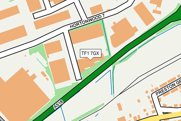
TF1 7GX is located in the Wrockwardine Wood & Trench electoral ward, within the unitary authority of Telford and Wrekin and the English Parliamentary constituency of Telford. The Sub Integrated Care Board (ICB) Location is NHS Shropshire, Telford and Wrekin ICB - M2L0M and the police force is West Mercia. This postcode has been in use since June 2000.


GetTheData
Source: OS OpenMap – Local (Ordnance Survey)
Source: OS VectorMap District (Ordnance Survey)
Licence: Open Government Licence (requires attribution)
| Easting | 368875 |
| Northing | 313193 |
| Latitude | 52.715507 |
| Longitude | -2.462188 |
GetTheData
Source: Open Postcode Geo
Licence: Open Government Licence
| Country | England |
| Postcode District | TF1 |
| ➜ TF1 open data dashboard ➜ See where TF1 is on a map ➜ Where is Telford? | |
GetTheData
Source: Land Registry Price Paid Data
Licence: Open Government Licence
Elevation or altitude of TF1 7GX as distance above sea level:
| Metres | Feet | |
|---|---|---|
| Elevation | 70m | 230ft |
Elevation is measured from the approximate centre of the postcode, to the nearest point on an OS contour line from OS Terrain 50, which has contour spacing of ten vertical metres.
➜ How high above sea level am I? Find the elevation of your current position using your device's GPS.
GetTheData
Source: Open Postcode Elevation
Licence: Open Government Licence
| Ward | Wrockwardine Wood & Trench |
| Constituency | Telford |
GetTheData
Source: ONS Postcode Database
Licence: Open Government Licence
| August 2023 | Criminal damage and arson | On or near Trench Road | 384m |
| July 2023 | Other crime | On or near Trench Road | 384m |
| May 2023 | Public order | On or near Trench Road | 384m |
| ➜ Get more crime data in our Crime section | |||
GetTheData
Source: data.police.uk
Licence: Open Government Licence
| Preston Grove (Trench Road) | Trench | 367m |
| Preston Grove (Trench Road) | Trench | 393m |
| Meadow Close (Trench Road) | Trench | 531m |
| Meadow Close (Trench Road) | Trench | 546m |
| Stanmore Drive (Trench Road) | Trench | 558m |
| Oakengates Station | 2.6km |
| Wellington (Shropshire) Station | 4km |
| Telford Central Station | 4.1km |
GetTheData
Source: NaPTAN
Licence: Open Government Licence
Estimated total energy consumption in TF1 7GX by fuel type, 2015.
| Consumption (kWh) | 238,089 |
|---|---|
| Meter count | 11 |
| Mean (kWh/meter) | 21,644 |
| Median (kWh/meter) | 16,671 |
GetTheData
Source: Postcode level gas estimates: 2015 (experimental)
Source: Postcode level electricity estimates: 2015 (experimental)
Licence: Open Government Licence
GetTheData
Source: ONS Postcode Database
Licence: Open Government Licence


➜ Get more ratings from the Food Standards Agency
GetTheData
Source: Food Standards Agency
Licence: FSA terms & conditions
| Last Collection | |||
|---|---|---|---|
| Location | Mon-Fri | Sat | Distance |
| Trench Road | 16:45 | 12:15 | 1,557m |
| Park Dale | 16:30 | 12:15 | 1,845m |
| Wellington Road Post Office | 17:00 | 11:30 | 2,234m |
GetTheData
Source: Dracos
Licence: Creative Commons Attribution-ShareAlike
| Facility | Distance |
|---|---|
| Wrockwardine Wood Juniors School Church Road, Trench, Telford Grass Pitches | 717m |
| Teagues Bridge Primary School Teagues Crescent, Teagues Crescent, Trench, Telford Grass Pitches | 829m |
| Sutherland Co-operative Academy (Closed) Gibbons Road, Trench, Telford Grass Pitches, Sports Hall | 1km |
GetTheData
Source: Active Places
Licence: Open Government Licence
| School | Phase of Education | Distance |
|---|---|---|
| St Luke's Catholic Primary School Church Road, Trench, Telford, TF2 7HG | Primary | 657m |
| Wrockwardine Wood Church of England Junior School Wrockwardine Wood Junior School Church Road, Trench, Telford, TF2 7HG | Primary | 716m |
| Teagues Bridge Primary School Teagues Cresent, Trench, Telford, TF2 6RE | Primary | 829m |
GetTheData
Source: Edubase
Licence: Open Government Licence
| Risk of TF1 7GX flooding from rivers and sea | Medium |
| ➜ TF1 7GX flood map | |
GetTheData
Source: Open Flood Risk by Postcode
Licence: Open Government Licence
The below table lists the International Territorial Level (ITL) codes (formerly Nomenclature of Territorial Units for Statistics (NUTS) codes) and Local Administrative Units (LAU) codes for TF1 7GX:
| ITL 1 Code | Name |
|---|---|
| TLG | West Midlands (England) |
| ITL 2 Code | Name |
| TLG2 | Shropshire and Staffordshire |
| ITL 3 Code | Name |
| TLG21 | Telford and Wrekin |
| LAU 1 Code | Name |
| E06000020 | Telford and Wrekin |
GetTheData
Source: ONS Postcode Directory
Licence: Open Government Licence
The below table lists the Census Output Area (OA), Lower Layer Super Output Area (LSOA), and Middle Layer Super Output Area (MSOA) for TF1 7GX:
| Code | Name | |
|---|---|---|
| OA | E00071726 | |
| LSOA | E01014207 | Telford and Wrekin 008C |
| MSOA | E02002935 | Telford and Wrekin 008 |
GetTheData
Source: ONS Postcode Directory
Licence: Open Government Licence
| TF1 7GP | Hortonwood 7 | 145m |
| TF1 7ES | Hortonwood 10 | 309m |
| TF2 6PL | Trench Road | 331m |
| TF2 7DD | Preston Grove | 339m |
| TF2 6PJ | Edward Terrace | 353m |
| TF2 6PH | Lily Terrace | 356m |
| TF2 7DE | Preston Grove | 372m |
| TF2 6PG | Eagle Villas | 376m |
| TF2 6PF | Trench Road | 398m |
| TF2 6QR | Millway | 406m |
GetTheData
Source: Open Postcode Geo; Land Registry Price Paid Data
Licence: Open Government Licence