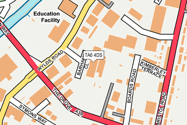
TA6 4DS is located in the Bridgwater North & Central electoral ward, within the unitary authority of Somerset and the English Parliamentary constituency of Bridgwater and West Somerset. The Sub Integrated Care Board (ICB) Location is NHS Somerset ICB - 11X and the police force is Avon and Somerset. This postcode has been in use since June 1996.


GetTheData
Source: OS OpenMap – Local (Ordnance Survey)
Source: OS VectorMap District (Ordnance Survey)
Licence: Open Government Licence (requires attribution)
| Easting | 330352 |
| Northing | 138018 |
| Latitude | 51.137179 |
| Longitude | -2.996865 |
GetTheData
Source: Open Postcode Geo
Licence: Open Government Licence
| Country | England |
| Postcode District | TA6 |
| ➜ TA6 open data dashboard ➜ See where TA6 is on a map ➜ Where is Bridgwater? | |
GetTheData
Source: Land Registry Price Paid Data
Licence: Open Government Licence
Elevation or altitude of TA6 4DS as distance above sea level:
| Metres | Feet | |
|---|---|---|
| Elevation | 10m | 33ft |
Elevation is measured from the approximate centre of the postcode, to the nearest point on an OS contour line from OS Terrain 50, which has contour spacing of ten vertical metres.
➜ How high above sea level am I? Find the elevation of your current position using your device's GPS.
GetTheData
Source: Open Postcode Elevation
Licence: Open Government Licence
| Ward | Bridgwater North & Central |
| Constituency | Bridgwater And West Somerset |
GetTheData
Source: ONS Postcode Database
Licence: Open Government Licence
| January 2024 | Violence and sexual offences | On or near Linham Road | 445m |
| January 2024 | Violence and sexual offences | On or near Linham Road | 445m |
| January 2024 | Burglary | On or near Linham Road | 445m |
| ➜ Get more crime data in our Crime section | |||
GetTheData
Source: data.police.uk
Licence: Open Government Licence
| Filling Station (Bristol Road) | Bridgwater | 241m |
| Premdor (Bristol Road) | Bridgwater | 293m |
| Premdor (Bristol Road) | Bridgwater | 295m |
| East Quay Medical Centre (East Quay) | Eastover | 331m |
| East Quay Medical Centre (East Quay) | Eastover | 342m |
| Bridgwater Station | 1.1km |
GetTheData
Source: NaPTAN
Licence: Open Government Licence
GetTheData
Source: ONS Postcode Database
Licence: Open Government Licence


➜ Get more ratings from the Food Standards Agency
GetTheData
Source: Food Standards Agency
Licence: FSA terms & conditions
| Last Collection | |||
|---|---|---|---|
| Location | Mon-Fri | Sat | Distance |
| Western Way | 17:30 | 12:00 | 672m |
| Church Street | 17:30 | 12:00 | 691m |
| Anson Way | 17:30 | 12:00 | 782m |
GetTheData
Source: Dracos
Licence: Creative Commons Attribution-ShareAlike
| Facility | Distance |
|---|---|
| Drove House Health And Rehabilitation The Drove, Bridgwater Health and Fitness Gym, Studio | 181m |
| Bristol Road Playing Field Bristol Road, Bridgwater Grass Pitches | 407m |
| Curves For Women (Bridgewater) (Closed) Bath Road Business Park, Bath Road, Bridgwater Health and Fitness Gym | 596m |
GetTheData
Source: Active Places
Licence: Open Government Licence
| School | Phase of Education | Distance |
|---|---|---|
| Eastover Primary School Wellington Road, Bridgwater, TA6 5EX | Primary | 756m |
| Chilton Trinity School Chilton Street, Bridgwater, TA6 3JA | Secondary | 831m |
| Northgate Primary School Northgate, Bridgwater, TA6 3EU | Primary | 928m |
GetTheData
Source: Edubase
Licence: Open Government Licence
| Risk of TA6 4DS flooding from rivers and sea | Low |
| ➜ TA6 4DS flood map | |
GetTheData
Source: Open Flood Risk by Postcode
Licence: Open Government Licence
The below table lists the International Territorial Level (ITL) codes (formerly Nomenclature of Territorial Units for Statistics (NUTS) codes) and Local Administrative Units (LAU) codes for TA6 4DS:
| ITL 1 Code | Name |
|---|---|
| TLK | South West (England) |
| ITL 2 Code | Name |
| TLK2 | Dorset and Somerset |
| ITL 3 Code | Name |
| TLK23 | Somerset CC |
| LAU 1 Code | Name |
| E07000188 | Sedgemoor |
GetTheData
Source: ONS Postcode Directory
Licence: Open Government Licence
The below table lists the Census Output Area (OA), Lower Layer Super Output Area (LSOA), and Middle Layer Super Output Area (MSOA) for TA6 4DS:
| Code | Name | |
|---|---|---|
| OA | E00148192 | |
| LSOA | E01029096 | Sedgemoor 008B |
| MSOA | E02006068 | Sedgemoor 008 |
GetTheData
Source: ONS Postcode Directory
Licence: Open Government Licence
| TA6 4DH | Wylds Road | 96m |
| TA6 4BB | Boards Road | 154m |
| TA6 4BE | Kimberley Terrace | 182m |
| TA6 4FF | Bristol Road | 205m |
| TA6 4BG | Bristol Road | 230m |
| TA6 4BP | Bristol Road | 281m |
| TA6 4BS | Bristol Road | 292m |
| TA6 4BA | Quantock Terrace | 329m |
| TA6 4DL | Robins Drive | 353m |
| TA6 4AX | Bristol Road | 390m |
GetTheData
Source: Open Postcode Geo; Land Registry Price Paid Data
Licence: Open Government Licence