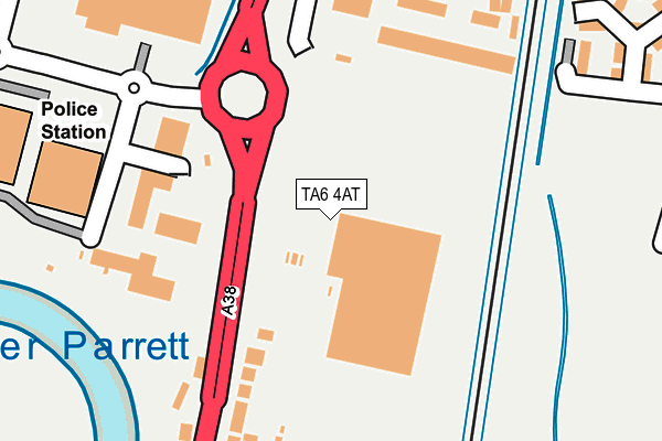
TA6 4AT is located in the Bridgwater North & Central electoral ward, within the unitary authority of Somerset and the English Parliamentary constituency of Bridgwater and West Somerset. The Sub Integrated Care Board (ICB) Location is NHS Somerset ICB - 11X and the police force is Avon and Somerset. This postcode has been in use since December 1996.


GetTheData
Source: OS OpenMap – Local (Ordnance Survey)
Source: OS VectorMap District (Ordnance Survey)
Licence: Open Government Licence (requires attribution)
| Easting | 330874 |
| Northing | 138965 |
| Latitude | 51.145756 |
| Longitude | -2.989588 |
GetTheData
Source: Open Postcode Geo
Licence: Open Government Licence
| Country | England |
| Postcode District | TA6 |
| ➜ TA6 open data dashboard ➜ See where TA6 is on a map ➜ Where is Bridgwater? | |
GetTheData
Source: Land Registry Price Paid Data
Licence: Open Government Licence
Elevation or altitude of TA6 4AT as distance above sea level:
| Metres | Feet | |
|---|---|---|
| Elevation | 10m | 33ft |
Elevation is measured from the approximate centre of the postcode, to the nearest point on an OS contour line from OS Terrain 50, which has contour spacing of ten vertical metres.
➜ How high above sea level am I? Find the elevation of your current position using your device's GPS.
GetTheData
Source: Open Postcode Elevation
Licence: Open Government Licence
| Ward | Bridgwater North & Central |
| Constituency | Bridgwater And West Somerset |
GetTheData
Source: ONS Postcode Database
Licence: Open Government Licence
| June 2022 | Drugs | On or near Conference/Exhibition Centre | 142m |
| June 2022 | Violence and sexual offences | On or near Conference/Exhibition Centre | 142m |
| June 2022 | Theft from the person | On or near Conference/Exhibition Centre | 142m |
| ➜ Get more crime data in our Crime section | |||
GetTheData
Source: data.police.uk
Licence: Open Government Licence
| Stobarts | Bridgwater | 64m |
| Stobarts (Bristol Road) | Bridgwater | 108m |
| Express Park Industrial Estate (Bristol Road) | Bridgwater | 324m |
| Express Park Industrial Estate | Bridgwater | 326m |
| Kings Road Roundabout (Kings Drive) | Bridgwater | 493m |
| Bridgwater Station | 2km |
GetTheData
Source: NaPTAN
Licence: Open Government Licence
GetTheData
Source: ONS Postcode Database
Licence: Open Government Licence


➜ Get more ratings from the Food Standards Agency
GetTheData
Source: Food Standards Agency
Licence: FSA terms & conditions
| Last Collection | |||
|---|---|---|---|
| Location | Mon-Fri | Sat | Distance |
| Coultings | 13:00 | 08:00 | 1,229m |
| Western Way | 17:30 | 12:00 | 1,393m |
| Church Street | 17:30 | 12:00 | 1,741m |
GetTheData
Source: Dracos
Licence: Creative Commons Attribution-ShareAlike
| Facility | Distance |
|---|---|
| Energie Fitness (Bridgwater) (Closed) Express Park, Bristol Road, Bridgwater Health and Fitness Gym, Studio | 141m |
| Kingsdown Pavilion Kings Drive, Bridgwater Grass Pitches, Studio | 649m |
| Bristol Road Playing Field Bristol Road, Bridgwater Grass Pitches | 931m |
GetTheData
Source: Active Places
Licence: Open Government Licence
| School | Phase of Education | Distance |
|---|---|---|
| Willowdown Primary School Kings Drive, Bridgwater, TA6 4FU | Primary | 794m |
| Chilton Trinity School Chilton Street, Bridgwater, TA6 3JA | Secondary | 1.4km |
| Bridgwater College Academy Parkway, Bridgwater, TA6 4QY | All-through | 1.6km |
GetTheData
Source: Edubase
Licence: Open Government Licence
| Risk of TA6 4AT flooding from rivers and sea | Low |
| ➜ TA6 4AT flood map | |
GetTheData
Source: Open Flood Risk by Postcode
Licence: Open Government Licence
The below table lists the International Territorial Level (ITL) codes (formerly Nomenclature of Territorial Units for Statistics (NUTS) codes) and Local Administrative Units (LAU) codes for TA6 4AT:
| ITL 1 Code | Name |
|---|---|
| TLK | South West (England) |
| ITL 2 Code | Name |
| TLK2 | Dorset and Somerset |
| ITL 3 Code | Name |
| TLK23 | Somerset CC |
| LAU 1 Code | Name |
| E07000188 | Sedgemoor |
GetTheData
Source: ONS Postcode Directory
Licence: Open Government Licence
The below table lists the Census Output Area (OA), Lower Layer Super Output Area (LSOA), and Middle Layer Super Output Area (MSOA) for TA6 4AT:
| Code | Name | |
|---|---|---|
| OA | E00148192 | |
| LSOA | E01029096 | Sedgemoor 008B |
| MSOA | E02006068 | Sedgemoor 008 |
GetTheData
Source: ONS Postcode Directory
Licence: Open Government Licence
| TA6 4FY | Bayswater Drive | 297m |
| TA6 4GB | Westminster Way | 312m |
| TA6 4GA | Britannia Way | 331m |
| TA6 4BU | Bristol Road | 333m |
| TA6 4FZ | Regents Walk | 356m |
| TA6 4GD | Clarence Terrace | 368m |
| TA6 4BJ | Bristol Road | 375m |
| TA6 4GE | Devonshire Way | 405m |
| TA6 4FH | Imperial Way | 472m |
| TA6 4RN | Express Park | 481m |
GetTheData
Source: Open Postcode Geo; Land Registry Price Paid Data
Licence: Open Government Licence