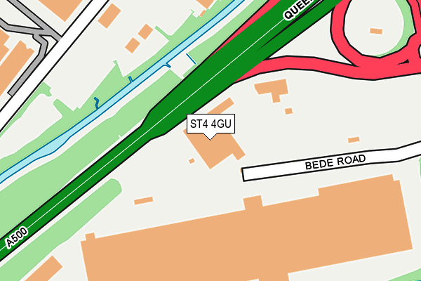
ST4 4GU is located in the Hanford, Newstead & Trentham electoral ward, within the unitary authority of Stoke-on-Trent and the English Parliamentary constituency of Stoke-on-Trent South. The Sub Integrated Care Board (ICB) Location is NHS Staffordshire and Stoke-on-Trent ICB - 05W and the police force is Staffordshire. This postcode has been in use since October 2006.


GetTheData
Source: OS OpenMap – Local (Ordnance Survey)
Source: OS VectorMap District (Ordnance Survey)
Licence: Open Government Licence (requires attribution)
| Easting | 387414 |
| Northing | 343232 |
| Latitude | 52.986275 |
| Longitude | -2.188925 |
GetTheData
Source: Open Postcode Geo
Licence: Open Government Licence
| Country | England |
| Postcode District | ST4 |
| ➜ ST4 open data dashboard ➜ See where ST4 is on a map ➜ Where is Stoke-on-Trent? | |
GetTheData
Source: Land Registry Price Paid Data
Licence: Open Government Licence
Elevation or altitude of ST4 4GU as distance above sea level:
| Metres | Feet | |
|---|---|---|
| Elevation | 100m | 328ft |
Elevation is measured from the approximate centre of the postcode, to the nearest point on an OS contour line from OS Terrain 50, which has contour spacing of ten vertical metres.
➜ How high above sea level am I? Find the elevation of your current position using your device's GPS.
GetTheData
Source: Open Postcode Elevation
Licence: Open Government Licence
| Ward | Hanford, Newstead & Trentham |
| Constituency | Stoke-on-trent South |
GetTheData
Source: ONS Postcode Database
Licence: Open Government Licence
| June 2022 | Anti-social behaviour | On or near Queensway | 274m |
| June 2022 | Burglary | On or near Queensway | 274m |
| June 2022 | Anti-social behaviour | On or near Queensway | 274m |
| ➜ Get more crime data in our Crime section | |||
GetTheData
Source: data.police.uk
Licence: Open Government Licence
| Sainsbury Distribution (A500 Sliproad) | Sideway | 326m |
| Dunelm Distribution Centre (Radial Park) | Sideway | 353m |
| Queensway (Campbell Road) | Sideway | 453m |
| Queensway (Campbell Road) | Sideway | 472m |
| Campbell Road | Sideway | 610m |
| Stoke-on-Trent Station | 2.5km |
| Longton Station | 3.5km |
| Wedgwood Station | 4.1km |
GetTheData
Source: NaPTAN
Licence: Open Government Licence
GetTheData
Source: ONS Postcode Database
Licence: Open Government Licence


➜ Get more ratings from the Food Standards Agency
GetTheData
Source: Food Standards Agency
Licence: FSA terms & conditions
| Last Collection | |||
|---|---|---|---|
| Location | Mon-Fri | Sat | Distance |
| Trent Vale Post Office | 17:00 | 12:00 | 886m |
| Stone Road | 17:30 | 09:15 | 914m |
| Fletcher Road | 18:00 | 09:45 | 917m |
GetTheData
Source: Dracos
Licence: Creative Commons Attribution-ShareAlike
| Facility | Distance |
|---|---|
| Oakhill Primary School Rookery Lane, Stoke-on-trent Grass Pitches | 662m |
| St Josephs College London Road, Stoke-on-trent Sports Hall, Health and Fitness Gym, Grass Pitches, Outdoor Tennis Courts | 711m |
| Stoke City Fc (Bet365 Stadium) Stanley Matthews Way, Stoke-on-trent Grass Pitches | 890m |
GetTheData
Source: Active Places
Licence: Open Government Licence
| School | Phase of Education | Distance |
|---|---|---|
| Oakhill Primary School Rookery Lane, Oakhill, Stoke-on-Trent, ST4 5NS | Primary | 662m |
| St Joseph's College London Road, Trent Vale, Stoke-on-Trent, ST4 5NT | Secondary | 683m |
| St Joseph's Preparatory School Rookery Lane, Trent Vale, Stoke-on-Trent, Staffordshire, ST4 5RF | Not applicable | 683m |
GetTheData
Source: Edubase
Licence: Open Government Licence
| Risk of ST4 4GU flooding from rivers and sea | Low |
| ➜ ST4 4GU flood map | |
GetTheData
Source: Open Flood Risk by Postcode
Licence: Open Government Licence
The below table lists the International Territorial Level (ITL) codes (formerly Nomenclature of Territorial Units for Statistics (NUTS) codes) and Local Administrative Units (LAU) codes for ST4 4GU:
| ITL 1 Code | Name |
|---|---|
| TLG | West Midlands (England) |
| ITL 2 Code | Name |
| TLG2 | Shropshire and Staffordshire |
| ITL 3 Code | Name |
| TLG23 | Stoke-on-Trent |
| LAU 1 Code | Name |
| E06000021 | Stoke-on-Trent |
GetTheData
Source: ONS Postcode Directory
Licence: Open Government Licence
The below table lists the Census Output Area (OA), Lower Layer Super Output Area (LSOA), and Middle Layer Super Output Area (MSOA) for ST4 4GU:
| Code | Name | |
|---|---|---|
| OA | E00072452 | |
| LSOA | E01014346 | Stoke-on-Trent 030A |
| MSOA | E02002980 | Stoke-on-Trent 030 |
GetTheData
Source: ONS Postcode Directory
Licence: Open Government Licence
| ST4 4FB | Campbell Road | 241m |
| ST4 4RJ | Campbell Road | 371m |
| ST4 8QQ | Clermont Avenue | 456m |
| ST4 4EX | Sideway | 458m |
| ST4 8QG | Ferrand Close | 489m |
| ST4 8QP | Clermont Avenue | 492m |
| ST4 8QS | Marcel Close | 551m |
| ST4 8QR | Rolfe Close | 561m |
| ST4 5BD | Kensington Road | 573m |
| ST4 8QJ | Balmoral Close | 611m |
GetTheData
Source: Open Postcode Geo; Land Registry Price Paid Data
Licence: Open Government Licence