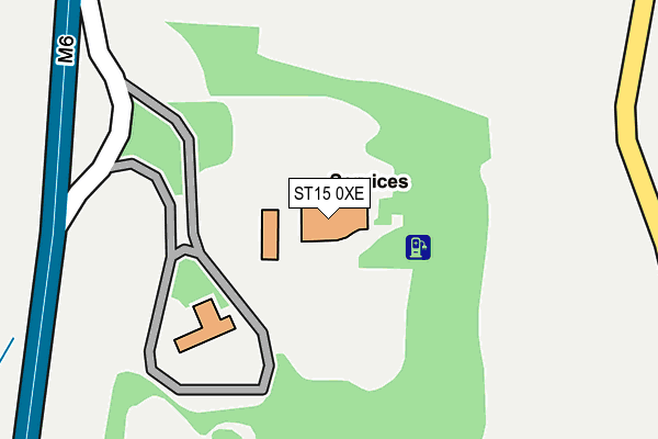
ST15 0XE lies on Stafford Motorway Service Area in Stone. ST15 0XE is located in the Milwich electoral ward, within the local authority district of Stafford and the English Parliamentary constituency of Stone. The Sub Integrated Care Board (ICB) Location is NHS Staffordshire and Stoke-on-Trent ICB - 05V and the police force is Staffordshire. This postcode has been in use since December 1998.


GetTheData
Source: OS OpenMap – Local (Ordnance Survey)
Source: OS VectorMap District (Ordnance Survey)
Licence: Open Government Licence (requires attribution)
| Easting | 389247 |
| Northing | 330648 |
| Latitude | 52.873195 |
| Longitude | -2.161200 |
GetTheData
Source: Open Postcode Geo
Licence: Open Government Licence
| Street | Stafford Motorway Service Area |
| Town/City | Stone |
| Country | England |
| Postcode District | ST15 |
| ➜ ST15 open data dashboard ➜ See where ST15 is on a map | |
GetTheData
Source: Land Registry Price Paid Data
Licence: Open Government Licence
Elevation or altitude of ST15 0XE as distance above sea level:
| Metres | Feet | |
|---|---|---|
| Elevation | 120m | 394ft |
Elevation is measured from the approximate centre of the postcode, to the nearest point on an OS contour line from OS Terrain 50, which has contour spacing of ten vertical metres.
➜ How high above sea level am I? Find the elevation of your current position using your device's GPS.
GetTheData
Source: Open Postcode Elevation
Licence: Open Government Licence
| Ward | Milwich |
| Constituency | Stone |
GetTheData
Source: ONS Postcode Database
Licence: Open Government Licence
| June 2022 | Vehicle crime | On or near Petrol Station | 140m |
| June 2022 | Vehicle crime | On or near Petrol Station | 140m |
| June 2022 | Other theft | On or near Petrol Station | 140m |
| ➜ Get more crime data in our Crime section | |||
GetTheData
Source: data.police.uk
Licence: Open Government Licence
| Cuisine De France (Opal Way) | Walton | 1,649m |
| Cuisine De France (Opal Way) | Walton | 1,703m |
| Emerald Way (Brooms Road) | Walton | 1,928m |
| Emerald Way (Brooms Road) | Walton | 1,955m |
| Norton Bridge Station | 2.1km |
| Stone Station | 3.9km |
GetTheData
Source: NaPTAN
Licence: Open Government Licence
GetTheData
Source: ONS Postcode Database
Licence: Open Government Licence


➜ Get more ratings from the Food Standards Agency
GetTheData
Source: Food Standards Agency
Licence: FSA terms & conditions
| Last Collection | |||
|---|---|---|---|
| Location | Mon-Fri | Sat | Distance |
| Norton Bridge | 14:45 | 09:00 | 2,192m |
| Aston Village Hall | 17:45 | 07:00 | 2,301m |
| Aston Lane | 17:45 | 07:00 | 2,331m |
GetTheData
Source: Dracos
Licence: Creative Commons Attribution-ShareAlike
| Facility | Distance |
|---|---|
| Walton Common Walton Cross, Stone Grass Pitches | 1.7km |
| Stone House Hotel Stafford Road, Stone Health and Fitness Gym, Swimming Pool, Outdoor Tennis Courts | 2.1km |
| Norton Bridge Golf Club (Closed) Eccleshall Road, Stone Golf | 2.1km |
GetTheData
Source: Active Places
Licence: Open Government Licence
| School | Phase of Education | Distance |
|---|---|---|
| Walton Priory Middle School Beacon Rise, Walton, Stone, ST15 0AL | Middle deemed secondary | 2.2km |
| Pirehill First School Tilling Drive, Walton, Stone, ST15 0AA | Primary | 2.4km |
| The Yarlet School Yarlet, Stafford, ST18 9SU | Not applicable | 2.5km |
GetTheData
Source: Edubase
Licence: Open Government Licence
The below table lists the International Territorial Level (ITL) codes (formerly Nomenclature of Territorial Units for Statistics (NUTS) codes) and Local Administrative Units (LAU) codes for ST15 0XE:
| ITL 1 Code | Name |
|---|---|
| TLG | West Midlands (England) |
| ITL 2 Code | Name |
| TLG2 | Shropshire and Staffordshire |
| ITL 3 Code | Name |
| TLG24 | Staffordshire CC |
| LAU 1 Code | Name |
| E07000197 | Stafford |
GetTheData
Source: ONS Postcode Directory
Licence: Open Government Licence
The below table lists the Census Output Area (OA), Lower Layer Super Output Area (LSOA), and Middle Layer Super Output Area (MSOA) for ST15 0XE:
| Code | Name | |
|---|---|---|
| OA | E00151504 | |
| LSOA | E01029733 | Stafford 004A |
| MSOA | E02006191 | Stafford 004 |
GetTheData
Source: ONS Postcode Directory
Licence: Open Government Licence
| ST18 9RY | Pirehill Grange | 538m |
| ST15 0BU | Pirehill Lane | 1164m |
| ST15 0BS | Pirehill | 1301m |
| ST15 0LD | Windsor Close | 1589m |
| ST15 0AY | Coombe Park Road | 1599m |
| ST15 0BA | Boundary Close | 1608m |
| ST15 0LE | Dutton Way | 1622m |
| ST15 0AZ | Cherry Tree Close | 1638m |
| ST18 9SR | Green Lane | 1674m |
| ST15 0LB | Essex Drive | 1682m |
GetTheData
Source: Open Postcode Geo; Land Registry Price Paid Data
Licence: Open Government Licence