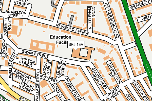
SR5 1EA is located in the Southwick electoral ward, within the metropolitan district of Sunderland and the English Parliamentary constituency of Sunderland Central. The Sub Integrated Care Board (ICB) Location is NHS North East and North Cumbria ICB - 00P and the police force is Northumbria. This postcode has been in use since January 1980.


GetTheData
Source: OS OpenMap – Local (Ordnance Survey)
Source: OS VectorMap District (Ordnance Survey)
Licence: Open Government Licence (requires attribution)
| Easting | 439251 |
| Northing | 558511 |
| Latitude | 54.919760 |
| Longitude | -1.389166 |
GetTheData
Source: Open Postcode Geo
Licence: Open Government Licence
| Country | England |
| Postcode District | SR5 |
| ➜ SR5 open data dashboard ➜ See where SR5 is on a map ➜ Where is Sunderland? | |
GetTheData
Source: Land Registry Price Paid Data
Licence: Open Government Licence
Elevation or altitude of SR5 1EA as distance above sea level:
| Metres | Feet | |
|---|---|---|
| Elevation | 40m | 131ft |
Elevation is measured from the approximate centre of the postcode, to the nearest point on an OS contour line from OS Terrain 50, which has contour spacing of ten vertical metres.
➜ How high above sea level am I? Find the elevation of your current position using your device's GPS.
GetTheData
Source: Open Postcode Elevation
Licence: Open Government Licence
| Ward | Southwick |
| Constituency | Sunderland Central |
GetTheData
Source: ONS Postcode Database
Licence: Open Government Licence
| January 2024 | Anti-social behaviour | On or near Hood Close | 254m |
| December 2023 | Criminal damage and arson | On or near Boundary Street | 248m |
| December 2023 | Burglary | On or near Sophy Street | 307m |
| ➜ Get more crime data in our Crime section | |||
GetTheData
Source: data.police.uk
Licence: Open Government Licence
| Newcastle Road-crozier Street (Newcastle Road) | Monkwearmouth | 241m |
| Newcastle Road-wearmouth Drive (Newcastle Road) | Monkwearmouth | 251m |
| Southwick Road-wallace Street (Southwick Road) | Monkwearmouth | 261m |
| Southwick Road-stadium (Southwick Road) | Monkwearmouth | 297m |
| Newcastle Road-newbridge Avenue (Newcastle Road) | Monkwearmouth | 303m |
| Stadium Of Light (Tyne And Wear Metro Station) (Millennium Way) | Sunderland Stadium Of Light | 436m |
| St Peter's (Tyne And Wear Metro Station) (Sheepfolds North) | St Peter's | 988m |
| Seaburn (Tyne And Wear Metro Station) (Station Road) | Fulwell | 1,077m |
| Sunderland (Tyne And Wear Metro Station) (Station Street) | Sunderland | 1,531m |
| Millfield (Tyne And Wear Metro Station) (Hylton Road) | Millfield | 1,660m |
| St Peters Station | 1km |
| Seaburn Station | 1.1km |
| Sunderland Station | 1.7km |
GetTheData
Source: NaPTAN
Licence: Open Government Licence
GetTheData
Source: ONS Postcode Database
Licence: Open Government Licence


➜ Get more ratings from the Food Standards Agency
GetTheData
Source: Food Standards Agency
Licence: FSA terms & conditions
| Last Collection | |||
|---|---|---|---|
| Location | Mon-Fri | Sat | Distance |
| Crozier Street | 16:45 | 11:30 | 282m |
| Carley Road | 17:00 | 11:30 | 448m |
| Sidecliffe Road | 17:15 | 11:45 | 472m |
GetTheData
Source: Dracos
Licence: Creative Commons Attribution-ShareAlike
| Facility | Distance |
|---|---|
| Newcastle Road Baths (Closed) Newcastle Road, Sunderland Swimming Pool, Health and Fitness Gym | 270m |
| Thompson Park Newcastle Road, Sunderland Grass Pitches, Outdoor Tennis Courts | 373m |
| Beacon Of Light Vaux Brewery Way, Sunderland Artificial Grass Pitch, Sports Hall | 392m |
GetTheData
Source: Active Places
Licence: Open Government Licence
| School | Phase of Education | Distance |
|---|---|---|
| Grange Park Primary School Swan Street, Sunderland, SR5 1EA | Primary | 4m |
| Beacon of Light School Vaux Brewery Way, Stadium Park, Sunderland, SR5 1SN | Not applicable | 392m |
| Redby Academy Fulwell Road, Sunderland, SR6 9QP | Primary | 592m |
GetTheData
Source: Edubase
Licence: Open Government Licence
The below table lists the International Territorial Level (ITL) codes (formerly Nomenclature of Territorial Units for Statistics (NUTS) codes) and Local Administrative Units (LAU) codes for SR5 1EA:
| ITL 1 Code | Name |
|---|---|
| TLC | North East (England) |
| ITL 2 Code | Name |
| TLC2 | Northumberland, and Tyne and Wear |
| ITL 3 Code | Name |
| TLC23 | Sunderland |
| LAU 1 Code | Name |
| E08000024 | Sunderland |
GetTheData
Source: ONS Postcode Directory
Licence: Open Government Licence
The below table lists the Census Output Area (OA), Lower Layer Super Output Area (LSOA), and Middle Layer Super Output Area (MSOA) for SR5 1EA:
| Code | Name | |
|---|---|---|
| OA | E00044226 | |
| LSOA | E01008708 | Sunderland 005A |
| MSOA | E02001795 | Sunderland 005 |
GetTheData
Source: ONS Postcode Directory
Licence: Open Government Licence
| SR5 1LH | Newbold Avenue | 68m |
| SR5 1EP | Empress Street | 107m |
| SR5 1LG | Newbold Avenue | 116m |
| SR5 1HA | Ross Street | 123m |
| SR5 1DY | Eglinton Street North | 143m |
| SR5 1DX | Eglinton Street | 143m |
| SR5 1LQ | Nettleham Road | 147m |
| SR5 1ET | Pilgrim Close | 152m |
| SR5 1LJ | Northwood Court | 153m |
| SR5 1HD | Wallace Street | 161m |
GetTheData
Source: Open Postcode Geo; Land Registry Price Paid Data
Licence: Open Government Licence