Newcastle Road Baths (Closed) - Sunderland
Newcastle Road Baths (Closed) is located in Sunderland (SR5).
| Address | Newcastle Road, Sunderland, SR5 1JJ |
| Car Park | Yes |
| Car Park Capacity | 30 |
| Management Type | Not Known |
| Management Group | Not Known |
| Owner Type | Local Authority |
| Owner Group | Local Authority |
| Education Phase | Not Known |
| Closure Date | 17th Apr 2008 |
| Closure Reason | Unclassified |
Facilities
| Closure Date | 17th Apr 2008 |
| Closure Reason | Unclassified |
| Accessibility | Pay and Play |
| Management Type | Not Known |
| Year Built | 1936 |
| Year Refurbished | 1974 |
| Changing Rooms | Yes |
| Year Changing Rooms Refurbished | 2006 |
| Date Record Checked | 23rd Apr 2008 |
| Opening Times | Detailed Timings |
Facility specifics
| Access to Pool Hoist | Don't Know |
| Area | 313m² |
| Diving Boards | No |
| Length | 25m |
| Maximum Depth | 2.5m |
| Minimum Depth | 1.5m |
| Movable Floor | No |
| Width | 12.5m |
| Closure Date | 17th Apr 2008 |
| Closure Reason | Unclassified |
| Accessibility | Pay and Play |
| Management Type | Not Known |
| Year Built | 1936 |
| Year Refurbished | 1974 |
| Changing Rooms | Yes |
| Year Changing Rooms Refurbished | 2006 |
| Date Record Checked | 23rd Apr 2008 |
| Opening Times | Detailed Timings |
Facility specifics
| Access to Pool Hoist | Don't Know |
| Area | 15m² |
| Diving Boards | No |
| Length | 10m |
| Maximum Depth | 1.5m |
| Minimum Depth | 1m |
| Movable Floor | No |
| Width | 1.5m |
| Closure Date | 17th Apr 2008 |
| Closure Reason | Unclassified |
| Accessibility | Pay and Play |
| Management Type | Not Known |
| Year Built | 1996 |
| Year Refurbished | 2004 |
| Changing Rooms | Yes |
| Year Changing Rooms Refurbished | 2006 |
| Date Record Checked | 23rd Apr 2008 |
| Opening Times | Detailed Timings |
Facility specifics
Disabled access
Disabled access for Newcastle Road Baths (Closed)
| Notes | There are stairs into the centre |
Where is Newcastle Road Baths (Closed)?
| Sub Building Name | |
| Building Name | |
| Building Number | 0 |
| Dependent Thoroughfare | |
| Thoroughfare Name | Newcastle Road |
| Double Dependent Locality | |
| Dependent Locality | |
| PostTown | Sunderland |
| Postcode | SR5 1JJ |
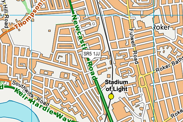
Newcastle Road Baths (Closed) on a map

Newcastle Road Baths (Closed) geodata
| Easting | 439486 |
| Northing | 558643.4 |
| Latitude | 54.920931 |
| Longitude | -1.385482 |
| Local Authority Name | Sunderland |
| Local Authority Code | E08000024 |
| Parliamentary Constituency Name | Sunderland Central |
| Parliamentary Constituency Code | E14000982 |
| Region Name | North East |
| Region Code | E15000001 |
| Ward Name | Southwick |
| Ward Code | E05001172 |
| Output Area Code | E00044222 |
About this data
This data is open data sourced from Active Places Power and licenced under the Active Places Open Data Licence.
| Created On | 14th Dec 2014 |
| Audited On | 26th Jan 2015 |
| Checked On | 23rd Apr 2008 |
