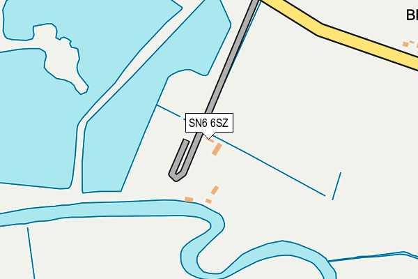
SN6 6SZ is located in the Cricklade & Latton electoral ward, within the unitary authority of Wiltshire and the English Parliamentary constituency of North Wiltshire. The Sub Integrated Care Board (ICB) Location is NHS Bath and North East Somerset, Swindon and Wiltshire ICB - 92 and the police force is Wiltshire. This postcode has been in use since January 1993.


GetTheData
Source: OS OpenMap – Local (Ordnance Survey)
Source: OS VectorMap District (Ordnance Survey)
Licence: Open Government Licence (requires attribution)
| Easting | 413839 |
| Northing | 196150 |
| Latitude | 51.663965 |
| Longitude | -1.801301 |
GetTheData
Source: Open Postcode Geo
Licence: Open Government Licence
| Country | England |
| Postcode District | SN6 |
| ➜ SN6 open data dashboard ➜ See where SN6 is on a map | |
GetTheData
Source: Land Registry Price Paid Data
Licence: Open Government Licence
Elevation or altitude of SN6 6SZ as distance above sea level:
| Metres | Feet | |
|---|---|---|
| Elevation | 80m | 262ft |
Elevation is measured from the approximate centre of the postcode, to the nearest point on an OS contour line from OS Terrain 50, which has contour spacing of ten vertical metres.
➜ How high above sea level am I? Find the elevation of your current position using your device's GPS.
GetTheData
Source: Open Postcode Elevation
Licence: Open Government Licence
| Ward | Cricklade & Latton |
| Constituency | North Wiltshire |
GetTheData
Source: ONS Postcode Database
Licence: Open Government Licence
| Second Chance Touring Park (Castle Eaton Road) | Marston Meysey | 224m |
| Second Chance Touring Park (Castle Eaton Road) | Marston Meysey | 233m |
| Castle Eaton Bridge (The Street) | Castle Eaton | 730m |
| Castle Eaton Bridge (The Street) | Castle Eaton | 730m |
| Red Lion (The Street) | Castle Eaton | 762m |
GetTheData
Source: NaPTAN
Licence: Open Government Licence
GetTheData
Source: ONS Postcode Database
Licence: Open Government Licence


➜ Get more ratings from the Food Standards Agency
GetTheData
Source: Food Standards Agency
Licence: FSA terms & conditions
| Last Collection | |||
|---|---|---|---|
| Location | Mon-Fri | Sat | Distance |
| Down Ampney X-rds | 16:45 | 09:00 | 4,095m |
| Down Ampney P.o. | 16:45 | 10:45 | 4,226m |
| Cricklade Post Office | 17:30 | 12:30 | 4,536m |
GetTheData
Source: Dracos
Licence: Creative Commons Attribution-ShareAlike
| Facility | Distance |
|---|---|
| Down Ampney Football Broadleaze, Down Ampney Grass Pitches | 4km |
| Meysey Hampton Playing Field Road From High Street To Vale Of White Horse Kennels, Meysey Hampton Grass Pitches | 4km |
| The Water Pitches Thames Lane, Cricklade Grass Pitches | 4.1km |
GetTheData
Source: Active Places
Licence: Open Government Licence
| School | Phase of Education | Distance |
|---|---|---|
| Kempsford Church of England Primary School High Street, Kempsford, Fairford, GL7 4EY | Primary | 1.9km |
| Down Ampney Church of England Primary School Down Ampney, Cirencester, GL7 5QR | Primary | 4km |
| Meadow Bridge School The Old School House, High Street, Cricklade, Wiltshire, SN6 6DD | Not applicable | 4.3km |
GetTheData
Source: Edubase
Licence: Open Government Licence
| Risk of SN6 6SZ flooding from rivers and sea | Medium |
| ➜ SN6 6SZ flood map | |
GetTheData
Source: Open Flood Risk by Postcode
Licence: Open Government Licence
The below table lists the International Territorial Level (ITL) codes (formerly Nomenclature of Territorial Units for Statistics (NUTS) codes) and Local Administrative Units (LAU) codes for SN6 6SZ:
| ITL 1 Code | Name |
|---|---|
| TLK | South West (England) |
| ITL 2 Code | Name |
| TLK1 | Gloucestershire, Wiltshire and Bath/Bristol area |
| ITL 3 Code | Name |
| TLK15 | Wiltshire |
| LAU 1 Code | Name |
| E06000054 | Wiltshire |
GetTheData
Source: ONS Postcode Directory
Licence: Open Government Licence
The below table lists the Census Output Area (OA), Lower Layer Super Output Area (LSOA), and Middle Layer Super Output Area (MSOA) for SN6 6SZ:
| Code | Name | |
|---|---|---|
| OA | E00162883 | |
| LSOA | E01031935 | Wiltshire 001C |
| MSOA | E02006644 | Wiltshire 001 |
GetTheData
Source: ONS Postcode Directory
Licence: Open Government Licence
| SN6 6LG | 362m | |
| SN6 6JY | Mill Lane | 724m |
| SN6 6JJ | Ettone Barns | 750m |
| SN6 6LL | 799m | |
| SN6 6JZ | The Street | 799m |
| SN6 6LB | Long Row | 912m |
| SN6 6LF | School Lane | 914m |
| SN6 6JX | 930m | |
| SN6 6LD | Church View | 1001m |
| SN6 6LE | 1250m |
GetTheData
Source: Open Postcode Geo; Land Registry Price Paid Data
Licence: Open Government Licence