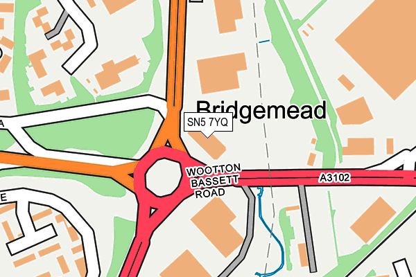
SN5 7YQ is located in the Mannington and Western electoral ward, within the unitary authority of Swindon and the English Parliamentary constituency of South Swindon. The Sub Integrated Care Board (ICB) Location is NHS Bath and North East Somerset, Swindon and Wiltshire ICB - 92 and the police force is Wiltshire. This postcode has been in use since April 1985.


GetTheData
Source: OS OpenMap – Local (Ordnance Survey)
Source: OS VectorMap District (Ordnance Survey)
Licence: Open Government Licence (requires attribution)
| Easting | 413047 |
| Northing | 184093 |
| Latitude | 51.555573 |
| Longitude | -1.813208 |
GetTheData
Source: Open Postcode Geo
Licence: Open Government Licence
| Country | England |
| Postcode District | SN5 |
| ➜ SN5 open data dashboard ➜ See where SN5 is on a map ➜ Where is Swindon? | |
GetTheData
Source: Land Registry Price Paid Data
Licence: Open Government Licence
Elevation or altitude of SN5 7YQ as distance above sea level:
| Metres | Feet | |
|---|---|---|
| Elevation | 100m | 328ft |
Elevation is measured from the approximate centre of the postcode, to the nearest point on an OS contour line from OS Terrain 50, which has contour spacing of ten vertical metres.
➜ How high above sea level am I? Find the elevation of your current position using your device's GPS.
GetTheData
Source: Open Postcode Elevation
Licence: Open Government Licence
| Ward | Mannington And Western |
| Constituency | South Swindon |
GetTheData
Source: ONS Postcode Database
Licence: Open Government Licence
| January 2024 | Burglary | On or near Fox Wood | 358m |
| January 2024 | Drugs | On or near Fox Wood | 358m |
| January 2024 | Drugs | On or near Fox Wood | 358m |
| ➜ Get more crime data in our Crime section | |||
GetTheData
Source: data.police.uk
Licence: Open Government Licence
| Mannington Roundabout (Wootton Bassett Road) | Mannington | 113m |
| Mannington Roundabout (Wootton Bassett Road) | Mannington | 163m |
| Mannington House (Mannington Lane) | Westlea | 266m |
| Mannington House (Mannington Lane) | Westlea | 275m |
| Applewood Court (Mannington Lane) | Westlea | 440m |
| Swindon Station | 2.2km |
GetTheData
Source: NaPTAN
Licence: Open Government Licence
GetTheData
Source: ONS Postcode Database
Licence: Open Government Licence


➜ Get more ratings from the Food Standards Agency
GetTheData
Source: Food Standards Agency
Licence: FSA terms & conditions
| Last Collection | |||
|---|---|---|---|
| Location | Mon-Fri | Sat | Distance |
| Delta Office Park | 340m | ||
| Delta Office Park | 18:30 | 12:45 | 342m |
| Sainsbury's | 18:30 | 13:00 | 356m |
GetTheData
Source: Dracos
Licence: Creative Commons Attribution-ShareAlike
| Facility | Distance |
|---|---|
| Puregym (Swindon Mannington Retail Park) Telford Way, Mannington, Swindon Health and Fitness Gym | 227m |
| Delta Tennis Centre Welton Road, Westlea, Swindon Indoor Tennis Centre, Outdoor Tennis Courts | 552m |
| Hazelwood Academy Stokesay Drive, Toothill, Swindon Grass Pitches | 744m |
GetTheData
Source: Active Places
Licence: Open Government Licence
| School | Phase of Education | Distance |
|---|---|---|
| Hazelwood Academy Stokesay Drive, Toothill, Swindon, SN5 8DR | Primary | 806m |
| Westlea Primary School Langstone Way, Westlea, Swindon, SN5 7BT | Primary | 1.1km |
| The Deanery CE Academy Peglars Way, Wichelstowe, Swindon, SN1 7DA | Secondary | 1.1km |
GetTheData
Source: Edubase
Licence: Open Government Licence
| Risk of SN5 7YQ flooding from rivers and sea | Low |
| ➜ SN5 7YQ flood map | |
GetTheData
Source: Open Flood Risk by Postcode
Licence: Open Government Licence
The below table lists the International Territorial Level (ITL) codes (formerly Nomenclature of Territorial Units for Statistics (NUTS) codes) and Local Administrative Units (LAU) codes for SN5 7YQ:
| ITL 1 Code | Name |
|---|---|
| TLK | South West (England) |
| ITL 2 Code | Name |
| TLK1 | Gloucestershire, Wiltshire and Bath/Bristol area |
| ITL 3 Code | Name |
| TLK14 | Swindon |
| LAU 1 Code | Name |
| E06000030 | Swindon |
GetTheData
Source: ONS Postcode Directory
Licence: Open Government Licence
The below table lists the Census Output Area (OA), Lower Layer Super Output Area (LSOA), and Middle Layer Super Output Area (MSOA) for SN5 7YQ:
| Code | Name | |
|---|---|---|
| OA | E00078741 | |
| LSOA | E01015568 | Swindon 014D |
| MSOA | E02003225 | Swindon 014 |
GetTheData
Source: ONS Postcode Directory
Licence: Open Government Licence
| SN5 8WA | Telford Way | 143m |
| SN5 8WF | Wootton Bassett Road | 154m |
| SN5 8AB | Markenfield | 278m |
| SN5 8AA | Markenfield | 280m |
| SN5 7LQ | Mannington Lane | 301m |
| SN5 7AW | Fox Wood | 355m |
| SN5 7AH | Applewood Court | 364m |
| SN5 7AL | Littlecote Close | 383m |
| SN5 8AD | Longthorpe Close | 401m |
| SN5 8AR | Shelfinch | 402m |
GetTheData
Source: Open Postcode Geo; Land Registry Price Paid Data
Licence: Open Government Licence