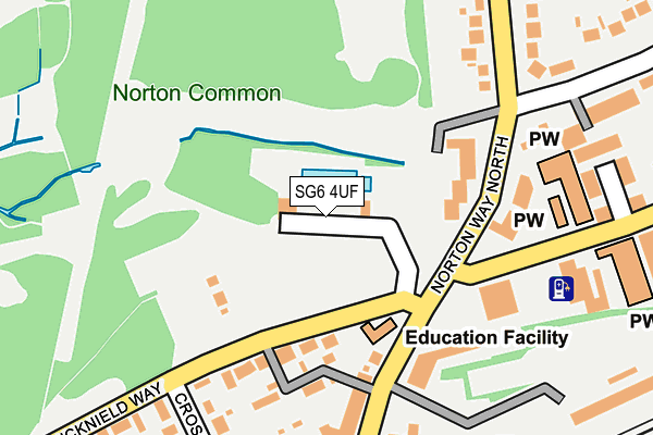
SG6 4UF is located in the Letchworth East electoral ward, within the local authority district of North Hertfordshire and the English Parliamentary constituency of North East Hertfordshire. The Sub Integrated Care Board (ICB) Location is NHS Hertfordshire and West Essex ICB - 06K and the police force is Hertfordshire. This postcode has been in use since January 1980.


GetTheData
Source: OS OpenMap – Local (Ordnance Survey)
Source: OS VectorMap District (Ordnance Survey)
Licence: Open Government Licence (requires attribution)
| Easting | 522035 |
| Northing | 233271 |
| Latitude | 51.984502 |
| Longitude | -0.224381 |
GetTheData
Source: Open Postcode Geo
Licence: Open Government Licence
| Country | England |
| Postcode District | SG6 |
| ➜ SG6 open data dashboard ➜ See where SG6 is on a map ➜ Where is Letchworth? | |
GetTheData
Source: Land Registry Price Paid Data
Licence: Open Government Licence
Elevation or altitude of SG6 4UF as distance above sea level:
| Metres | Feet | |
|---|---|---|
| Elevation | 70m | 230ft |
Elevation is measured from the approximate centre of the postcode, to the nearest point on an OS contour line from OS Terrain 50, which has contour spacing of ten vertical metres.
➜ How high above sea level am I? Find the elevation of your current position using your device's GPS.
GetTheData
Source: Open Postcode Elevation
Licence: Open Government Licence
| Ward | Letchworth East |
| Constituency | North East Hertfordshire |
GetTheData
Source: ONS Postcode Database
Licence: Open Government Licence
| June 2022 | Other theft | On or near Norton Way North | 145m |
| June 2022 | Other theft | On or near Norton Way North | 145m |
| June 2022 | Public order | On or near Norton Way North | 145m |
| ➜ Get more crime data in our Crime section | |||
GetTheData
Source: data.police.uk
Licence: Open Government Licence
| Norton Common (Norton Way North) | Letchworth | 140m |
| Norton Common (Norton Way North) | Letchworth | 140m |
| Norton Way North (Icknield Way) | Letchworth | 216m |
| Glebe Road (Norton Way North) | Letchworth | 230m |
| Glebe Road (Norton Way North) | Letchworth | 238m |
| Letchworth Station | 0.6km |
| Baldock Station | 2.7km |
| Hitchin Station | 4.4km |
GetTheData
Source: NaPTAN
Licence: Open Government Licence
GetTheData
Source: ONS Postcode Database
Licence: Open Government Licence


➜ Get more ratings from the Food Standards Agency
GetTheData
Source: Food Standards Agency
Licence: FSA terms & conditions
| Last Collection | |||
|---|---|---|---|
| Location | Mon-Fri | Sat | Distance |
| Nevells Rod | 17:00 | 12:00 | 283m |
| Norton Way North | 18:30 | 12:00 | 355m |
| Letchworth Cfpo | 17:30 | 12:30 | 440m |
GetTheData
Source: Dracos
Licence: Creative Commons Attribution-ShareAlike
| Facility | Distance |
|---|---|
| Letchworth Outdoor Pool Icknield Way, Letchworth Garden City Swimming Pool | 0m |
| Norton Common Icknield Way, Letchworth Garden City Outdoor Tennis Courts | 173m |
| Letchworth Settlement Nevells Road, Letchworth Garden City Sports Hall | 277m |
GetTheData
Source: Active Places
Licence: Open Government Licence
| School | Phase of Education | Distance |
|---|---|---|
| Hillshott Infant School and Nursery Ridge Avenue, Letchworth, SG6 1QE | Primary | 721m |
| Northfields Infants and Nursery School Burley, Letchworth Garden City, SG6 4PT | Primary | 1.1km |
| Wilbury Junior School Bedford Road, Letchworth Garden City, SG6 4DU | Primary | 1.1km |
GetTheData
Source: Edubase
Licence: Open Government Licence
| Risk of SG6 4UF flooding from rivers and sea | Medium |
| ➜ SG6 4UF flood map | |
GetTheData
Source: Open Flood Risk by Postcode
Licence: Open Government Licence
The below table lists the International Territorial Level (ITL) codes (formerly Nomenclature of Territorial Units for Statistics (NUTS) codes) and Local Administrative Units (LAU) codes for SG6 4UF:
| ITL 1 Code | Name |
|---|---|
| TLH | East |
| ITL 2 Code | Name |
| TLH2 | Bedfordshire and Hertfordshire |
| ITL 3 Code | Name |
| TLH23 | Hertfordshire CC |
| LAU 1 Code | Name |
| E07000099 | North Hertfordshire |
GetTheData
Source: ONS Postcode Directory
Licence: Open Government Licence
The below table lists the Census Output Area (OA), Lower Layer Super Output Area (LSOA), and Middle Layer Super Output Area (MSOA) for SG6 4UF:
| Code | Name | |
|---|---|---|
| OA | E00120017 | |
| LSOA | E01023634 | North Hertfordshire 006E |
| MSOA | E02004914 | North Hertfordshire 006 |
GetTheData
Source: ONS Postcode Directory
Licence: Open Government Licence
| SG6 4UE | Icknield Way | 134m |
| SG6 1FG | Norton Way North | 152m |
| SG6 1BH | Norton Way North | 186m |
| SG6 4UB | Nevells Road | 229m |
| SG6 4UD | Cross Street | 253m |
| SG6 4TX | Icknield Way | 267m |
| SG6 1BX | Norton Way North | 267m |
| SG6 1UJ | Icknield Way | 277m |
| SG6 4UA | Nevells Green | 295m |
| SG6 1BY | Norton Way North | 313m |
GetTheData
Source: Open Postcode Geo; Land Registry Price Paid Data
Licence: Open Government Licence