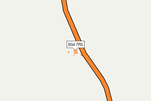
SG4 7PG is located in the Hitchwood, Offa and Hoo electoral ward, within the local authority district of North Hertfordshire and the English Parliamentary constituency of Hitchin and Harpenden. The Sub Integrated Care Board (ICB) Location is NHS Hertfordshire and West Essex ICB - 06K and the police force is Hertfordshire. This postcode has been in use since January 1980.


GetTheData
Source: OS OpenMap – Local (Ordnance Survey)
Source: OS VectorMap District (Ordnance Survey)
Licence: Open Government Licence (requires attribution)
| Easting | 519888 |
| Northing | 225326 |
| Latitude | 51.913570 |
| Longitude | -0.258398 |
GetTheData
Source: Open Postcode Geo
Licence: Open Government Licence
| Country | England |
| Postcode District | SG4 |
| ➜ SG4 open data dashboard ➜ See where SG4 is on a map | |
GetTheData
Source: Land Registry Price Paid Data
Licence: Open Government Licence
Elevation or altitude of SG4 7PG as distance above sea level:
| Metres | Feet | |
|---|---|---|
| Elevation | 90m | 295ft |
Elevation is measured from the approximate centre of the postcode, to the nearest point on an OS contour line from OS Terrain 50, which has contour spacing of ten vertical metres.
➜ How high above sea level am I? Find the elevation of your current position using your device's GPS.
GetTheData
Source: Open Postcode Elevation
Licence: Open Government Licence
| Ward | Hitchwood, Offa And Hoo |
| Constituency | Hitchin And Harpenden |
GetTheData
Source: ONS Postcode Database
Licence: Open Government Licence
| The Rusty Gun Ph (London Road) | Little Almshoe | 40m |
| The Rusty Gun Ph (London Road) | Little Almshoe | 158m |
| Crossroads (Little Almshoe Hamlet) | Little Almshoe | 664m |
| Crossroads (Little Almshoe Hamlet) | Little Almshoe | 693m |
| Tatmore Place (Preston Road) | Gosmore | 1,604m |
| Stevenage Station | 3.8km |
| Hitchin Station | 4.4km |
GetTheData
Source: NaPTAN
Licence: Open Government Licence
GetTheData
Source: ONS Postcode Database
Licence: Open Government Licence


➜ Get more ratings from the Food Standards Agency
GetTheData
Source: Food Standards Agency
Licence: FSA terms & conditions
| Last Collection | |||
|---|---|---|---|
| Location | Mon-Fri | Sat | Distance |
| Little Almshoe | 17:00 | 08:45 | 655m |
| Tatmore Place | 16:45 | 07:45 | 1,614m |
| St Ippolyts | 17:00 | 08:30 | 1,632m |
GetTheData
Source: Dracos
Licence: Creative Commons Attribution-ShareAlike
| Facility | Distance |
|---|---|
| The Princess Helena College (Closed) Preston, Hitchin Health and Fitness Gym, Grass Pitches, Sports Hall, Swimming Pool, Studio | 1.7km |
| Preston Cricket Club The Green, Preston, Hitchin Grass Pitches | 2km |
| Saint Ippolyts Recreation Ground Orchard Close , St. Ippolyts, Hitchin Grass Pitches | 2km |
GetTheData
Source: Active Places
Licence: Open Government Licence
| School | Phase of Education | Distance |
|---|---|---|
| St Ippolyts Church of England Aided Primary School Ashbrook Lane, Hitchin, SG4 7PB | Primary | 1.8km |
| Preston Primary School Back Lane, Preston, Hitchin, SG4 7UJ | Primary | 2.2km |
| Wymondley Junior Mixed and Infant School Siccut Road, Little Wymondley, Hitchin, SG4 7HN | Primary | 2.7km |
GetTheData
Source: Edubase
Licence: Open Government Licence
| Risk of SG4 7PG flooding from rivers and sea | Medium |
| ➜ SG4 7PG flood map | |
GetTheData
Source: Open Flood Risk by Postcode
Licence: Open Government Licence
The below table lists the International Territorial Level (ITL) codes (formerly Nomenclature of Territorial Units for Statistics (NUTS) codes) and Local Administrative Units (LAU) codes for SG4 7PG:
| ITL 1 Code | Name |
|---|---|
| TLH | East |
| ITL 2 Code | Name |
| TLH2 | Bedfordshire and Hertfordshire |
| ITL 3 Code | Name |
| TLH23 | Hertfordshire CC |
| LAU 1 Code | Name |
| E07000099 | North Hertfordshire |
GetTheData
Source: ONS Postcode Directory
Licence: Open Government Licence
The below table lists the Census Output Area (OA), Lower Layer Super Output Area (LSOA), and Middle Layer Super Output Area (MSOA) for SG4 7PG:
| Code | Name | |
|---|---|---|
| OA | E00119972 | |
| LSOA | E01023623 | North Hertfordshire 014C |
| MSOA | E02004922 | North Hertfordshire 014 |
GetTheData
Source: ONS Postcode Directory
Licence: Open Government Licence
| SG4 7NP | 609m | |
| SG4 7PW | Whitwell Road | 761m |
| SG4 7NJ | London Road | 901m |
| SG4 7NT | 940m | |
| SG4 7RX | 1043m | |
| SG4 7NL | London Road | 1316m |
| SG4 7PA | Sperberry Hill | 1373m |
| SG4 7PT | Langley End | 1415m |
| SG4 7RW | Hitchwood Lane | 1444m |
| SG4 7NZ | Sperberry Hill | 1503m |
GetTheData
Source: Open Postcode Geo; Land Registry Price Paid Data
Licence: Open Government Licence