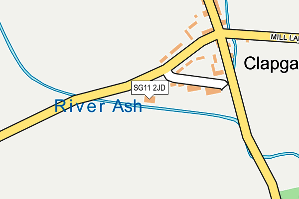
SG11 2JD is located in the Little Hadham & The Pelhams electoral ward, within the local authority district of East Hertfordshire and the English Parliamentary constituency of North East Hertfordshire. The Sub Integrated Care Board (ICB) Location is NHS Hertfordshire and West Essex ICB - 06K and the police force is Hertfordshire. This postcode has been in use since December 2001.


GetTheData
Source: OS OpenMap – Local (Ordnance Survey)
Source: OS VectorMap District (Ordnance Survey)
Licence: Open Government Licence (requires attribution)
| Easting | 544151 |
| Northing | 224839 |
| Latitude | 51.903449 |
| Longitude | 0.093917 |
GetTheData
Source: Open Postcode Geo
Licence: Open Government Licence
| Country | England |
| Postcode District | SG11 |
| ➜ SG11 open data dashboard ➜ See where SG11 is on a map ➜ Where is Clapgate? | |
GetTheData
Source: Land Registry Price Paid Data
Licence: Open Government Licence
Elevation or altitude of SG11 2JD as distance above sea level:
| Metres | Feet | |
|---|---|---|
| Elevation | 80m | 262ft |
Elevation is measured from the approximate centre of the postcode, to the nearest point on an OS contour line from OS Terrain 50, which has contour spacing of ten vertical metres.
➜ How high above sea level am I? Find the elevation of your current position using your device's GPS.
GetTheData
Source: Open Postcode Elevation
Licence: Open Government Licence
| Ward | Little Hadham & The Pelhams |
| Constituency | North East Hertfordshire |
GetTheData
Source: ONS Postcode Database
Licence: Open Government Licence
| Parsonage Lane (Albury Road) | Clapgate | 192m |
| Parsonage Lane (Albury Road) | Clapgate | 198m |
| St Mary The Virgin Church (Parsonage Lane) | Albury | 599m |
| St Mary The Virgin Church (Parsonage Lane) | Albury | 609m |
| Gravesend Farm (Albury Road) | Gravesend | 903m |
GetTheData
Source: NaPTAN
Licence: Open Government Licence
GetTheData
Source: ONS Postcode Database
Licence: Open Government Licence


➜ Get more ratings from the Food Standards Agency
GetTheData
Source: Food Standards Agency
Licence: FSA terms & conditions
| Last Collection | |||
|---|---|---|---|
| Location | Mon-Fri | Sat | Distance |
| Clapgate | 16:15 | 09:30 | 179m |
| High Farm | 16:00 | 08:30 | 579m |
| Church End | 16:15 | 07:00 | 772m |
GetTheData
Source: Dracos
Licence: Creative Commons Attribution-ShareAlike
| Facility | Distance |
|---|---|
| Albury Football Ground Church End, Albury, Ware Grass Pitches | 838m |
| Brewery Field Furneux Pelham, Buntingford Grass Pitches | 2.7km |
| Braughing Playing Fields Green Lane, Braughing Grass Pitches, Sports Hall, Outdoor Tennis Courts | 4.2km |
GetTheData
Source: Active Places
Licence: Open Government Licence
| School | Phase of Education | Distance |
|---|---|---|
| Albury Church of England Voluntary Aided Primary School Church End, Albury, SG11 2JQ | Primary | 653m |
| Little Hadham Primary School Stortford Road, Little Hadham, Ware, SG11 2DX | Primary | 2.2km |
| Furneux Pelham Church of England School Furneux Pelham School, Furneux Pelham, SG9 0LH | Primary | 3.2km |
GetTheData
Source: Edubase
Licence: Open Government Licence
| Risk of SG11 2JD flooding from rivers and sea | Very Low |
| ➜ SG11 2JD flood map | |
GetTheData
Source: Open Flood Risk by Postcode
Licence: Open Government Licence
The below table lists the International Territorial Level (ITL) codes (formerly Nomenclature of Territorial Units for Statistics (NUTS) codes) and Local Administrative Units (LAU) codes for SG11 2JD:
| ITL 1 Code | Name |
|---|---|
| TLH | East |
| ITL 2 Code | Name |
| TLH2 | Bedfordshire and Hertfordshire |
| ITL 3 Code | Name |
| TLH23 | Hertfordshire CC |
| LAU 1 Code | Name |
| E07000242 | East Hertfordshire |
GetTheData
Source: ONS Postcode Directory
Licence: Open Government Licence
The below table lists the Census Output Area (OA), Lower Layer Super Output Area (LSOA), and Middle Layer Super Output Area (MSOA) for SG11 2JD:
| Code | Name | |
|---|---|---|
| OA | E00119328 | |
| LSOA | E01023493 | East Hertfordshire 003F |
| MSOA | E02004880 | East Hertfordshire 003 |
GetTheData
Source: ONS Postcode Directory
Licence: Open Government Licence
| SG11 2JH | Clapgate | 86m |
| SG11 2JR | The Bourne | 92m |
| SG11 2JL | 127m | |
| SG11 2JP | The Bourne | 144m |
| SG11 2JN | 182m | |
| SG11 2JW | 191m | |
| SG11 2JS | 213m | |
| SG11 2JT | Mill Lane | 228m |
| SG11 2LE | 260m | |
| SG11 2LF | Chalk Hill Cottages | 353m |
GetTheData
Source: Open Postcode Geo; Land Registry Price Paid Data
Licence: Open Government Licence