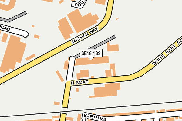
SE18 1BS is located in the Plumstead & Glyndon electoral ward, within the London borough of Greenwich and the English Parliamentary constituency of Erith and Thamesmead. The Sub Integrated Care Board (ICB) Location is NHS South East London ICB - 72Q and the police force is Metropolitan Police. This postcode has been in use since April 2013.


GetTheData
Source: OS OpenMap – Local (Ordnance Survey)
Source: OS VectorMap District (Ordnance Survey)
Licence: Open Government Licence (requires attribution)
| Easting | 545491 |
| Northing | 178991 |
| Latitude | 51.491153 |
| Longitude | 0.094300 |
GetTheData
Source: Open Postcode Geo
Licence: Open Government Licence
| Country | England |
| Postcode District | SE18 |
| ➜ SE18 open data dashboard ➜ See where SE18 is on a map ➜ Where is London? | |
GetTheData
Source: Land Registry Price Paid Data
Licence: Open Government Licence
Elevation or altitude of SE18 1BS as distance above sea level:
| Metres | Feet | |
|---|---|---|
| Elevation | 10m | 33ft |
Elevation is measured from the approximate centre of the postcode, to the nearest point on an OS contour line from OS Terrain 50, which has contour spacing of ten vertical metres.
➜ How high above sea level am I? Find the elevation of your current position using your device's GPS.
GetTheData
Source: Open Postcode Elevation
Licence: Open Government Licence
| Ward | Plumstead & Glyndon |
| Constituency | Erith And Thamesmead |
GetTheData
Source: ONS Postcode Database
Licence: Open Government Licence
| June 2022 | Anti-social behaviour | On or near Barth Mews | 151m |
| June 2022 | Violence and sexual offences | On or near Barth Mews | 151m |
| June 2022 | Violence and sexual offences | On or near Barth Mews | 151m |
| ➜ Get more crime data in our Crime section | |||
GetTheData
Source: data.police.uk
Licence: Open Government Licence
| Boughton Road (Nathan Way) | Plumstead | 202m |
| Hadden Road (Nathan Way) | Plumstead | 207m |
| Boughton Road (Nathan Way) | Plumstead | 209m |
| Hadden Road (Nathan Way) | Plumstead | 296m |
| Lakedale Road | Plumstead | 437m |
| Plumstead Station | 0.7km |
| Woolwich Arsenal Station | 1.7km |
| Abbey Wood (London) Station | 1.9km |
GetTheData
Source: NaPTAN
Licence: Open Government Licence
GetTheData
Source: ONS Postcode Database
Licence: Open Government Licence


➜ Get more ratings from the Food Standards Agency
GetTheData
Source: Food Standards Agency
Licence: FSA terms & conditions
| Last Collection | |||
|---|---|---|---|
| Location | Mon-Fri | Sat | Distance |
| 113 Nathan Way | 17:30 | 12:00 | 320m |
| Benares Road | 17:30 | 12:00 | 361m |
| Plumstead High Street | 17:30 | 12:00 | 436m |
GetTheData
Source: Dracos
Licence: Creative Commons Attribution-ShareAlike
| Facility | Distance |
|---|---|
| Hmp Thameside Griffin Manor Way, London Artificial Grass Pitch | 535m |
| Seven Acre Sports & Social Club Church Manorway, London Grass Pitches | 539m |
| The Plumstead Centre Plumstead High Street, Plumstead High Street, London Health and Fitness Gym, Studio | 550m |
GetTheData
Source: Active Places
Licence: Open Government Licence
| School | Phase of Education | Distance |
|---|---|---|
| Bannockburn Primary School Plumstead High Street, London, SE18 1HE | Primary | 447m |
| Conway Primary School Gallosson Road, Plumstead, London, SE18 1QY | Primary | 574m |
| St Thomas A Becket Roman Catholic Primary School Mottisfont Road, Abbey Wood, London, SE2 9LY | Primary | 680m |
GetTheData
Source: Edubase
Licence: Open Government Licence
| Risk of SE18 1BS flooding from rivers and sea | Very Low |
| ➜ SE18 1BS flood map | |
GetTheData
Source: Open Flood Risk by Postcode
Licence: Open Government Licence
The below table lists the International Territorial Level (ITL) codes (formerly Nomenclature of Territorial Units for Statistics (NUTS) codes) and Local Administrative Units (LAU) codes for SE18 1BS:
| ITL 1 Code | Name |
|---|---|
| TLI | London |
| ITL 2 Code | Name |
| TLI5 | Outer London - East and North East |
| ITL 3 Code | Name |
| TLI51 | Bexley and Greenwich |
| LAU 1 Code | Name |
| E09000011 | Greenwich |
GetTheData
Source: ONS Postcode Directory
Licence: Open Government Licence
The below table lists the Census Output Area (OA), Lower Layer Super Output Area (LSOA), and Middle Layer Super Output Area (MSOA) for SE18 1BS:
| Code | Name | |
|---|---|---|
| OA | E00008328 | |
| LSOA | E01001672 | Greenwich 006A |
| MSOA | E02000318 | Greenwich 006 |
GetTheData
Source: ONS Postcode Directory
Licence: Open Government Licence
| SE18 1EA | Marmadon Road | 151m |
| SE28 0BQ | Nathan Way | 195m |
| SE18 1ER | Bannockburn Road | 201m |
| SE18 1SQ | Barth Road | 204m |
| SE18 1EP | Bannockburn Road | 209m |
| SE18 1EB | Balgowan Street | 209m |
| SE18 1SF | Barth Road | 213m |
| SE18 1DW | White Hart Road | 220m |
| SE18 1ED | Balgowan Street | 225m |
| SE18 1EE | Hylton Street | 265m |
GetTheData
Source: Open Postcode Geo; Land Registry Price Paid Data
Licence: Open Government Licence