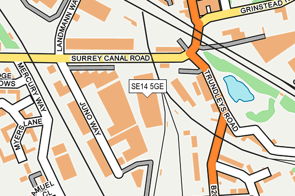
SE14 5GE is located in the New Cross Gate electoral ward, within the London borough of Lewisham and the English Parliamentary constituency of Lewisham, Deptford. The Sub Integrated Care Board (ICB) Location is NHS South East London ICB - 72Q and the police force is Metropolitan Police. This postcode has been in use since February 2009.


GetTheData
Source: OS OpenMap – Local (Ordnance Survey)
Source: OS VectorMap District (Ordnance Survey)
Licence: Open Government Licence (requires attribution)
| Easting | 535812 |
| Northing | 177798 |
| Latitude | 51.482838 |
| Longitude | -0.045487 |
GetTheData
Source: Open Postcode Geo
Licence: Open Government Licence
| Country | England |
| Postcode District | SE14 |
| ➜ SE14 open data dashboard ➜ See where SE14 is on a map ➜ Where is London? | |
GetTheData
Source: Land Registry Price Paid Data
Licence: Open Government Licence
Elevation or altitude of SE14 5GE as distance above sea level:
| Metres | Feet | |
|---|---|---|
| Elevation | 10m | 33ft |
Elevation is measured from the approximate centre of the postcode, to the nearest point on an OS contour line from OS Terrain 50, which has contour spacing of ten vertical metres.
➜ How high above sea level am I? Find the elevation of your current position using your device's GPS.
GetTheData
Source: Open Postcode Elevation
Licence: Open Government Licence
| Ward | New Cross Gate |
| Constituency | Lewisham, Deptford |
GetTheData
Source: ONS Postcode Database
Licence: Open Government Licence
| January 2024 | Violence and sexual offences | On or near Sharratt Street | 461m |
| January 2024 | Violence and sexual offences | On or near Sharratt Street | 461m |
| January 2024 | Anti-social behaviour | On or near Chipley Street | 488m |
| ➜ Get more crime data in our Crime section | |||
GetTheData
Source: data.police.uk
Licence: Open Government Licence
| Cold Blow Lane (Sanford Street) | New Cross | 268m |
| Surrey Canal Road (Trundley's Road) | New Cross | 275m |
| Cold Blow Lane (Sanford Street) | New Cross | 303m |
| Sterling Gardens (Sanford Street) | New Cross | 316m |
| Grinstead Road | Deptford | 355m |
| South Bermondsey Station | 0.9km |
| New Cross Gate ELL Station | 0.9km |
| New Cross ELL Station | 1.2km |
GetTheData
Source: NaPTAN
Licence: Open Government Licence
GetTheData
Source: ONS Postcode Database
Licence: Open Government Licence


➜ Get more ratings from the Food Standards Agency
GetTheData
Source: Food Standards Agency
Licence: FSA terms & conditions
| Last Collection | |||
|---|---|---|---|
| Location | Mon-Fri | Sat | Distance |
| John Williams Close | 17:30 | 12:00 | 277m |
| Sanford Street | 17:30 | 12:00 | 408m |
| Monson Road | 17:30 | 12:00 | 440m |
GetTheData
Source: Dracos
Licence: Creative Commons Attribution-ShareAlike
| Facility | Distance |
|---|---|
| The Thunderdome Stockholm Road, Stockholm Road, London Sports Hall | 462m |
| All Saints Church Hatcham Community Centre Monson Road, London Sports Hall | 503m |
| Millwall Fc (The Den) Zampa Road, London Grass Pitches | 526m |
GetTheData
Source: Active Places
Licence: Open Government Licence
| School | Phase of Education | Distance |
|---|---|---|
| Haberdashers' Hatcham Primary Hunsdon Road, London, SE14 5RD | Primary | 377m |
| Twin Oaks Primary School Scawen Road, London, SE8 5AE | Primary | 404m |
| Kings Kids Christian School 100 Woodpecker Road, New Cross, London, SE14 6EU | Not applicable | 577m |
GetTheData
Source: Edubase
Licence: Open Government Licence
| Risk of SE14 5GE flooding from rivers and sea | Very Low |
| ➜ SE14 5GE flood map | |
GetTheData
Source: Open Flood Risk by Postcode
Licence: Open Government Licence
The below table lists the International Territorial Level (ITL) codes (formerly Nomenclature of Territorial Units for Statistics (NUTS) codes) and Local Administrative Units (LAU) codes for SE14 5GE:
| ITL 1 Code | Name |
|---|---|
| TLI | London |
| ITL 2 Code | Name |
| TLI4 | Inner London - East |
| ITL 3 Code | Name |
| TLI44 | Lewisham and Southwark |
| LAU 1 Code | Name |
| E09000023 | Lewisham |
GetTheData
Source: ONS Postcode Directory
Licence: Open Government Licence
The below table lists the Census Output Area (OA), Lower Layer Super Output Area (LSOA), and Middle Layer Super Output Area (MSOA) for SE14 5GE:
| Code | Name | |
|---|---|---|
| OA | E00016716 | |
| LSOA | E01003297 | Lewisham 003A |
| MSOA | E02000655 | Lewisham 003 |
GetTheData
Source: ONS Postcode Directory
Licence: Open Government Licence
| SE14 5RU | Myers Lane | 107m |
| SE14 5RP | Samuel Close | 151m |
| SE14 5RZ | Myers Lane | 161m |
| SE14 5RX | Myers Lane | 163m |
| SE14 5XF | John Williams Close | 197m |
| SE14 5ST | Bridge Meadows | 200m |
| SE14 5XH | John Williams Close | 216m |
| SE14 5RY | Myers Lane | 232m |
| SE14 5SU | Bridge Meadows | 238m |
| SE14 5XE | John Williams Close | 250m |
GetTheData
Source: Open Postcode Geo; Land Registry Price Paid Data
Licence: Open Government Licence